National Weather Summary for Tuesday, July 14, 2015
by WeatherOps, on Jul 14, 2015 4:56:34 AM
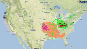
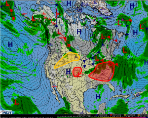
Severe thunderstorms are likely Tuesday for portions of the Ohio River Valley, Tennessee Valley, and the Carolinas. Scattered severe thunderstorms are possible late in the day for portions of Kansas and Nebraska. Isolated to scattered strong thunderstorms are possible for the Northern Rockies and Northern Plains.
An area of low pressure moving through the Lower Great Lakes will result for another active weather day across much of the eastern US. Some strong to severe thunderstorms activity will be ongoing this morning across the Ohio and Tennessee Valleys. Additional thunderstorm development is expected from Indiana into western Pennsylvania. Those storms will become organized and move southeastward. Large hail and damaging winds will be the main hazards, however, there will also be an elevated risk for tornadoes. Heavy to excessive rainfall will be a concern over the Central Appalachians.
Across Kansas and Nebraska, an approaching disturbance may result in scattered thunderstorms late this afternoon into tonight. Large hail and damaging winds would be the primary hazards.
Across the Northern Rockies and Plains, isolated thunderstorms capable of severe wind gusts and large hail will be possible.


