by WeatherOps, on Jul 18, 2014 9:49:34 AM

by WeatherOps, on Jul 18, 2014 9:49:34 AM
Heavy rain and flooding is possible today for portions of the Lower Mississippi River Valley. Isolated severe thunderstorms will be possible for the Central High Plains. A line of thunderstorms will be possible for portions of the Upper Midwest.
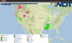
Current NWS Advisories/Watches/Warnings in iMapPro:

A shortwave trough will continue progressing eastward into the Ohio River Valley. Morning showers and thunderstorms will span from Southeast Texas into the Tennessee River Valley. Rainfall totals could approach 3 inches along the Gulf Coast with 1-2 inches into the Ohio River Valley.
An area of low pressure will trigger a line of thunderstorms along the North Dakota/Minnesota border with hail and damaging winds possible. Isolated thunderstorms will be possible across the Central High Plains with the same threats.
This is where you give the visitor a brief introduction to both this blog and your company. Keep it short. More →