National Weather Summary for Wednesday, March 25, 2015
by WeatherOps, on Mar 25, 2015 9:48:17 AM
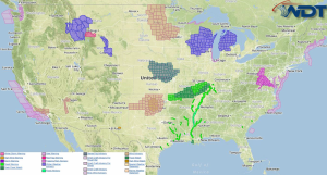
Strong to severe thunderstorms are expected by Tuesday afternoon across the Mississippi Valley and Central Plains. Light to moderate snow will end across the Northern Great Lakes by late morning.
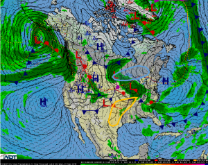
An area of low pressure exiting the Rockies will push a cold front across the Southern Plains and into the Mississippi Valley today allowing for the development of scattered showers and thunderstorms during the early afternoon. Thunderstorms that develop will have the potential for hail, damaging winds, and isolated tornadoes. By evening, the activity is expected to become linear, limiting the hazards to hail and wind gusts in excess of 60 mph or higher.
Across the Northern Great Lakes, a strengthening frontal boundary will advance through the region during the morning, allowing for light to moderate snow across portions of the Northern Great Lakes. Snow accumulations of 3-6 inches will be possible. With elevated surface winds, lowered visibility and slick and hazardous roadways are expected.


