National Weather Summary for Monday, March 23, 2015
by WeatherOps, on Mar 23, 2015 9:48:38 AM
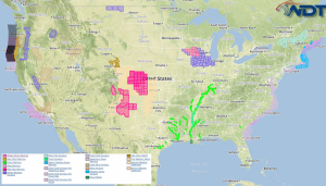
Strong to isolated severe thunderstorms are possible Monday for portions of the Northern Rockies and Central Plains. Light to moderate snow is possible in the higher elevations of the Pacific Northwest.
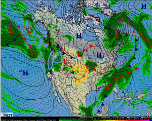
A frontal boundary will approach the Pacific Northwest allowing for rain and snow showers across the Coastal Range and along the Blue Mountains. Snow accumulations of 6-10 inches will be possible in the highest elevations. Strong winds will lower visibility through mountain passes and could make for hazardous travel conditions.
Across the Northern and Central Rockies, an area of low pressure and associated cold front will begin to track into the Central Rockies and Southern Plains. Showers and thunderstorms are anticipated to develop across the region. Modest moisture and afternoon surface temperatures will allow for thunderstorm development Monday afternoon into Tuesday from Western Nebraska to the Texas Panhandle. Stronger storms could produce heavy rain, frequent lightning, damaging winds in excess of 50 miles per hour, and small hail.


