National Weather Summary for Wednesday, June 10, 2015
by WeatherOps, on Jun 10, 2015 4:51:37 AM
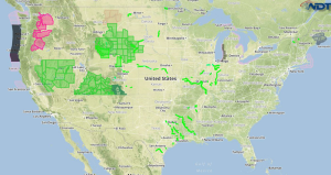
Hazardous thunderstorms are possible Wednesday for Kansas and Nebraska, as well as Upstate New York. Heavy rain is possible for Eastern Nebraska.
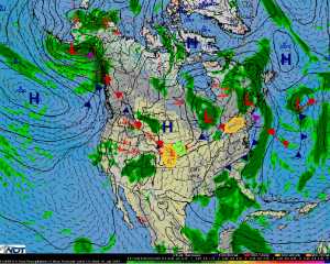
Kansas and Nebraska:Thunderstorms are expected to develop ahead of a cold front stretched across the Central Great Plains during the late afternoon hours on Wednesday. Strong surface heating and ample moisture at the surface will allow for some of these thunderstorms to become severe, with large hail being the primary hazard. After sunset, there will be a damaging wind threat, with the severe weather threat diminishing during the late evening hours by midnight.
Upstate New York:Thunderstorms are expected to develop near a warm front located across the Northeast and southeastern Ontario. Conditions will be favorable for some of these thunderstorms to become severe, with damaging wind gusts being the primary hazard. A few tornadoes will also be possible. The greatest severe weather threat will be during the afternoon and early evening hours.
Eastern Nebraska:Thunderstorms are expected to be ongoing across central and western Nebraska during the late afternoon and early evening hours. During the evening, these storms are expected to merge into a large complex and move towards the east. The widespread coverage of these thunderstorms along with the deep moisture that will be in place will result in heavy rainfall. Widespread rainfall totals in excess of two inches are expected, with locally higher amounts in excess of four inches possible.


