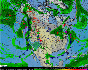
Hazardous Weather Outlook for Wednesday, December 17, 2014
by WeatherOps, on Dec 16, 2014 3:58:43 PM
Light to moderate snow will be possible Wednesday across the Northeast with the heaviest snow over Northern Maine. Light to moderate snowfall will spread eastward across the Rockies.
Northeast: A low pressure area is forecast to move out of the Great Lakes and across the Northeast on Wednesday. This will help generate some light lake effect snow across over the eastern shore of Lake Ontario, along with light snow over northern Vermont and northern New Hampshire. Heavier snow is anticipated over northern Maine. Precipitation will likely begin as rain across much of the region before transitioning to snow. Snowfall amounts of 2-4 inches will be likely for many locations, with 4-10 inches expected over northern Maine.
Western United States: Periods of snow will begin to taper off across the Sierra Nevada Range on Wednesday, though an additional 2-4 inches will be possible for locations above 5000 feet. Snow is also forecast to spread eastward across the higher elevations of the Great Basin/Southwest and into the Rocky Mountains as the upper level low pressure system moves eastward. Snowfall accumulations of 3-6 inches, isolated higher amounts, are anticipated for locations mainly above 5000 feet.


