National Weather Summary for Monday, August 3, 2015
by WeatherOps, on Aug 3, 2015 4:41:19 AM
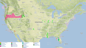
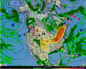
Severe thunderstorms are possible on Monday from the Ohio Valley to the Upper Northeast. Strong thunderstorms are possible from the Central and High Plains into the Southern Plains. Excessive rainfall is possible across Florida.
Ohio Valley to Upper Northeast: As the low makes its way through Canada, a trough will
stretch all the way down to the Tennessee Valley with a cold front through the Ohio Valley.
Showers and storms currently ongoing will continue to weaken, but this activity combined
with cloud cover in the region could help complicate the setup. Fresh storms are still
expected along the cold front during the afternoon through, moving nearly parallel with the
boundary, allowing for storms within the cluster to produce some damaging wind gusts and
large hail, as well as an isolated embedded tornado.
Central and High Plains into Southern Plains: A stalled frontal boundary in the region will
be the focal point for fresh storm initiation today. Although a cap will exist to help inhibit
early development, a strengthening low-level jet will promote storms by the evening hours.
Some clusters of storms could become stronger, with gusty to damaging winds and large
hail the threats, as well as moderate to heavy rainfall of 1-2 inches and locally heavier
amounts.
Florida: Periods of rain and thunderstorms will continue for West-Central Florida today.
Additional rainfall amounts of 1-3 inches, with locally heavier amounts, will be possible.
This will promote another very strong possibility of flooding for the region.


