National Weather Summary for Tuesday, August 5, 2014
by WeatherOps, on Aug 5, 2014 9:56:34 AM
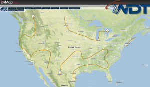
Isolated scattered showers and thunderstorms will be possible from portions of the Central Plains to the Mid Mississippi Valley to the New England region. Isolated showers and thunderstorms will be possible for portions of the Great Basin and Intermountain West. Isolated thunderstorms will be possible for the Gulf and Atlantic Coast.
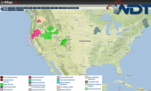
Current NWS Advisories/Watches/Warnings in iMapPro:

An upper level low situated off the California coast will allow for showers and thunderstorms across the Great Basin and the Intermountain West. Further east, a front situated from Montana to Iowa will allow for isolated to scattered showers and thunderstorms. Small hail and gusty winds to 45 miles per hour will be possible. Additional thunderstorms will be possible across portions of the foothills of Wyoming and Colorado, but should diminish after dark. The rest of the Central US will be dry. A few showers and thunderstorms will be possible for portions the Ohio Valley into New England. Isolated activity possible along the Gulf and Mid Atlantic coasts.


