National Weather Summary for Wednesday, April 15, 2015
by WeatherOps, on Apr 15, 2015 9:41:53 AM
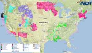
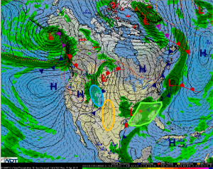
Heavy rain will continue Wednesday across portions of the Southeast. Moderate to heavy snow is likely across the Central Rockies. Strong to severe thunderstorms are possible for portions of Oklahoma and Texas.
Rain and thunderstorms will continue to track over the southeastern US as an area of low pressure continues to track to the east and a frontal boundary stalls along the Gulf Coast. 1-2 inches of additional rainfall will be possible.
An area of low pressure in the Pacific Northwest will deepen and move into the Central Rockies on Wednesday. Rain and snow showers are possible through the mountains with 6-8 inches of snow possible. Some areas may receive in excess of 12 inches with the heaviest accumulations in the highest elevations. Travel could be impacted and winds will lower visibilities.
An area of low pressure through the Central Rockies will allow for showers and thunderstorms across West Texas and Oklahoma. While widespread severe weather is not anticipated, a few stronger storms could produce large hail and damaging winds.


