by WeatherOps, on Jun 27, 2014 9:42:29 AM

by WeatherOps, on Jun 27, 2014 9:42:29 AM
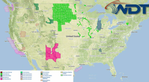
Scattered showers with isolated severe thunderstorms and localized flooding is possible today for portions of the Northern and Central Plains.
NWS Advisories/Watches/Warnings in iMapPro:

Storms from overnight will continue to move eastward across the Plains and slowly weaken into Friday; some areas could pick up to an inch of rain. By afternoon, showers and thunderstorms will develop ahead of a frontal boundary from Eastern Montana through Kansas where up to 2 inches of rain will be possible. Some storms may become severe with the potential for large hail, damaging winds, and isolated tornadoes. Localized flooding will also be possible.
A frontal boundary off the east coast and an area of low pressure through the Western Gulf of Mexico will develop through the region. This activity is expected to remain under severe limits, but stronger storms will have the potential for large hail and gusty winds.
This is where you give the visitor a brief introduction to both this blog and your company. Keep it short. More →