National Weather Summary for Friday, February 20, 2015
by WeatherOps, on Feb 20, 2015 9:49:39 AM
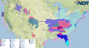
Light to moderate icing and light snow is possible Friday across the Midwest. Light snow is also expected across the Great Lakes. Moderate snow is likely across the Northern and Central Rockies.
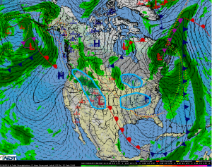
A frontal boundary developing across Alberta will track into the Great Lakes bringing arctic air and snow to the region. Light to moderate snow is expected with 2-5 inches of snow likely. Cold arctic air and strengthening winds will create wind chills as low as -10.
Across the Northern and Central Rockies, another disturbance will begin to advance into the Pacific Northwest and Northern Rockies. Snow is expected to develop across the Rockies with moderate to heavy snow from Idaho to Colorado. Accumulations of 4-8 inches will be possible with higher accumulations in the highest elevations. Travel conditions will deteriorate rapidly with snow, making for slick and hazardous roadways and lowered visibilities.
As cold air moves southward from the Great Lakes and an area of low pressure begins to move across the Southern US, a wintry mix is likely from Arkansas through Tennessee and into Southern Illinois. A tenth to a quarter inch of ice will be possible in most areas with a few areas seeing up to half an inch across portions of Northern Arkansas and Southern Missouri. A snow/sleet mix is possible with 1-3 inches of snow on average with isolated areas receiving up to 4 inches.


