National Weather Summary for Wednesday, June 3, 2015
by WeatherOps, on Jun 3, 2015 4:54:03 AM
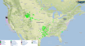
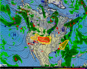
Particularly hazardous thunderstorms will be possible Wednesday from portions of Wyoming into the Central Plains/ Marginally hazardous thunderstorms are possible for the North Central US and the Southeast.
Strong moisture moving upslope into the high terrain of the Central US will allow for some potent thunderstorms for Wyoming into Nebraska. Storms forming initially will be slow moving cells with the potential for large hail and tornadoes. Into the evening, thunderstorms will evolve into a line, posing a damaging wind threat for Nebraska. For Nebraska, Kansas, and Iowa, ongoing storms will produce outflow boundaries that may allow for a few strong thunderstorms capable of large hail and damaging winds, along with an isolated tornado or two before the storms form a cluster and allow for a damaging wind threat.
The upper low across the Southeast is not expected to move much through the middle of the week. Scattered showers and thunderstorms, with a few severe thunderstorms, will be possible across the region. Hail and damaging winds will be the main threats.


