by Daphne Thompson, on Feb 23, 2018 1:40:48 PM
When you look at a weather map, you will often see the location of warm and cold fronts marked with specific symbols. A warm front is drawn as a red line with semi-circles. Cold fronts are displayed as blue lines with triangles. The delineations may make you think that the air is a solid force, but the reality is that it is a wishy-washy liquid.
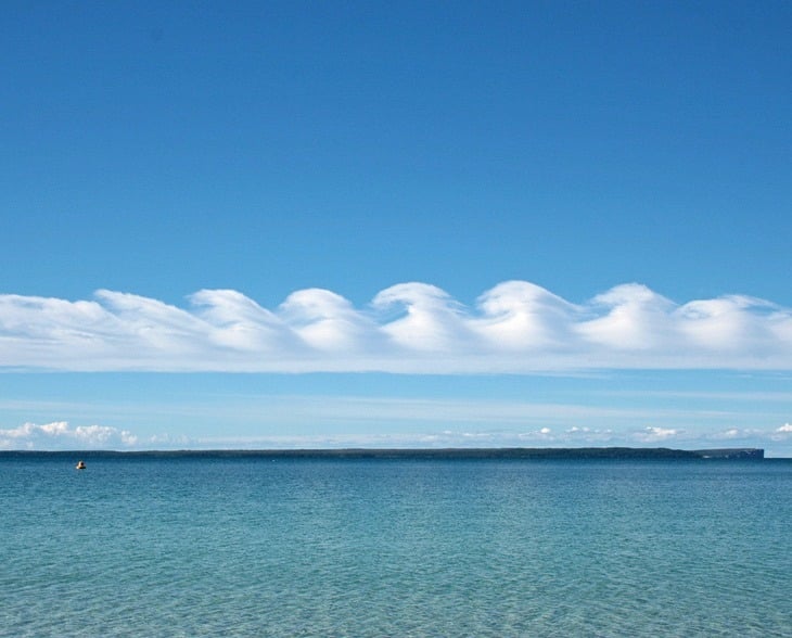
We are all surrounded by a liquid when outside. The air moves to and fro, just like the waves. It may not look like an ocean, but there are ways to see this motion. For instance, take a look at these Kelvin-Helmholtz clouds. They have formed waves in the sky.
Sometimes, just looking at the air from a different perspective can better allow you to see it flow like a liquid. View the video shown below and you can see the fog flowing through the valley. There is no doubt here that the air is a fluid.
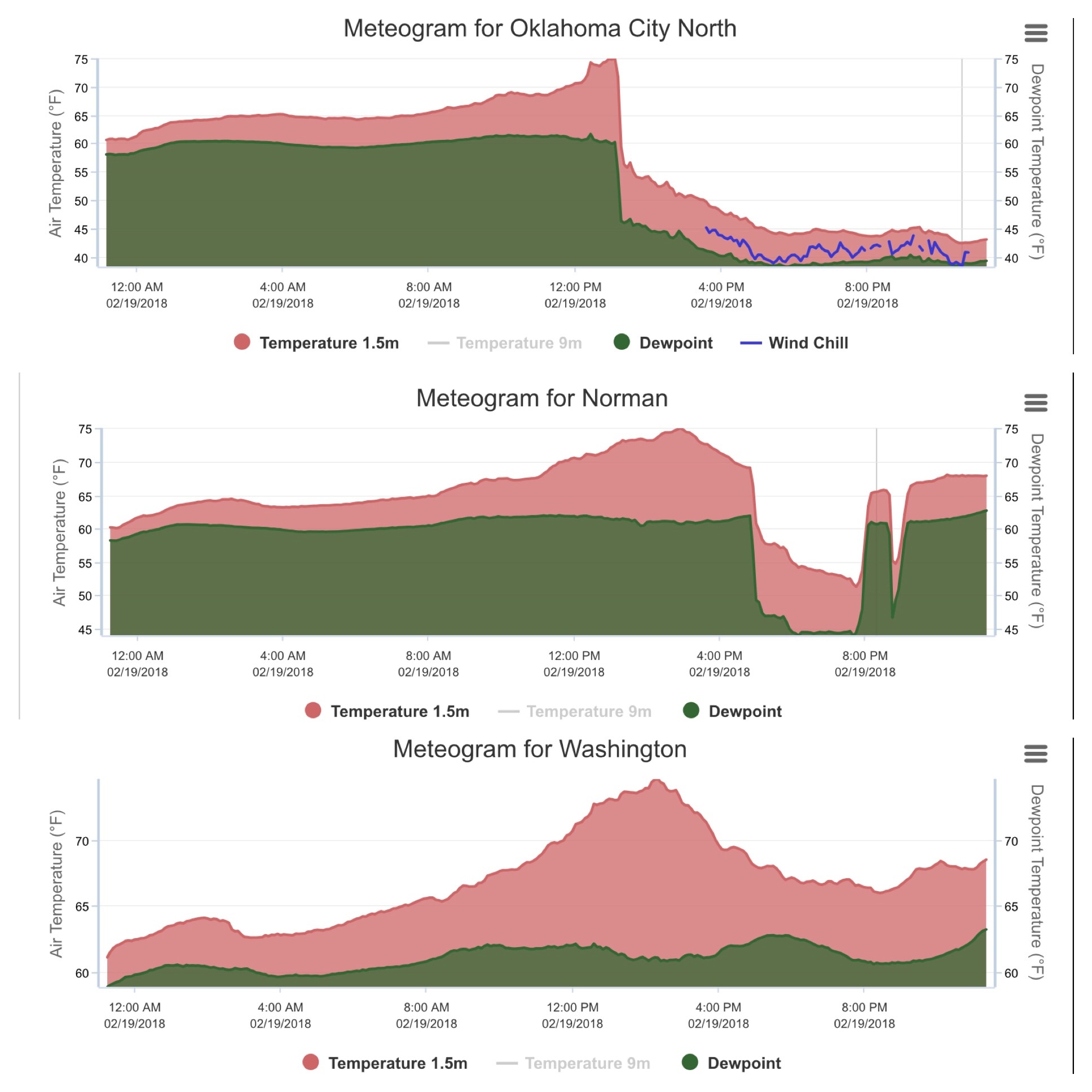
You can also see air moving from viewing graphs of data. In Oklahoma, we have a system of weather stations situated in every county. As such, we can get some fine-scale information by looking at the meteograms. These three towns are basically in a row from north to south. On the evening of February 19, 2018, a cold front was moving across the state. The Oklahoma City graph shows the cold air arriving at around 1 PM and from that point, the temperature and dew point quickly plummets. This cold air did not make it to Washington, OK and you can see the temperature only drops off due to diurnal circumstances. However, take a look at the data in Norman. Here, the front passes by around 5 PM and the temperature drops. Then the cold air retreats and warm air is again seen 8 PM. The front once again moves past with cold air one hour later, before once again becoming a warm front and the temperature once again rises.
 Just take a look at this loop, and you can see how wishy-washy the front was as it tried to come through the state. It moves back and forth, just like waves lapping against the shore.
In typical Oklahoma fashion we've gone from 60s and 70s to freezing rain and sleet in just a few hours. This data animation helps to summarize what's happened over the last day or so (ends at 7pm on Feb 20, 2018)! #okwx #okmesonet pic.twitter.com/BEKuFm8gBx
— Oklahoma Mesonet (@okmesonet) February 21, 2018
Of course, eventually we were overtaken by the cold front, and when it did decide to come through, it was more like a flash flood. The temperature took a nosedive as the cold air swept across the state. We went from the 70's to an ice storm - rapidly.
I know the groundhog predicted six more weeks of winter, but I am hoping that this was the last of it for us. Spring should be just around the corner. Is your company interested in learning more about the forecast for the upcoming months? Sign up for our seasonal forecast webinar today.