


by Daphne Thompson, on Mar 30, 2018 11:04:36 AM
Typhoon Jelawat is the third named storm and the first typhoon of the year in the Western Pacific. Jelawat will continue on a northeastward track, staying several hundred miles north of Guam and the Northern Mariana Islands through early next week.
Last year, the first typhoon didn’t form until July 24. That storm, Typhoon Noru, is remembered for being the third longest-lasting tropical cyclone on record in the West Pacific basin, persisting for nearly 19 days.
Given the time of year, it is not surprising that Typhoon Jelawat is weaker and farther south than Noru. At this time of year, cold fronts are still pushing across the East China Sea causing surges in the northeast monsoon. As a result, sea surface temperatures are still a relatively cool 22-26°C (70’s Fahrenheit) north of the Philippines, and much of the West Pacific is still under the influence of strong wind shear. As the monsoon gradually weakens through spring, warmer ocean temperatures spread northward, and wind shear diminishes. By late July, favorable ocean temperatures typically extend northward to southern Japan.
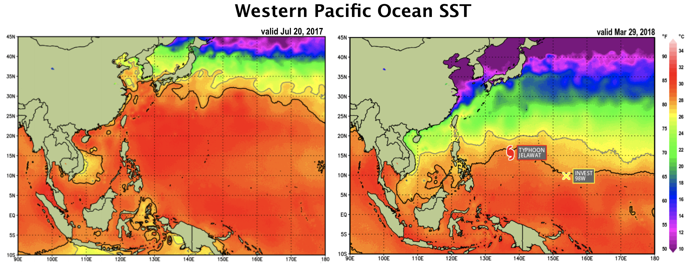
At present, favorable conditions are restricted south of 15°N from about 135°E eastward into the Central Pacific. In this area, low vertical wind shear and moist tropical air are present. Jelawat developed into a tropical depression within this favorable region on March 24.

Over the next several days, the system tracked northwesterly and then northerly along the western periphery of a weakening subtropical ridge to the east. Moderate southerly wind shear on the order of 20 to 30 knots kept Jelawat a disorganized depression for a few days. On March 28, convection became more organized, and Jelawat was upgraded to a tropical storm with winds of 35 knots. The weakening high to the east eventually caused a decrease in the forward speed, and Jelawat became nearly stationary on March 29.
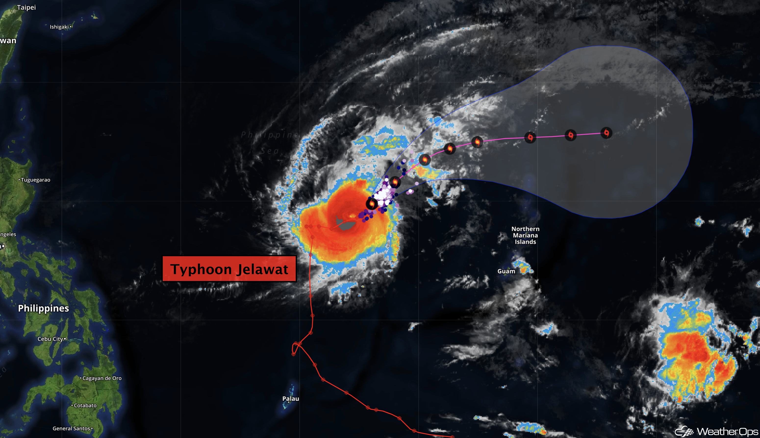
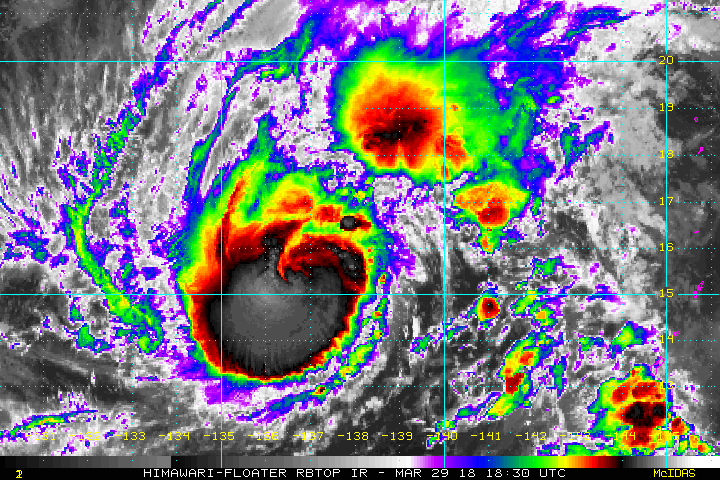
Competing factors allowed for only slow intensification over the next 24 hours. Ocean heat content (80-90 kJ/cm2) and sea surface temperatures (>28°C) were favorable but mid to upper-level winds were not as conducive. Jelawat finally became a minimal typhoon with winds of 65 knots the evening of March 29. Over the next 12 hours, Jelawat intensified rapidly to 115 knots and developed a 10nm eye. Some additional strengthening is possible through mid-day before strong upper-level winds ahead of an approaching trough begin to pull the storm east to northeastward. These winds will cause significant weakening after the next 24 hours or so as the typhoon becomes heavily sheared. No threats to land are expected.
Our WeatherOps customers can refer to the West Pacific Region Tropical Daily Planner and Active Storm Advisories for the latest forecast.
The Week Ahead
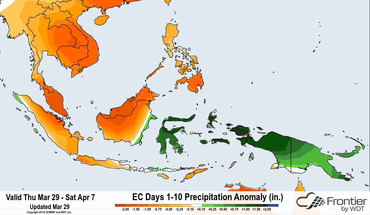
Forecast guidance indicates a strengthening MJO signal in April with the suppressed convective phase moving from the eastern Indian Ocean across SE Asia through the first week of the coming month. A decrease in tropical cyclone potential and below average precipitation is expected for Thailand, Vietnam, Malaysia, and the Philippines over the next 7-10 days.
