by Daphne Thompson, on Jan 7, 2019 2:06:47 PM
The ebb and flow of tides are a constant. In some areas of the country, it has made a significant economic impact though. With the right flow and depth of bays, ships can get to areas that are not located specifically on the coast. One area that has taken advantage of local currents is the San Francisco Bay.
According to the USGS, San Francisco Bay "is one of the largest and most altered estuaries within the United States." The floor of the bay changes constantly due to strong tides and dredging. In the early 1800s, the area had large spans of wetlands. However, in the late 1800s, large amounts of mud and gravel were pumped into the water from hydraulic mining. Dredging created channels for vessels to bring goods directly into the San Francisco area and has also changed the geography of the area.
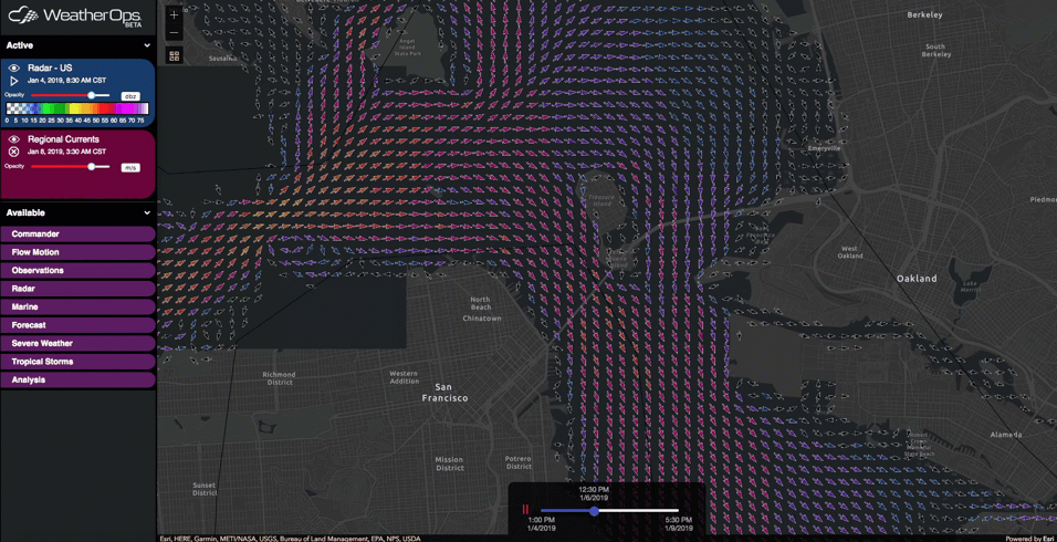
In the WeatherOps GIS image below, you can see the regional currents of the bay. Because of the tides, the water flows in and out of the area multiple times a day. This motion is a boon for recreation allowing for ideal conditions for windsurfing, kitesurfing, and kayaking.
 Click to Enlarge
One area where the currents have not been kind is Alcatraz Island. While no longer a federal prison, in the past it held some of the most notorious criminals of the day. No prisoners successfully escaped, but many tried and failed. In 1962, three of them tried to flee on a raft made of raincoats. Due to the current, it is believed they were either pulled out to sea or drowned in the cold waters of the bay while trying to reach the mainland.