


by Daphne Thompson, on Jan 31, 2018 2:53:38 PM
A prescribed, or controlled, burn is a fire that is strategically ignited for the benefit of communities, ecosystems, and the environment. It’s a useful tool for managing plant and animal species and suppressing non-native ones. A good example is the use of fire to remove mid-story brush in the W.G. Jones State Forest near the Woodlands, Texas. This 1,700-acre forest is home to the endangered Red-cockaded Woodpecker, which builds its nesting cavities in mature living pines. Fire maintains a mature open pine forest by removing the hardwood species that develop beneath them.
Wildland fire is an essential natural process driven by cloud-to-ground lightning strikes. Forests, marshes, and prairies are dependent on fire to:
● Provide healthy growth
● Fertilize the soil
● Increase plant diversity
● Kill pests and disease
U.S. agencies such as the Forest Service, the Fish and Wildlife Service, and the National Park Service, as well as state natural resource departments and landowners conduct seasonal burns to maintain healthy habitats. Careful planning is required to ensure the safety and efficient management of the fire. One of the more critical elements is the weather conditions before and through the duration of the burn.
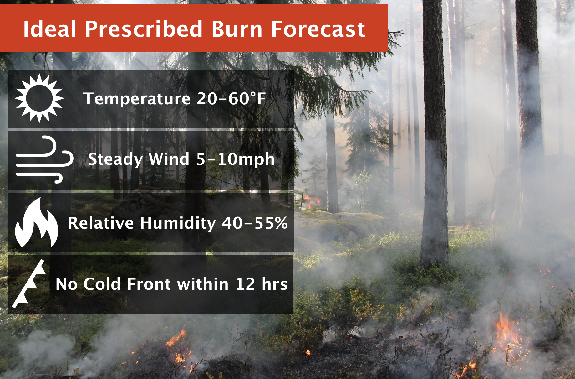
The typical season for planned burns is spring or fall when weather conditions are mild, and there is less foliage. Relative humidity is ideal when the air is neither excessively dry nor excessively moist. Low relative humidities (<20%) are attributed to more erratic fire behavior, and higher relative humidities (>55%) may moderate the temperature of a fire, causing the burn to be less efficient. Moisture of fuels such as grasses and weeds can be estimated by dividing the relative humidity by two. Fuel moisture of 10 to 20% is ideal and poses less risk to underground roots, microorganisms, and the soil. Therefore, a light rain several days before the burn may assist in protecting these aspects of the vegetation.
For prescribed burns, an ideal wind is one that is steady from the same direction. Light to gentle breezes helps carry the fire and prevents smoke from holding near the ground. A persistent wind direction ensures more control over the fire path within the burn area. Burn areas typically don’t exceed 100 acres and are contained by fire breaks such as roads and waterways. In the absence of natural fire blocks a “black line” is created by burning a strip of grass along the edge of the burn area eliminating the fuel to carry the fire further.
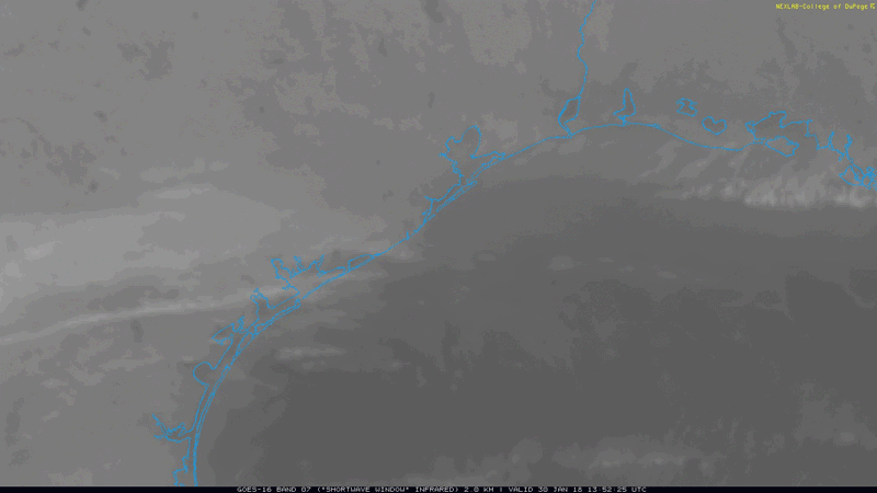
As with wildfires, smoke plumes from controlled fires are apparent from visible and infrared satellite imagery and radar. Prescribed burns stand out because they are carried out away from critical fire weather areas and can often be co-located with parks and preserves. In the GOES-16 shortwave infrared loop, shown above, these fires show up as black dots or “hot spots” over the Texas coastal bend and coastal Louisiana.
The next time you’re driving through the forest or near marshes along the Gulf coast and you encounter a smoke plume or observe fire on the side of the road, look for trained crews and signs indicating an ongoing prescribed burn. And if your company needs assistance with knowing the proper weather conditions exist, contact us!

