National Weather Summary for Wednesday, September 7, 2016
by David Moran, on Sep 7, 2016 11:27:24 AM
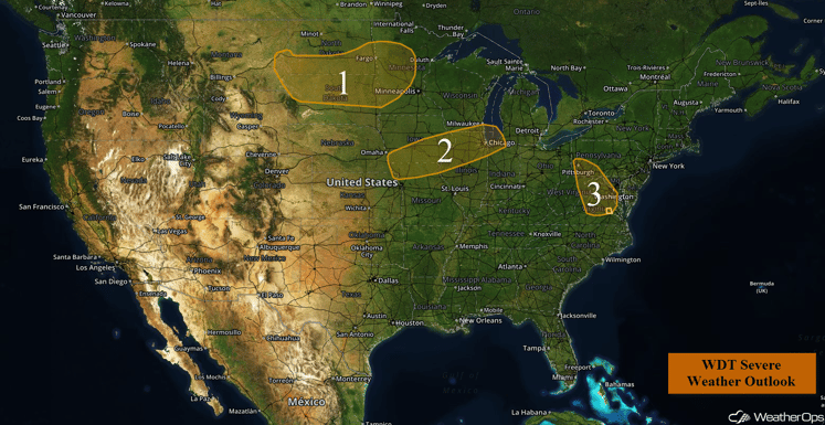
A stalled front from the Rockies to the Great Lakes will be the focus for the development of thunderstorms across the Midwest on Wednesday. From the Dakotas into Minnesota, thunderstorms are expected as an area of low pressure develops over the region. Thunderstorms will once again be likely across the Mid Atlantic as moisture from the remnants of Hermine moves into the region and instability builds. Heavy rainfall will continue across the Desert Southwest as moisture from Tropical Storm Newton streams northward. Across the Plains, thunderstorms will be possible across portions of the Plains on Thursday as a cold front begins to lift northward as a warm front. An area of low pressure and cold front will bring the potential for thunderstorms from the Ohio Valley into the Northeast. Thunderstorms with the potential for heavy rain will be likely across the Missouri Valley. Thunderstorms will be likely across the Central and Southern Plains into the Missouri Valley on Friday.
Region 1
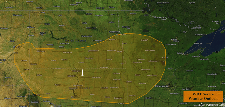
Although there will only be minimal instability across Region 1, a strong shortwave trough is forecast to move across the High Plains today bringing the threat for scattered showers and thunderstorms throughout the day. Currently, ongoing thunderstorms only pose a marginal threat during the morning. However, as the afternoon wears on, warm moist air will filter into the region. Combined with strong wind shear, there will be the potential for strong to severe thunderstorms. The primary threat with any thunderstorm that does develop will be strong winds, but an isolated tornado or two and hail cannot be ruled out.
Update 1:06pm CDT: Severe thunderstorms capable of hail and damaging winds approaching Bismarck, ND.
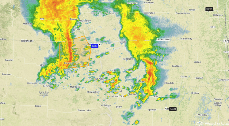
Radar 1:06pm CDT
Major Cities in Region: Bismarck, ND, Pierre, SD, Fargo, ND, St. Cloud, MN
Region 1
Region 2
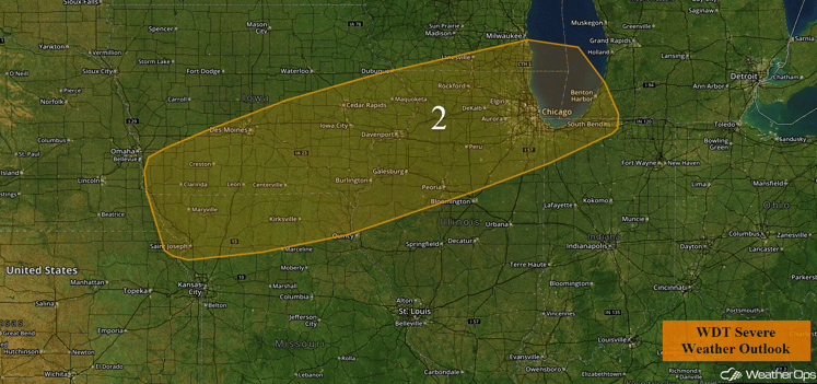
A stalled front extending westward across the Midwest and into the eastern Central Plains will be the main focus for the development of thunderstorms today. With plentiful moisture ahead of the front and building instability as a result of daytime heating, scattered thunderstorms will likely develop during the afternoon and early evening hours. With low to moderate shear across the region, the main threats with any thunderstorm that does develop will be damaging winds and isolated large hail. Storms are expected to continue to persist through the early evening, gradually weakening through midnight.
Major Cities in Region: Des Moines, IA, Davenport, IA, Chicago, IL
Region 2
Region 3
A weak area of low pressure will be the main focus for thunderstorms across portions of the Mid Atlantic today. With warm moist air in place, combined with weak to moderate instability due to daytime heating, thunderstorms are likely this afternoon. Damaging winds will be the primary hazard with any thunderstorm that does develop. Thunderstorms should gradually begin to diminish once the sun sets today.
Major Cities in Region: Pittsburgh, PA, Richmond, VA, Washington, DC
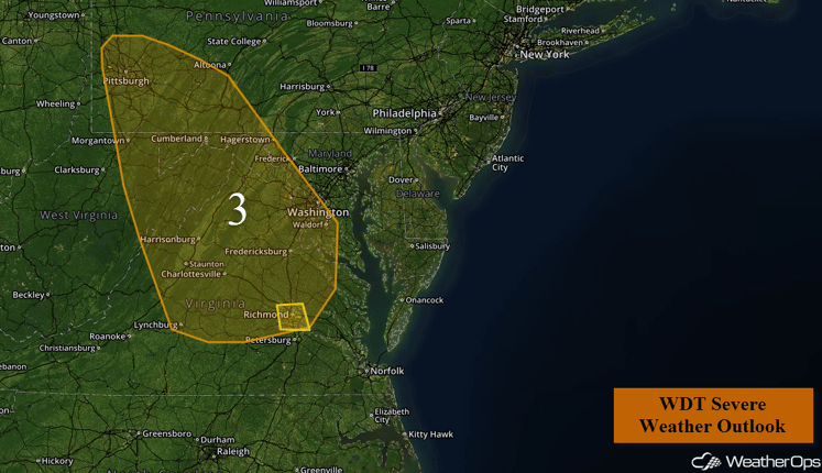
Region 3
Excessive Rainfall Possible Wednesday across the Desert Southwest
As Tropical Storm Newton continues to make landfall in Mexico, plentiful moisture will surge into the Desert Southwest, allowing for numerous showers and thunderstorms throughout the day. Rainfall amounts will average 1-3 inches with locally heavier amounts in southern portions of the region.
Major Cities in Region: Phoenix, AZ, Tucson, AZ
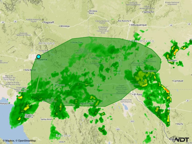
Excessive Rainfall Risk Outline for Wednesday
Strong to Severe Thunderstorms Possible Thursday for Nebraska and Iowa
Thunderstorm development will be possible late Thursday into Friday across the region as moisture increases across the region. A few thunderstorms with large hail and gusty winds will be possible before the activity merges into a squall line and continues to move eastward.
Major Cities in Region: Grand Island, NE, Omaha, NE, Des Moines, IA
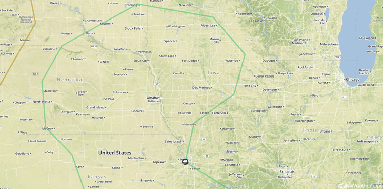
SPC Convective Outlook for Thursday
Strong to Severe Thunderstorms Possible for Portions of Kansas and Oklahoma on Thursday
A cold front will stall and eventually begin lifting northward as a warm front on Thursday, promoting thunderstorm development with a few severe thunderstorms possible. A few of these storms will have the potential to produce large hail and damaging winds through the evening and nighttime hours.
Major Cities in Region: Wichita, KS, Oklahoma City, OK, Tulsa, OK, Topeka, KS
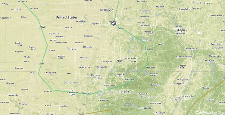
SPC Convective Outlook for Thursday
Strong to Severe Thunderstorms Possible Thursday from the Ohio Valley through the Northeast
A cold front and area of low pressure will approach the region on Thursday, bringing the potential for thunderstorms, some of which may be severe. Ongoing cloud cover could limit overall development, but any daytime heating that can develop should allow for the development of thunderstorms capable of large hail and damaging winds during the afternoon and evening.
Major Cities in Region: Columbus, OH, Cleveland, OH, Pittsburgh, PA, Albany, NY
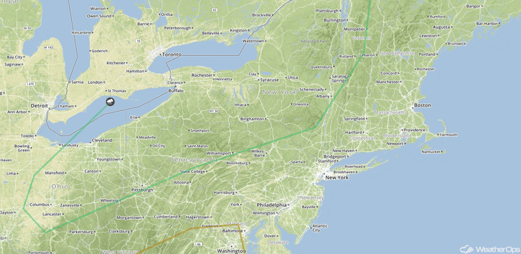
SPC Convective Outlook for Thursday
Excessive Rainfall Possible across the Missouri Valley on Thursday
Another round of thunderstorm activity is likely along a sagging frontal boundary across the Missouri Valley that should eventually lift back to the north as a warm front. Rainfall amounts of 1-2 inches will be possible, in addition to some flooding.
Major Cities in Region: Wichita, KS, Kansas City, MO, Springfield, MO, St. Louis, MO
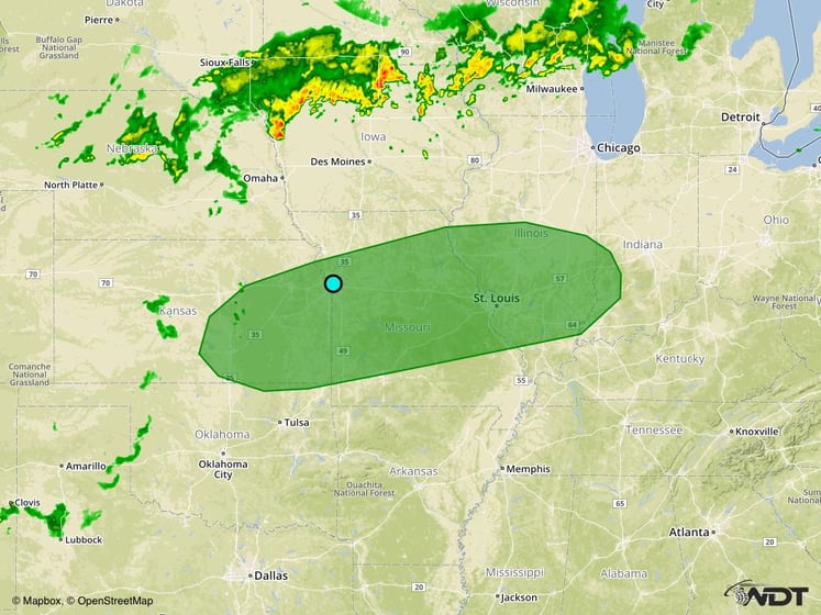
Excessive Rainfall Risk Outline for Thursday
Strong to Severe Thunderstorms Possible for Portions of the Plains and Missouri Valley on Friday
A cold front will be moving into the region on Friday, allowing for a risk of strong to severe thunderstorms during the day. Ongoing cloud cover and thunderstorms during the morning will limit thunderstorm development, but new thunderstorm activity will be likely with large hail and damaging winds the primary threats. Further to the east across the Missouri Valley, thunderstorms will be possible along a warm front during the evening and overnight hours. Excessive rainfall will also be possible with rainfall amounts of 1-2 inches and locally higher amounts in excess of 3 inches possible.
Major Cities in Region: Dodge City, KS, Oklahoma City, OK, Tulsa, OK, Kansas City, MO, Springfield, MO, St. Louis, MO
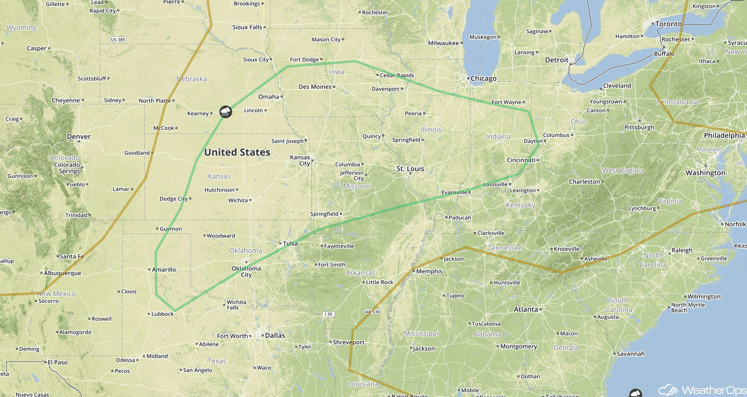
SPC Convective Outlook for Friday
Tropical Update
A tropical wave (green oval) is passing near the Cabo Verde Islands accompanied by disorganized showers and thunderstorms. No significant development is expected during the next couple of days, but conditions are expected to become a little more favorable for gradual development of this system, and a tropical depression could form by the weekend while it moves west-northwestward toward the central tropical Atlantic.
Tropical Storm Newton (red oval) continues to move north-northeastward and is expected to dissipate tonight. Tropical storm conditions could reach as far north as southern Arizona. Rainfall amounts of 3-6 inches with locally higher amounts in excess of 10 inches will be possible.
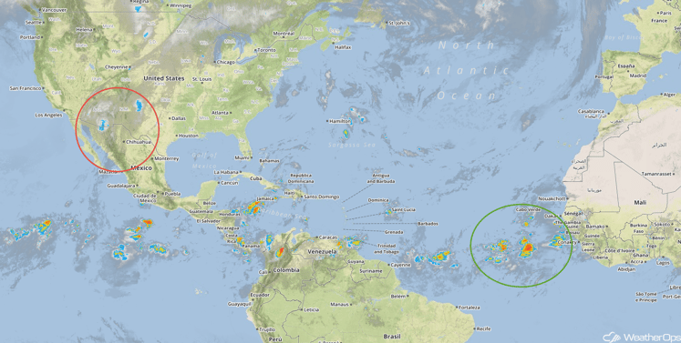
Tropical Infrared Satellite
A Look Ahead
Thunderstorms will be possible across the Ohio Valley on Saturday as an area of low pressure and cold front approach the region. By early next week, a new system will bring a risk for thunderstorms to portions of the Northern and Central Plains.
This is just a brief look at current weather hazards. We can provide you site-specific forecast information for the purpose of protecting your personnel and assets. Try a 7-day demo right away and learn how timely precision weather information can enhance your bottom line.


