


by David Moran, on Oct 24, 2018 10:12:15 AM
Snow will continue across northern Maine through Thursday as an area of low pressure moves across the region. A stalled front will promote elevated winds and seas across portions of the northern Gulf of Mexico through early evening.
- Snow across Northern Maine through Thursday
- Elevated Winds and Seas through Wednesday Evening across the Northern Gulf of Mexico
- Thunderstorms for Central Florida, Eastern Georgia, and Eastern South Carolina on Friday
- Tropical Update
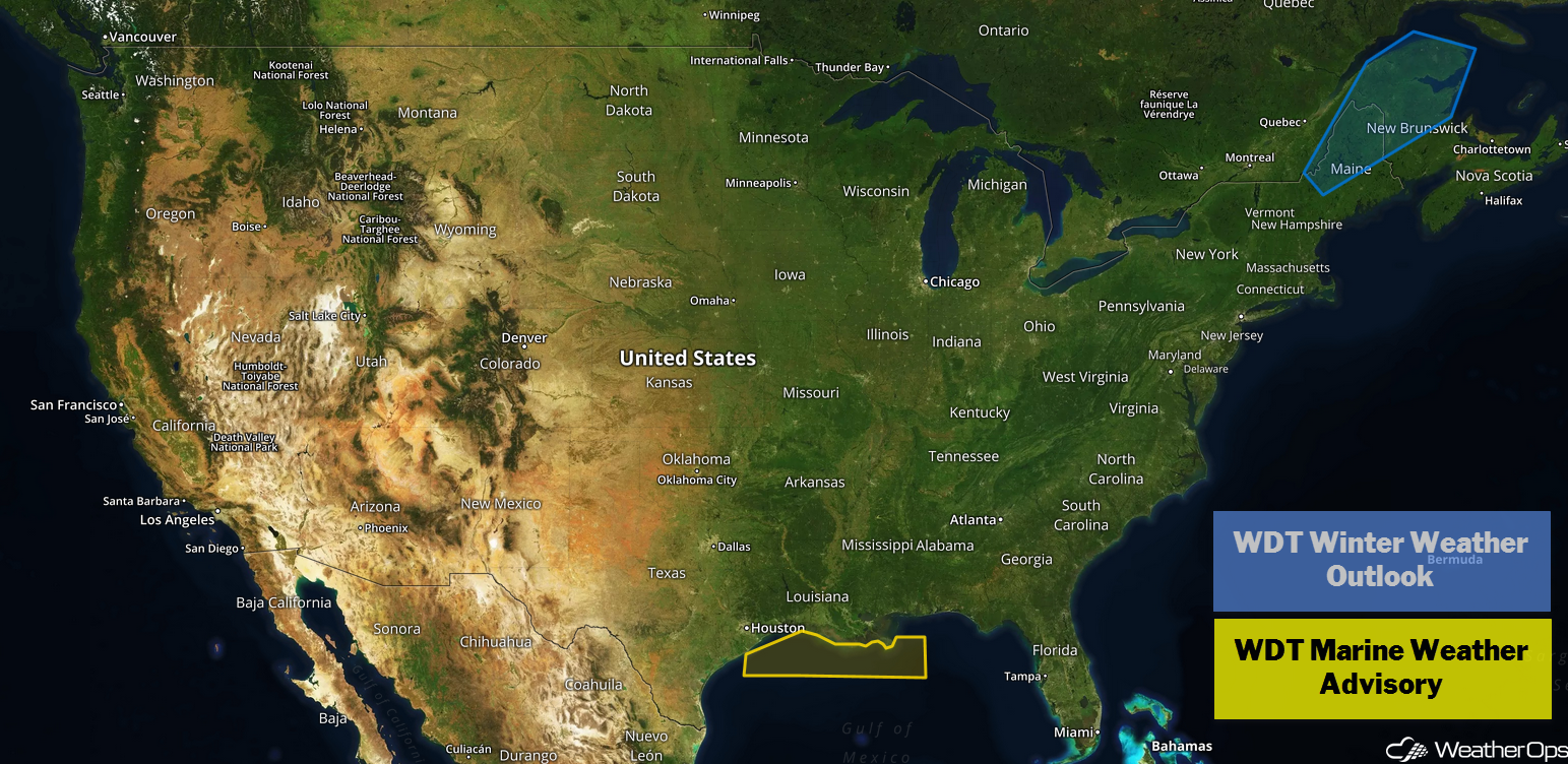
US Hazards
Snow across Northern Maine through Thursday
A strong area of low pressure is expected to move across portions of northern Maine today and tomorrow, bringing continued snowfall to the region. Widespread totals of 4-8 inches are expected with locally higher amounts in excess of 10 inches. In the mountains, 12-18 inches with locally higher amounts in excess of 24 inches are forecast in the highest elevations. In addition, temperatures will hover around freezing, allowing for light icing.
Major Cities in Region: Bangor, ME, Presque Isle, ME
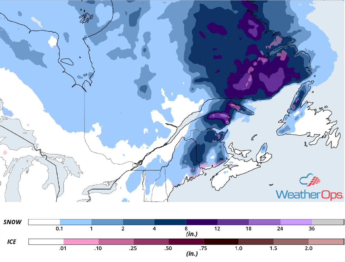
Snow Accumulation through Thursday
Elevated Winds and Seas through Wednesday Evening across the Northern Gulf of Mexico
An area of low pressure over the western Gulf of Mexico and a stationary front draped southeastward from the low will continue to promote easterly to east-northeasterly winds at 20-25 knots with gusts in excess of 30 knots. This will result in seas of 6-8 feet. Winds and seas will gradually diminish from west to east throughout the day.
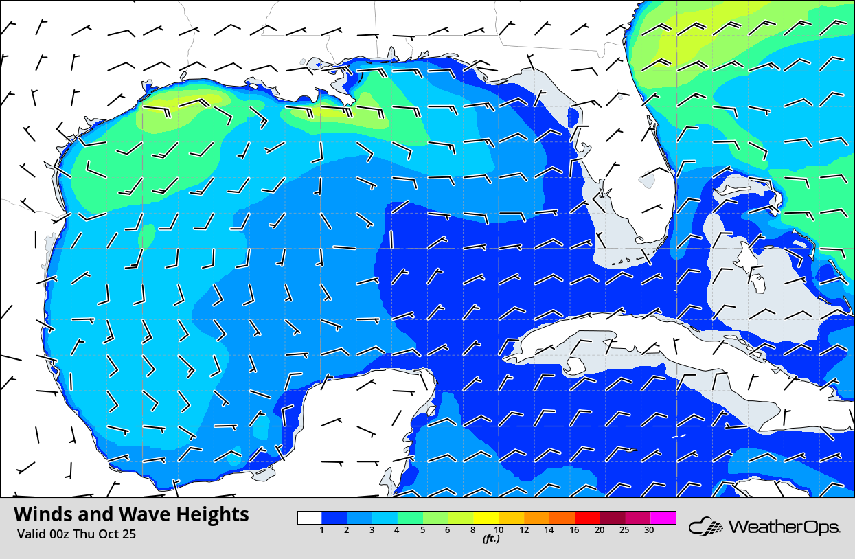
Winds and Wave Heights 7pm CDT Wednesday
Thunderstorms for Central Florida, Eastern Georgia, and Eastern South Carolina on Friday
An upper level trough moving across the region will allow for the development of scattered showers and thunderstorms on Friday. Daytime heating will allow instability to build, which may allow some storms to become strong to severe by the late afternoon and early evening. While widespread severe thunderstorms are not anticipated, severe winds and an isolated tornado will be the primary hazards with the stronger storms.
Major Cities in Region: Gainesville, FL, Jacksonville, FL, Savannah, GA, Charleston, SC, Myrtle Beach, SC
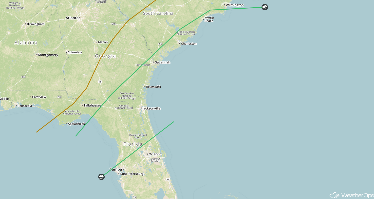
SPC Convective Outlook for Friday
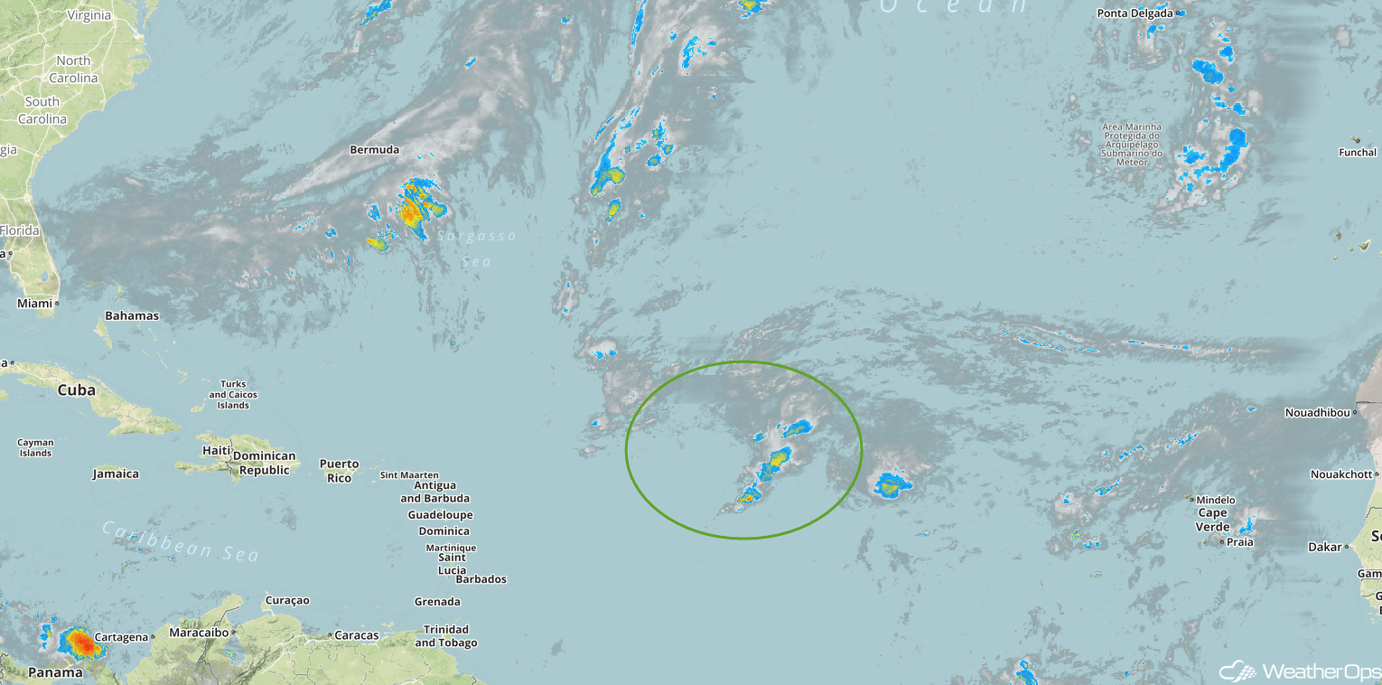
Tropical Update
A large area of disorganized showers and thunderstorms over the central Atlantic Ocean is associated with an area of low pressure about 900 miles east of the northern Leeward Islands. This system is expected to move slowly northward over the next few days into an environment that will be more favorable for development. A tropical or subtropical depression could develop over the weekend while the system moves westward.
Enhanced Infrared Satellite
A Look Ahead
An area of low pressure moving along the East Coast will bring rain to portions of the Mid Atlantic and Northeast on Saturday. By late Saturday, rain will change over to snow across the Northeast. A mix of rain and wintry precipitation is forecast across portions of New England on Sunday. On Monday, snow may develop across portions of Washington into northern Idaho. Rain and snow are forecast across the Central Rockies on Tuesday.
