National Weather Summary for Wednesday, October 19, 2016
by David Moran, on Oct 19, 2016 11:26:35 AM
A stationary front over the Southern Plains and Midwest will allow for isolated to scattered thunderstorms on Wednesday. As the front begins to move eastward on Thursday, thunderstorms are expected across the Ohio Valley. To the north of the area of low pressure associated with the cold front, heavy to excessive rainfall will be possible across the Eastern Great Lakes. By Friday, the risk for excessive rainfall will move into the Northeast.
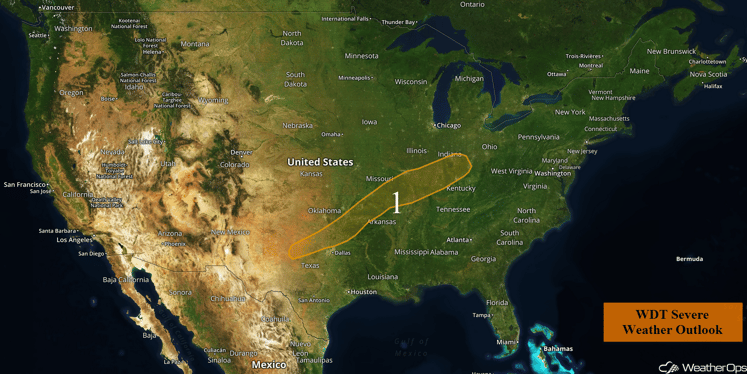
US Hazards
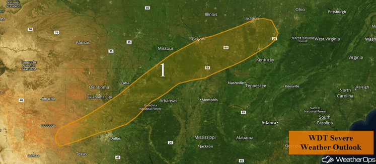
Region 1
Severe thunderstorms will be possible this afternoon and evening along and ahead of a cold front stretching from the lower Ohio Valley through the Mid-Mississippi Valley and into the Southern Plains. Plentiful heating along this front combined with instability should allow for the development of thunderstorms; strong winds and large hail will be the primary hazards. While the tornado potential is low, a few brief tornadoes cannot be completely ruled out. The greater risk for severe thunderstorms will be across the Ozark Plateau. This activity is expected to gradually weaken due to the loss of daytime heating and the southward movement of the front.
Update 12:36pm CDT: Severe thunderstorms capable of hail and damaging winds ongoing for portions of southwestern Missouri.
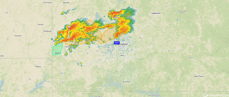
Radar 12:36pm CDT
Update 12:57pm CDT: Severe Thunderstorm Watch in effect for portions of Illinois and Missouri until 8pm CDT. Hail to 1.5 inches and damaging winds to 70 mph possible.
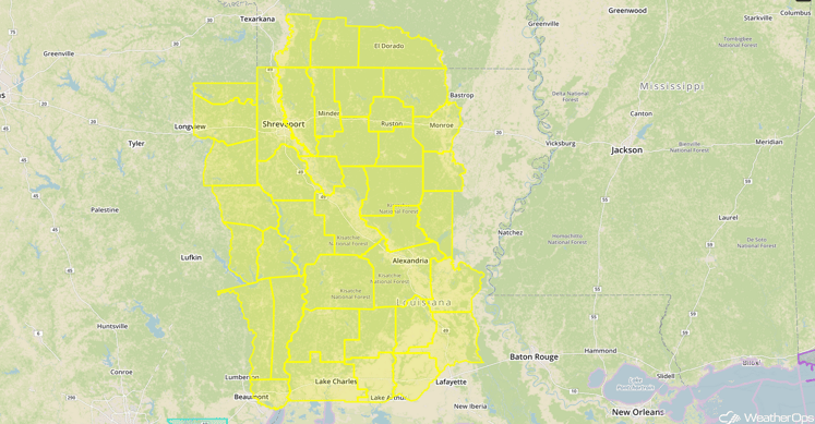
Severe Thunderstorm Watch
Update 2:37pm CDT: Severe thunderstorms continue to move eastward across Missouri; hail and damaging winds possible.
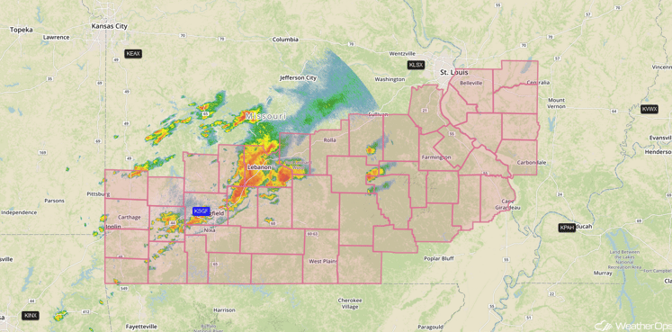
Radar 2:37pm CDT
Major Cities in Region: Sherman, TX, Fort Smith, AR, St. Louis, MO, Evansville, IN, Louisville, KY, Indianapolis, IN, Cincinnati, OH
Region 1
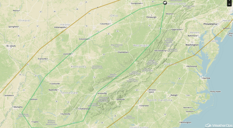
Strong to Severe Thunderstorms Possible Thursday across Ohio Valley
Thunderstorms are expected to develop across the Ohio Valley ahead of a cold front on Thursday. As instability builds, thunderstorms will develop during the afternoon. With weak upper level support, this activity should dissipate during the early evening.
Major Cities in Region: Tupelo, MS, Huntsville, AL, Chattanooga, TN, Charleston, WV, Pittsburgh, PA
SPC Convective Outlook for Thursday
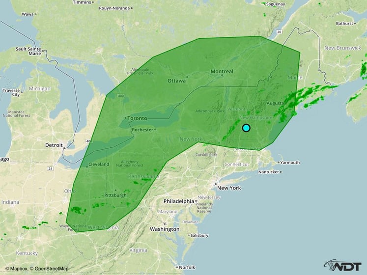
Excessive Rainfall Possible across the Eastern Great Lakes on Thursday
As an area of low pressure and warm front moves to the south of the region on Thursday, heavy to excessive rainfall will be possible. Total rainfall accumulations of 2-4 inches will be possible, especially across portions of New York, with locally heavier amounts in excess of 5 inches.
Major Cities in Region: Cleveland, OH, Pittsburgh, PA, Rochester, NY, Augusta, ME
Excessive Rainfall Risk Outline for Thursday
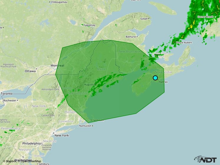
Excessive Rainfall Possible across the Northeast on Friday
As the area of low pressure mentioned above continues to track northeastward on Friday, heavy to excessive rainfall will be possible across portions of the Northeast. Total rainfall accumulations of 2-3 inches will be possible with locally higher amounts in excess of 4 inches.
Major Cities in Region: Augusta, ME, Boston, MA
Excessive Rainfall Risk Outline for Friday
Tropical Update
An area of low pressure is located about 250 miles northeast of the Turks and Caicos Islands. Associated cloudiness and thunderstorms are located well east of the center due to strong upper level winds. Upper level winds are expected to become more conducive for this system to acquire tropical characteristics, and a subtropical or tropical cyclone is likely to form within the next couple of days. The low is forecast to move northward today and turn north-northwestward on Thursday before turning north-northeastward by the weekend. Regardless of development, locally heavy rainfall is possible over Hispaniola, Puerto Rico, and portions of the northern Leeward Islands today.
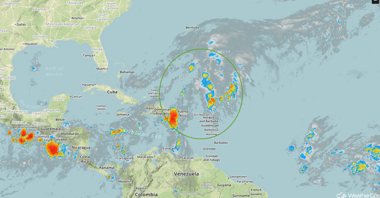
Infrared Tropical Satellite
A Look Ahead
Light rainfall may linger across the Northeast over the weekend as an area of low pressure moves across the region. By early next week, an area of low pressure will move into the Pacific Northwest, bringing with it a chance of rain to the region.
This is just a brief look at current weather hazards. We can provide you site-specific forecast information for the purpose of protecting your personnel and assets. Try a 7-day demo right away and learn how timely precision weather information can enhance your bottom line.


