National Weather Summary for Wednesday, November 8, 2017
by David Moran, on Nov 8, 2017 10:52:59 AM
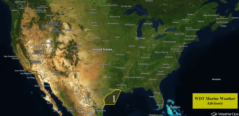
Thunderstorms, as well as elevated winds and seas, are forecast off the Texas and Louisiana coasts Wednesday into Thursday ahead of a cold front. Snow will continue from the Pacific Northwest into the Northern Plains as an area of low pressure moves through the region.
- Elevated Winds and Seas for the Northwestern Gulf of Mexico through Thursday Afternoon
- Snow Continuing through Thursday morning from the Pacific Northwest into the Northern Plains
- Tropical Update
 US Hazards
Elevated Winds and Seas for the Northwestern Gulf of Mexico through Thursday Afternoon
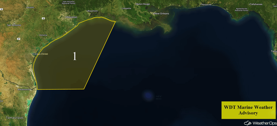
Showers and thunderstorms may develop off the southwest Louisiana and Texas coasts ahead of a cold front Wednesday afternoon. North-northeasterly winds will intensify off the coast with sustained winds of 25-30 knots and gusts of 30-40 knots. These winds will continue through mid-afternoon Thursday. Swells of 3-5 feet are expected near the shores and 6-9 feet in the deeper waters.
 Region 1
Snow Continuing through Thursday morning from the Pacific Northwest into the Northern Plains
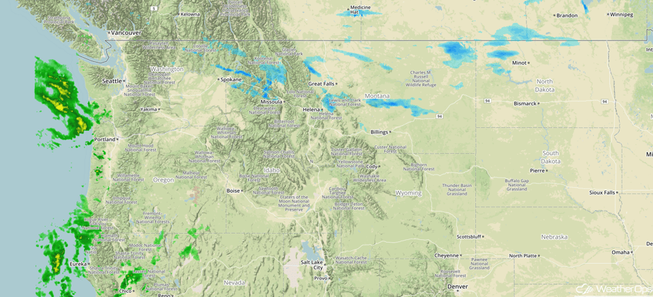
Snow will continue for portions of the Pacific Northwest and Northern Rockies through Thursday morning as an area of low pressure moves through the region. Across portions of eastern Washington, snowfall totals of 4-6 inches are forecast. Portions of Oregon may pick up 3-6 inches of snow. Further east across portions of Montana and North Dakota, snow accumulations should generally be less than an inch.
Major Cities in Region: Spokane, WA, Missoula, MT, Helena, MT, Great Falls, MT, Minot, ND
 Radar 7:53am PST
Tropical Update
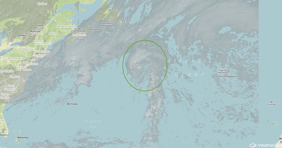
The center of Tropical Storm Rina is located 705 miles south-southeast of Cape Race, Newfoundland and is moving northward at 10 mph. A turn toward the north-northeast is expected by this afternoon, followed by a rapid northeastward motion on Thursday. Maximum sustained winds have increased to near 60 mph with higher gusts. Little change is forecast before weakening begins on Thursday.
 Visible Tropical Satellite
A Look Ahead
The potential for significant winter weather remains over the Great Lakes on Saturday as a strong, quick moving upper-level trough moves through the region. There is some uncertainty in whether cold air will be in place. However, the current forecast is for precipitation to begin early Saturday morning as an area of low pressure develops. Snow and sleet accumulations of 2-4 inches are expected in most places. Across the northern Great Lakes, snowfall totals may exceed 6 inches. By late afternoon, precipitation should transition to rain. Elsewhere, heavy snow may develop over the higher terrain of the Pacific Northwest on Sunday as an area of low pressure moves into the region.
Learn what to expect this winter by signing up for our Winter Weather Outlook webinar today.
This is just a brief look at current weather hazards. We can provide you site-specific weather forecast information for the purpose of protecting your personnel and assets and to assess your weather risk. Try a 7-day demo right away and learn how timely precision weather information can enhance your bottom line.


