


by David Moran, on Nov 21, 2018 10:57:29 AM
Snow is expected from the Cascades into the Rockies through Friday as a series of disturbances move across the region. Heavy to excessive rainfall will continue across Northern and Central California through Friday as moisture continues to stream into the region. Elevated winds and seas are expected Wednesday afternoon through Thursday afternoon across the western Gulf of Mexico as an area of low pressure develops.
- Snow from the Cascades into the Rockies through Friday
- Excessive Rainfall through Friday for Northern and Central California
- Elevated Winds and Seas for the Western Gulf of Mexico Wednesday Afternoon through Thursday Afternoon
- Potential for Snow Friday and Saturday across the Central Rockies
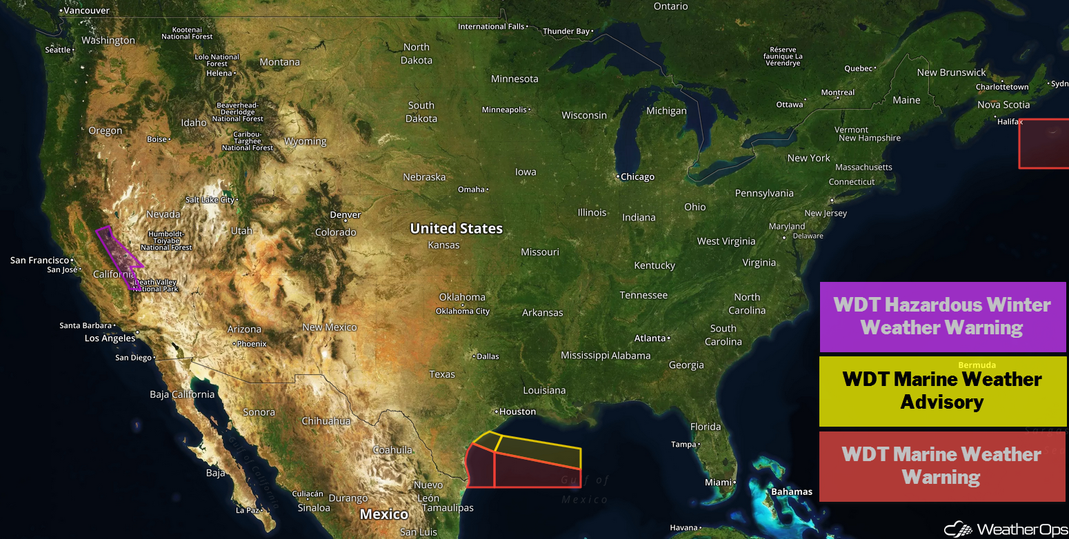
US Hazards
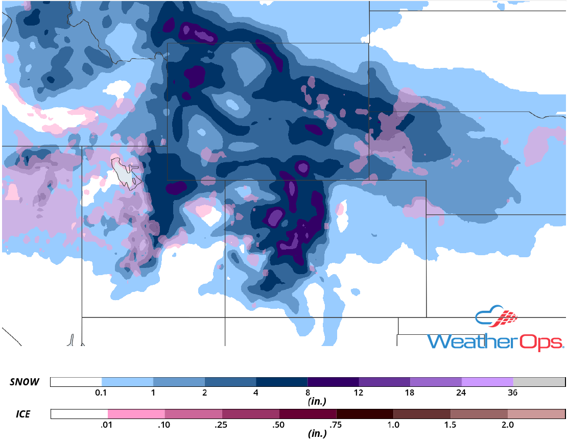
Snow from the Cascades into the Rockies through Friday
Multiple upper level disturbances will pivot across the Rockies over the next few days with snow expected for the higher elevations. Moderate to heavy snow will begin today across Idaho, Wyoming, Utah, and Colorado. Snow accumulations will range 4-8 inches with locally higher amounts in excess of a foot. While the more substantial snow will remain at higher elevations, lower elevations could pick up 1-3 inches. Across the Cascades, accumulations of 8-15 inches with locally higher amounts in excess of 20 inches are expected. In addition, wind gusts in excess of 50 mph will allow for blowing snow, limited visibilities, and hazardous travel conditions.
Major Cities in Region: Reno, NV, Boise, ID, Salt Lake City, UT, Cody, WY, Grand Junction, CO
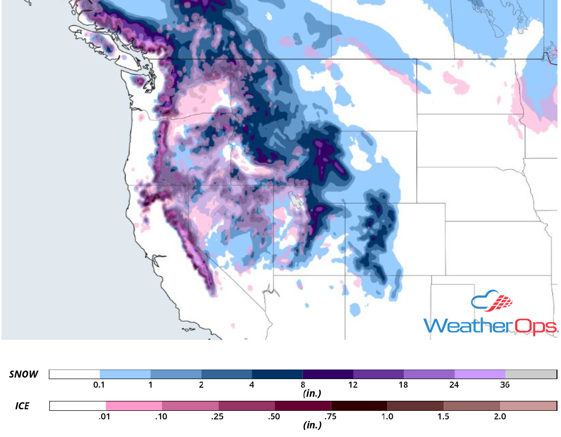
Snow Accumulation through Friday
Excessive Rainfall through Friday for Northern and Central California
Multiple rounds of shower and thunderstorm activity will begin across northern and central California this morning and afternoon as moisture streams into the region. This moisture, combined with forcing from two upper level troughs, will allow for the development of showers and thunderstorms through Friday. The first round of showers and thunderstorms will continue into the early morning hours on Thursday as the first trough approaches. Additional activity may develop later in the evening. The second disturbance will move into the region on Friday, producing additional showers that will continue into early Saturday. Rainfall amounts will range 1-3 inches with locally higher amounts in excess of 4 inches, leading to a potential for flooding and local runoff.
Major Cities in Region: San Francisco, CA, Redding, CA, Sacramento, CA
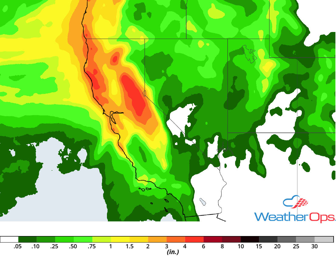
Rainfall Accumulation through Friday
Elevated Winds and Seas for the Western Gulf of Mexico Wednesday Afternoon through Thursday Afternoon
An area of low pressure is forecast to develop along a stalled front across the Gulf of Mexico, leading to elevated winds and seas beginning Wednesday afternoon and continuing through Thursday afternoon. Winds will be northeasterly at 25-32 knots with gusts in excess of 35 knots. Across western areas, seas will range 5-7 feet near the shore and 6-10 feet in the deeper waters. Further east, seas will range 8-11 feet. In addition, thunderstorms may develop along the front.
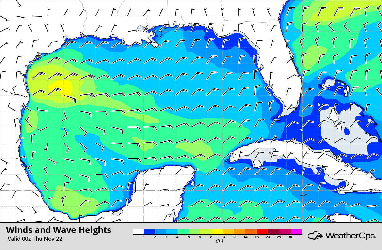
Winds and Wave Heights 6pm CST Wednesday
Potential for Snow Friday and Saturday across the Central Rockies
An area of low pressure will continue moving eastward while intensifying on Friday. This will allow for the potential for moderate to heavy snow across much of the Central Rockies. Significant accumulations will mainly be confined to higher elevations where 4-8 inches of snow are forecast. Snow will continue into Saturday and should end by Sunday.
Major Cities in Region: Grand Junction, CO, Steamboat Springs, CO
Snowfall Accumulation for Friday and Saturday
A Look Ahead
Showers and thunderstorms will extend from the Great Lakes into the Southeast on Saturday as an upper level trough moves eastward. Late Saturday into Sunday, an area of low pressure will move into the Plains, producing snow from Kansas northeastward into the Great Lakes. Light snow may continue across the Great Lakes Monday and Tuesday. By Tuesday, snow may develop across portions of the Northeast.
