National Weather Summary for Wednesday, May 17, 2017
by David Moran, on May 17, 2017 11:04:03 AM
A strong upper level low will bring a risk for strong to severe thunderstorms from portions of the Ozarks into the Midwest on Wednesday. Strong to severe thunderstorms may also develop across portions of the High Plains as instability builds through the day.
- Thunderstorm Potential from the Ozarks into the Midwest on Wednesday
- Elevated Conditions Continuing for the Northwestern Gulf of Mexico through Wednesday Morning
- Severe Thunderstorms Expected across Kansas and Oklahoma on Thursday
- Excessive Rainfall Risk for East Central Kansas on Thursday
- Thunderstorm Risk Friday from the Southern Plains into the Missouri and Ohio Valleys
- Excessive Rainfall Possible Friday for the Missouri Valley and Oklahoma
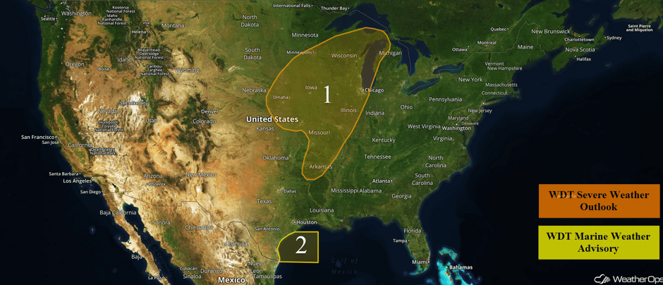 US Hazards
Thunderstorm Potential from the Ozarks into the Midwest on Wednesday
An area of low pressure over the Central Plains will move northeastward throughout the day on Wednesday. Strong southerly winds will bring plentiful moisture into the Midwest and Great Lakes, which will support the development of severe thunderstorms this afternoon and evening.
Further to the south, remnant showers and thunderstorms over portions of Missouri and Arkansas will continue to move northeastward and dissipate during the morning and afternoon. Additional thunderstorm activity may develop across southern Missouri and Arkansas this afternoon with severe wind and hail being the main concerns.
Later this afternoon and evening, storms will begin to develop in eastern Kansas and southeastern Nebraska. Severe wind, large hail, and tornadoes will be the primary hazards with these storms. The highest risk includes much of Iowa and southwestern Missouri.
Update 12:16pm CDT: Tornado Watch in effect for portions of Iowa, Kansas, Missouri, and Nebraska until 7pm CDT.
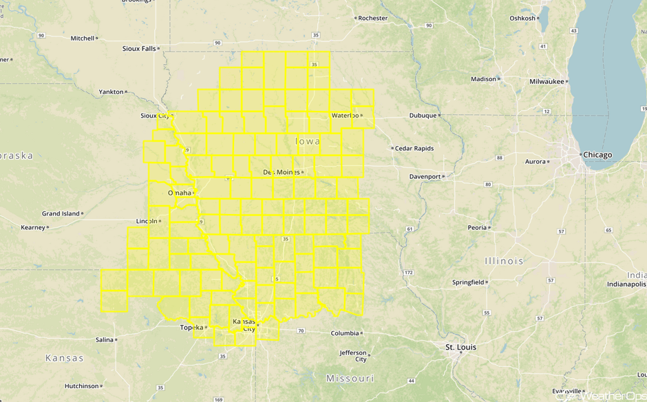 Tornado Watch
Update 1:20pm CDT: Severe Thunderstorm Warning south of Lincoln, NE. Hail and damaging winds will be the primary hazards.
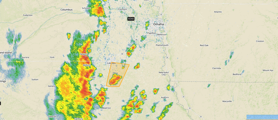 Radar 1:20pm CDT
Update 1:37pm CDT: Tornado Warning NE of Sioux City, IA.
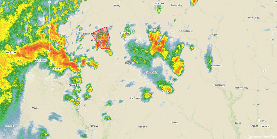 Radar 1:37pm CDT
Update 1:50pm CDT: Severe thunderstorm capable of hail and damaging winds southwest of Wausau, WI.
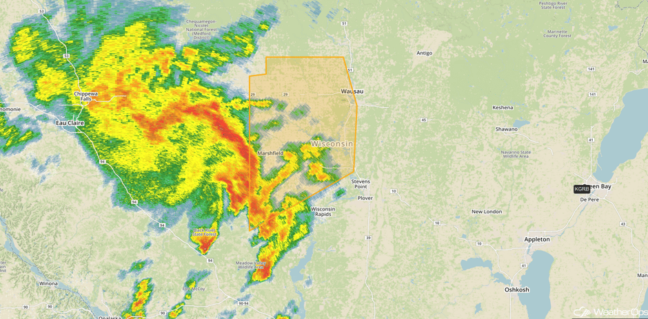 Radar 1:50pm CDT
Major Cities in Region: Topeka, KS, Omaha, NE, Kansas City, MO, Ft. Smith, AR, Little Rock, AR, Des Moines, IA, St. Louis, MO, Green Bay, WI, Milwaukee, WI, Chicago, IL, Traverse City, MI
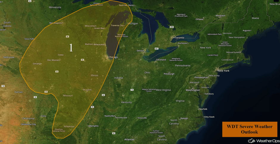 Region 1
Elevated Conditions Continuing for the Northwestern Gulf of Mexico through Wednesday Morning
Elevated winds and seas will continue through late Wednesday morning. Sustained winds of 20-25 knots with gusts in excess of 30 knots are expected. Seas will remain at 7-8 feet before subsiding by midday.
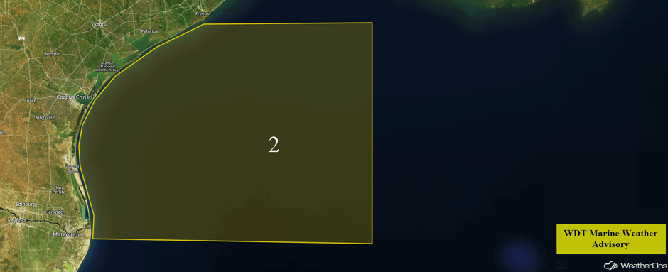 Region 2
Severe Thunderstorms Expected across Kansas and Oklahoma on Thursday
A volatile weather setup will take shape on Thursday across the Southern Plains of Kansas and Oklahoma. Moisture return is expected behind a cold front across the region. With a highly unstable atmosphere and an area of low pressure over Colorado, thunderstorms are expected to develop. Storms will quickly become severe with the potential for large hail, damaging winds, and tornadoes. As the evening progresses, thunderstorm activity will progress into eastern Kansas and northeastern Oklahoma where damaging winds will be the primary hazard, in addition to some isolated instances of hail.
Major Cities in Region: Dodge City, KS, Oklahoma City, OK, Wichita, KS, Tulsa, OK, Topeka, KS
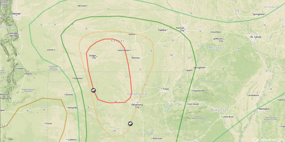 SPC Convective Outlook for Thursday
Excessive Rainfall Risk for East Central Kansas on Thursday
Shower and thunderstorm activity associated with a potent upper level low on Thursday is expected to shift eastward into the overnight hours. There will be a risk for excessive rainfall across portions of east-central Kansas through early Friday morning. Rainfall accumulations of 1-2 inches with locally heavier amounts in excess of 3 inches are forecast. This may result in minor flooding and local runoff.
Major Cities in Region: Wichita, KS
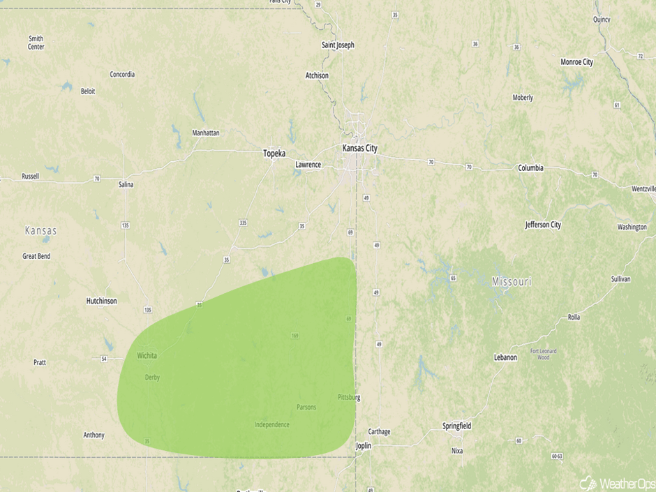 Excessive Rainfall Risk for Thursday
Thunderstorm Risk Friday from the Southern Plains into the Missouri and Ohio Valleys
The threat for significant severe weather will diminish by Friday, but severe thunderstorm potential will stretch from the Southern Plains into the Ohio Valley. At the surface, a slow moving cold front will provide a trigger for storm development from Western Oklahoma southward to Del Rio, Texas. Meanwhile, an area of low pressure over Kansas will likely support numerous showers and thunderstorms. Further east, a stationary front extending into West Virginia will be the focus for shower and thunderstorm development, some severe, across northern Missouri and into the Ohio Valley. Strong to severe thunderstorms may develop with large hail and and damaging winds being the primary hazards.
Major Cities in Region: Del Rio, TX, Oklahoma City, OK, Dallas, TX, Tulsa, OK, Ft. Smith, AR, Joplin, MO, Springfield, MO, Little Rock, AR, St. Louis, MO, Memphis, TN, Louisville, KY, Knoxville, TN
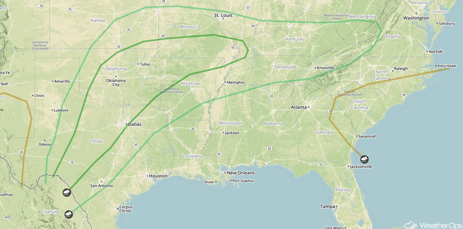 SPC Convective Outlook for Friday
Excessive Rainfall Possible Friday for the Missouri Valley and Oklahoma
As a result of increased shower and thunderstorm activity, a threat for excessive rainfall is forecast to develop on Friday. Total rainfall accumulations through early Saturday morning could range 1-3 inches with locally higher amounts in excess of 4 inches. This will pose an elevated risk for flooding and runoff.
Major Cities in Region: Oklahoma City, OK, Tulsa, OK, Kansas City, MO
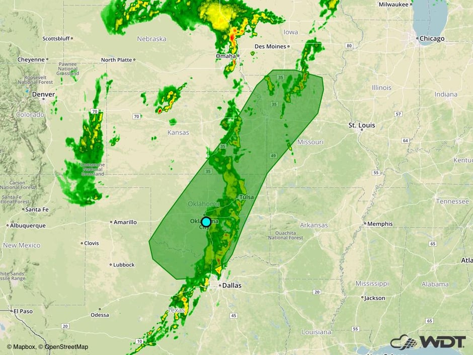 Excessive Rainfall Risk Outline for Friday
A Look Ahead
As the area of low pressure described above continues to lift northward on Saturday, thunderstorms may develop from the Midwest southward into Texas. By Sunday, the severe weather threat will shift eastward into the Southeast.
This is just a brief look at current weather hazards. We can provide you site-specific weather forecast information for the purpose of protecting your personnel and assets and to assess your weather risk. Try a 7-day demo right away and learn how timely precision weather information can enhance your bottom line.


