


by David Moran, on Jun 13, 2018 10:59:36 AM
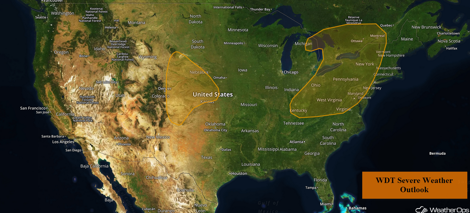
A cold front moving into the Northeast on Wednesday may allow for the development of thunderstorms during the afternoon. Thunderstorms are forecast across the Central High Plains during the afternoon and evening as upslope flow increases.
- Thunderstorms for the Northeast on Wednesday
- Risk for Thunderstorms Wednesday across the Central High Plains
- Thunderstorm Potential for the Northern Plains on Thursday
- Thunderstorms Friday across the Upper Midwest and Central Plains
- Tropical Update
 US Hazards

Thunderstorms for the Northeast on Wednesday
An area of low pressure moving across eastern Canada will progress eastward with a cold front extending into the Ohio Valley. During the morning, a warm front will lift northward, allowing moisture to increase across the region. By the afternoon, with daytime heating increasing, instability will build. A midlevel trough moving across the region will provide additional lift, allowing for the development of thunderstorms along and ahead of the front. Thunderstorms will quickly organize into a line with strong winds and large hail the primary hazards, but an isolated tornado or two cannot be ruled out. Heavy rain and frequent lightning are also expected.
Major Cities in Region: Pittsburgh, PA, Buffalo, NY. Syracuse, NY
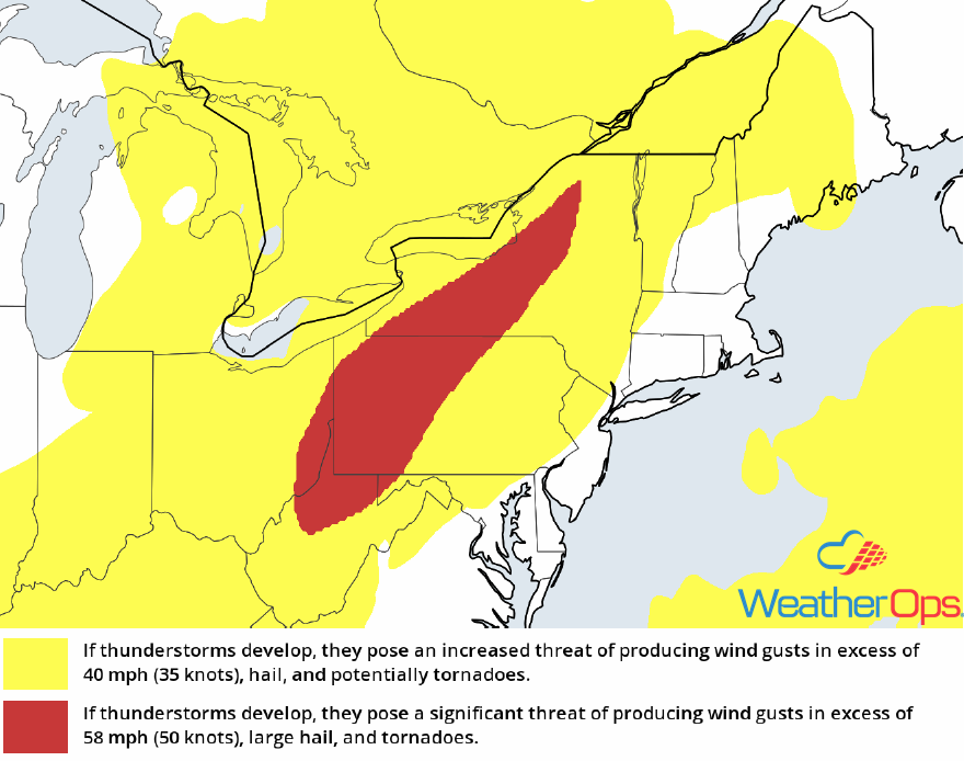 Thunderstorm Risk for Wednesday
Risk for Thunderstorms Wednesday across the Central High Plains
Isolated strong to severe thunderstorms are forecast over the Central High Plains today. Despite a ridge aloft, upslope flow and daytime heating will allow for the development of thunderstorms during the late afternoon and evening. Activity is expected to continue after dark. Strong winds and large hail will be the primary hazards, but an isolated tornado cannot be ruled out.
Major Cities in Region: Scottsbluff, NE, Goodland, KS, North Platte, NE
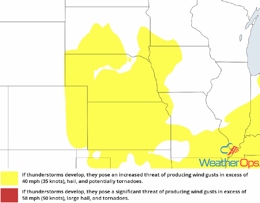 Thunderstorm Risk for Wednesday
Thunderstorm Potential for the Northern Plains on Thursday
Increasing moisture and daytime heating will allow instability to increase across the Northern Plains though the afternoon. As a cold front moves eastward, thunderstorms are expected to develop. Some thunderstorms could become supercells initially; as a result, a few isolated tornadoes cannot be ruled out. Storms will eventually evolve into clusters with strong winds and hail the primary hazards. Activity should persist into the overnight hours as storms continue to move to the east.
Major Cities in Region: Minot. ND, Bismarck, ND, Pierre, SD, Aberdeen, SD, Grand Forks, ND, Fargo, ND
 SPC Convective Outlook for Thursday
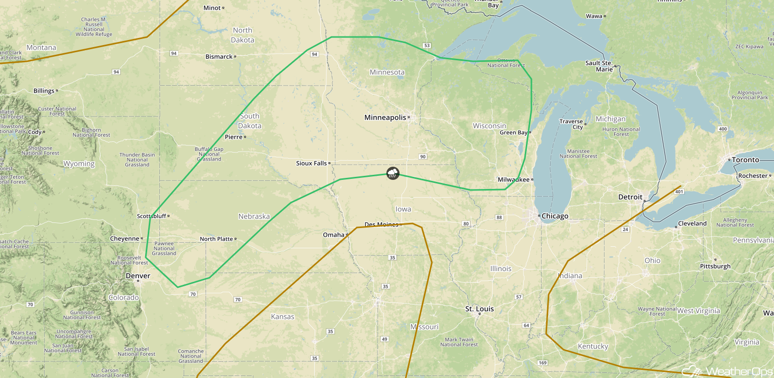
Thunderstorms Friday across the Upper Midwest and Central Plains
While there is some uncertainty in the severe weather potential on Friday, a few strong to severe thunderstorms may develop across portions of the Upper Midwest and Central Plains. Thunderstorms may move across the region Friday morning, which could limit the thunderstorm potential later in the day. If instability is sufficient during the afternoon, thunderstorms could develop along and ahead of a stalled front. Strong winds and hail will be the primary hazards with any storms that develop.
Major Cities in Region: Scottsbluff, NE, North Platte, NE, Pierre, SD,. Sioux Falls, SD, Minneapolis, MN, Green Bay, WI
 SPC Convective Outlook for Friday
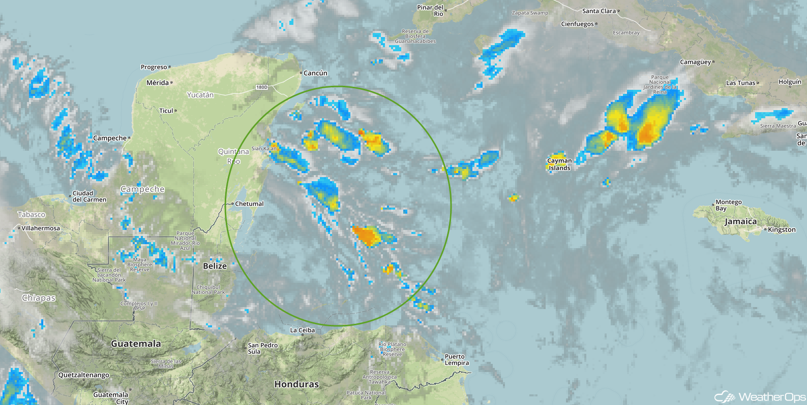
Tropical Update
Disorganized showers and thunderstorms over the western Caribbean are associated with a weak area of low pressure. This activity is forecast to move westward to northwestward over Central America and the Yucatan Peninsula during the next couple of days with no significant development expected. Environmental conditions could become slightly more conducive for development if the system moves into the southwestern Gulf of Mexico by the end of the week.
 Enhanced Infrared Satellite
A Look Ahead
Thunderstorms may continue across portions of the Northern Plains and Upper Midwest on Saturday as a cold front continues to move eastward. This activity may continue into Sunday. By late Sunday, tropical moisture will begin to stream into portions of southeastern and eastern Texas, as well as western Louisiana. This will bring a potential for excessive rainfall to the region Monday into Tuesday. Current model guidance suggests the potential for two day rainfall totals of 3-6 inches with locally higher amounts in excess of 7 inches.
This is just a brief look at current weather hazards. We can provide you site-specific weather forecast information for the purpose of protecting your personnel and assets and to assess your weather risk. Try a 7-day demo right away and learn how timely precision weather information can enhance your bottom line.
