


by David Moran, on Jul 18, 2018 11:01:42 AM
Thunderstorms will continue for portions of the northern Gulf of Mexico through Wednesday evening as an upper level trough moves across the region. An area of low pressure developing across the Plains may allow the development of thunderstorms during the afternoon and evening. Some of these storms may produce excessive rainfall across the Central and Northern Plains and into the Upper Mississippi Valley. Thunderstorms may develop across Northern Arizona as instability increases.
- Continued Thunderstorms Wednesday for the North Central Gulf of Mexico
- Thunderstorms for the Central Plains on Wednesday
- Excessive Rainfall Wednesday across the Central and Northern Plains into the Upper Mississippi Valley
- Potential for Thunderstorms across Northern Arizona on Wednesday
- Risk for Thunderstorms Thursday across the Upper Mississippi Valley
- Excessive Rainfall for the Upper Mississippi Valley on Thursday
- Thunderstorm Potential Friday for the Ohio and Tennessee Valleys
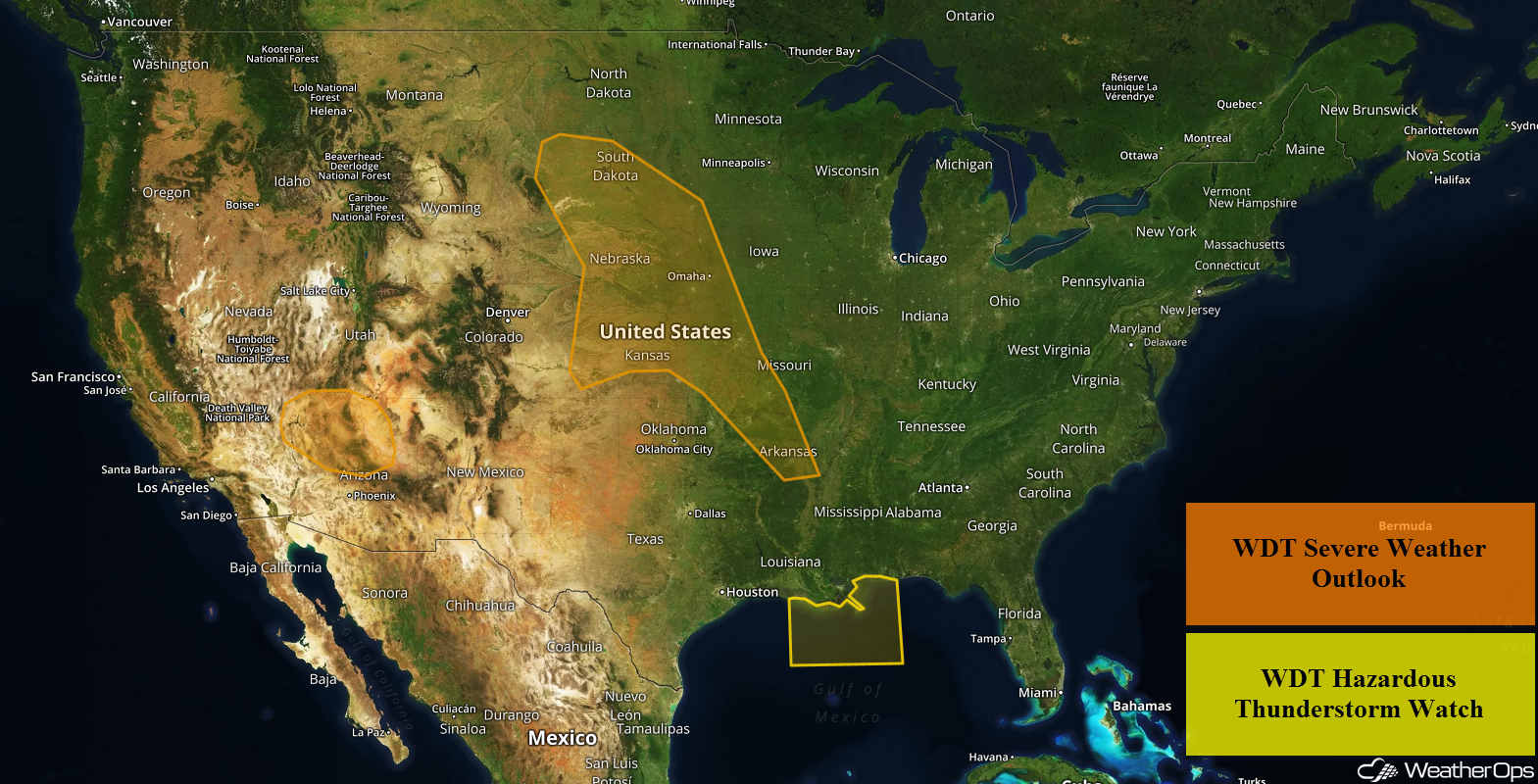
US Hazards
Continued Thunderstorms Wednesday for the North Central Gulf of Mexico
Thunderstorms will continue across the North Central Gulf of Mexico through Wednesday evening as a weak upper level trough moves over the region. Winds in excess of 40 knots, frequent lightning, and heavy rainfall will be the primary hazards, but a few waterspouts cannot be ruled out. While the severe thunderstorms should end during the late afternoon, showers and thunderstorms may continue into the evening.
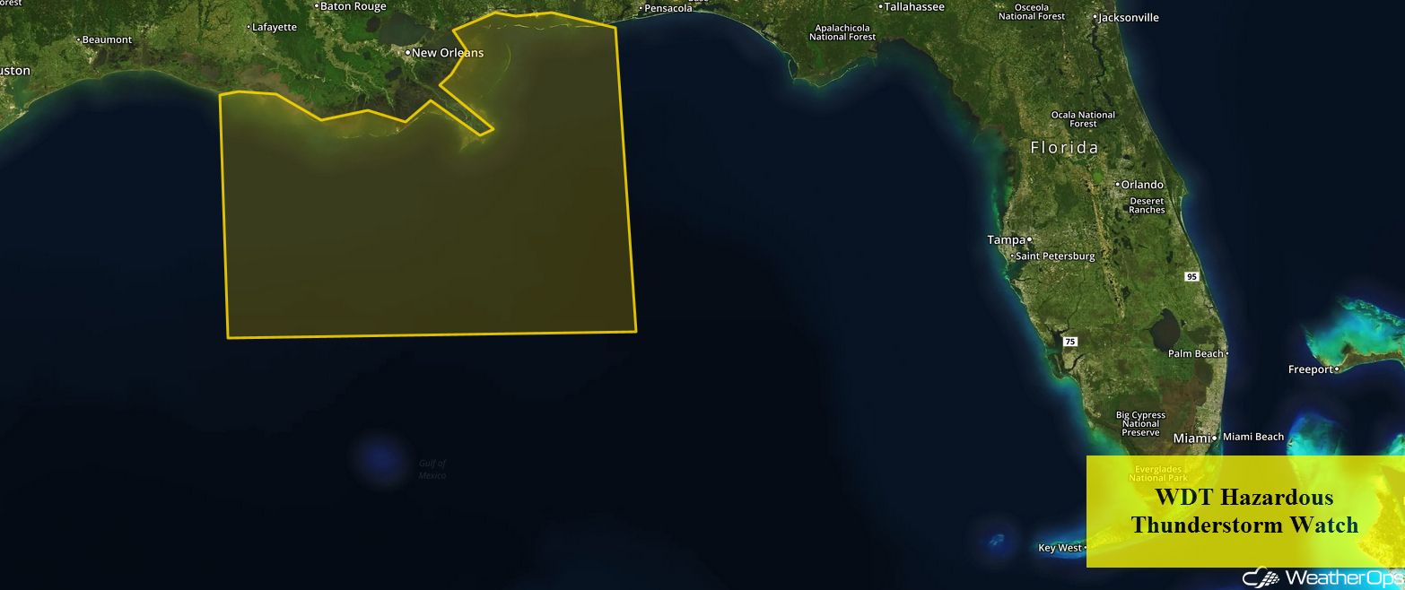
WDT Hazardous Thunderstorm Watch
Thunderstorms for the Central Plains on Wednesday
Severe weather is likely on Wednesday as an area of low pressure begins to develop across the region. Thunderstorms are ongoing across portions of Northern and Central Plains. However, by the afternoon, thunderstorms are expected to redevelop from southern South Dakota into Nebraska, where the strongest instability will be located. Thunderstorms that do develop will generally move southeastward through the afternoon and evening hours. Strong to damaging winds, large hail, and a few tornadoes will all be potential hazards. Further south across portions of Missouri and Arkansas, thunderstorm activity will be more isolated.
Major Cities in Region: North Platte, NE, Pierre, SD, Sioux City, IA, Omaha, NE, Kansas City, MO, Little Rock, AR
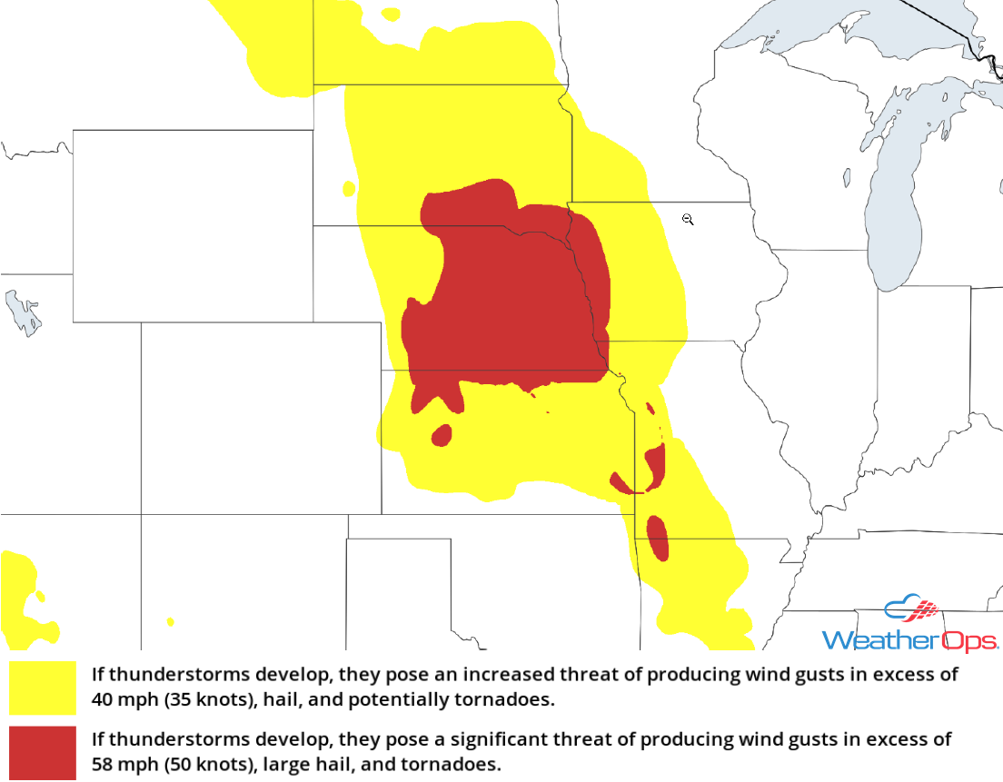
Thunderstorm Risk for Wednesday
Excessive Rainfall Wednesday across the Central and Northern Plains into the Upper Mississippi Valley
Some of the thunderstorms described above will have the potential to produce heavy to excessive rainfall. Rainfall totals will range 0.50-1.50 inches, with locally higher amounts in excess of 2.00 inches. This will likely lead to a risk for flooding.
Major Cities in Region: Pierre, SD, Sioux Falls, SD
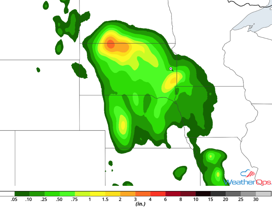
Rainfall Accumulation for Wednesday
Potential for Thunderstorms across Northern Arizona on Wednesday
Daytime heating and plentiful moisture will support the development of a few strong to severe thunderstorms, mainly across the higher terrain, during the afternoon and evening. Strong winds and possibly some small hail will be the primary hazards with these storms.
Major Cities in Region: Flagstaff, AZ
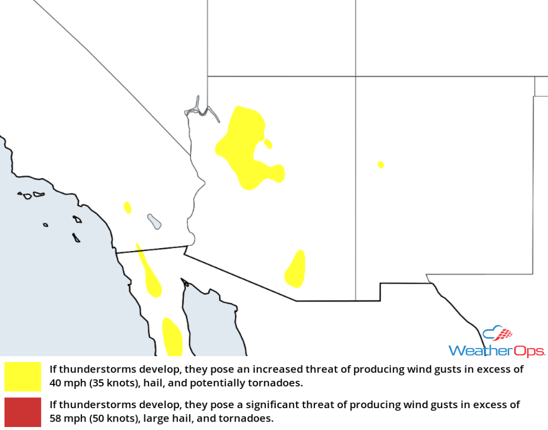
Thunderstorm Risk for Wednesday
Risk for Thunderstorms Thursday across the Upper Mississippi Valley
An area of low pressure and its associated cold front will move into the Upper Mississippi Valley on Thursday, bringing a risk for strong to severe thunderstorms. Thunderstorms may be ongoing during the morning. Additional storms may develop during the afternoon along the front. These thunderstorms are forecast to move eastward during the mid to late afternoon and evening hours. Strong winds and hail will be the primary hazards.
Major Cities in Region: Minneapolis, MN, Rochester, MN, Waterloo, IA, Cedar Rapids, IA, Dubuque, IA, Davenport, IA, Madison, WI
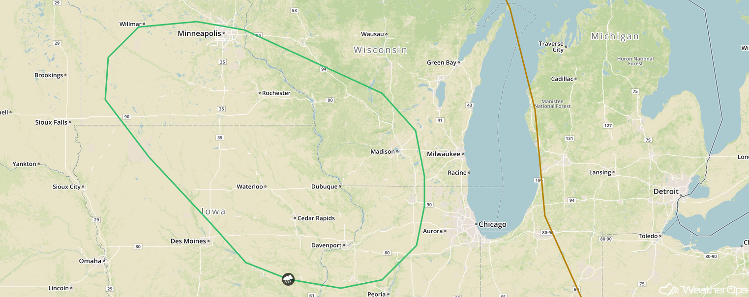
SPC Convective Outlook for Thursday
Excessive Rainfall for the Upper Mississippi Valley on Thursday
In addition to the thunderstorm potential described above, there will be a risk for excessive rainfall. Rainfall amounts will range from 0.50-1.50 inch with locally higher amounts in excess of 2.00 inches. Given the rainfall expected on Wednesday and this additional rain, there will be a potential for flooding.
Major Cities in Region: Bemidiji, MN, Minneapolis, MN
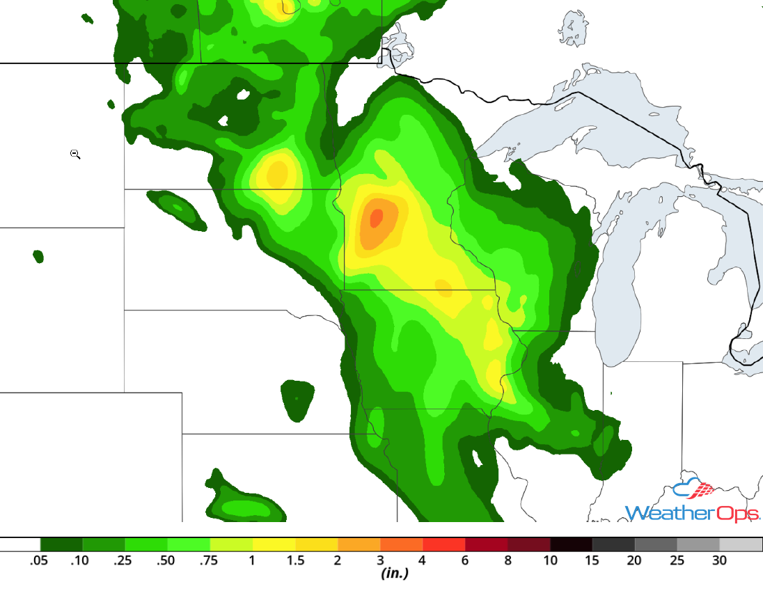
Rainfall Accumulation for Thursday
Thunderstorm Potential Friday for the Ohio and Tennessee Valleys
The area of low pressure tracking across the central US will move eastward into the Great Lakes on Friday with the cold front extending southward into the Ohio and Tennessee Valleys. Storms may be ongoing during the morning and additional thunderstorms are expected to develop during the afternoon ahead of the cold front. These storms will move eastward throughout the afternoon and evening. Strong to damaging winds and hail will be the primary hazards with the stronger storms.
Major Cities in Region: Evansville, IN, Nashville, TN. Louisville, KY, Chattanooga, TN, Cincinnati, OH, Knoxville, TN
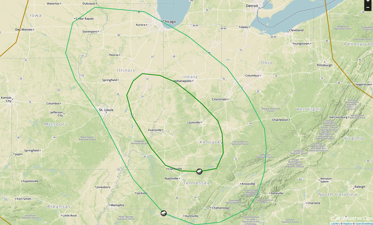
SPC Convective Outlook for Friday
A Look Ahead
As the area of low pressure described above continues to move eastward across the Great Lakes on Saturday, showers and thunderstorms will extend from the Great Lakes into the Southeast. An area of low pressure moving northward along the East Coast will bring a risk for heavy to excessive rainfall to portions of the Mid Atlantic and Northeast late Saturday into Sunday. Showers and thunderstorms may develop across the Northern Plains on Sunday ahead of a cold front. Rain is expected across much of the Northeast on Monday. Scattered showers and thunderstorms may develop along the East Coast on Tuesday.
