National Weather Summary for Wednesday, July 13, 2016
by David Moran, on Jul 13, 2016 11:34:12 AM
Thunderstorms are expected across portions of the Central Plains and Great Lakes on Wednesday ahead of a cold front. As the front continues to move eastward slowly, thunderstorms will be possible across the Great Plains and Ozarks on Thursday. In portions of the Ohio Valley and Northeast, thunderstorms will be possible as a cold front moves through the region. By Friday, thunderstorms will be possible from the Great Plains through the Mid South ahead of a cold front.
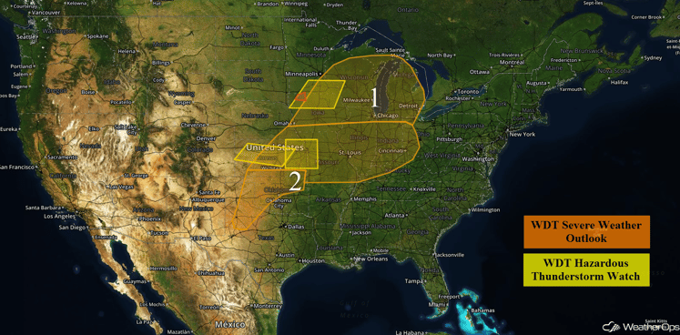
US Hazards
Region 1
Scattered thunderstorms are expected to develop and advance to the east across Region 1. Conditions are favorable for some of these thunderstorms to become severe with a large hail and damaging wind threat, but an isolated tornado or two cannot be ruled out.
In addition to the severe weather threat, there will be a threat for excessive rainfall for portions of the Mid Mississippi Valley. Rainfall accumulations of 1-2 inches with locally heavier amounts in excess of 3 inches will be possible, aggravating any existing flooding conditions.
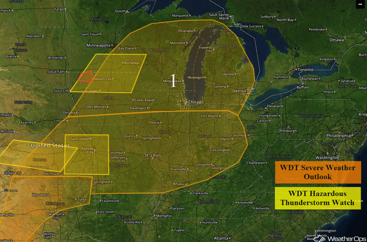
Region 1
Region 2
Isolated severe thunderstorms will be possible across portions of southern Kansas, Oklahoma, and northwestern Texas. Conditions are not overly favorable for the development of thunderstorms, but by late afternoon and evening, strong heating should allow for isolated thunderstorms to develop over portions of Region 2. These storms will track southeast through the late evening hours. Currently, the threat for severe weather appears to be rather isolated. The primary hazards with any storms that develop will be hail and strong winds, as well as frequent lightning and heavy rain.
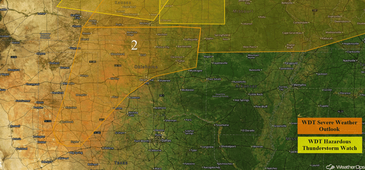 Region 2
Strong to Severe Thunderstorms Possible on Thursday for the Great Plains and Ozark Plateau
Thunderstorm development is expected during the afternoon ahead of a slow moving cold front across the Plains. Strong instability and wind shear will allow some thunderstorms to become supercells. These storms will lead to a threat for large hail and damaging winds during the late afternoon, across western portions of the region. As thunderstorms move eastward into the Southern Plains and eventually the Ozark Plateau, they will likely merge into a squall line, with the main severe weather hazard expected to be damaging winds.
In addition to the severe weather threat, locally heavy rainfall will be possible across southern Kansas and Northern Oklahoma. Widespread rainfall amounts of 1-3 inches will be likely, with locally higher amounts in excess of 4 inches possible.
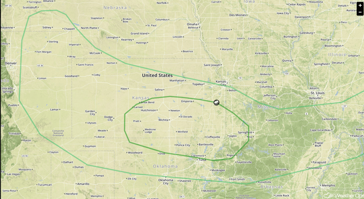
SPC Convective Outlook for Thursday
Strong to Severe Thunderstorms Possible Thursday for the Ohio Valley and Northeast
Thunderstorms will likely develop ahead of an approaching cold front from the Ohio Valley into the Northeast. While the overall severe weather threat is low, a few thunderstorms may become strong. Damaging winds will be the primary hazard, but some of the stronger storms may produce small hail as well.
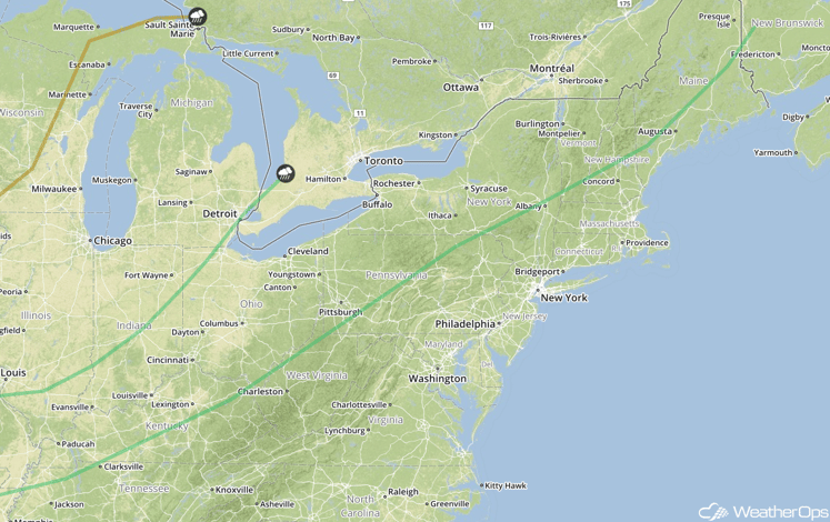
SPC Convective Outlook for Thursday
Strong to Severe Thunderstorms Possible from the Great Plains to the Mid South on Friday
Thunderstorms will be possible Friday across a large region extending from the Great Plains through the Mid-South along the tail end of a cold front. While the overall severe weather threat is expected to be low, a few thunderstorms will likely become strong to severe, with damaging winds likely to be the primary hazard.
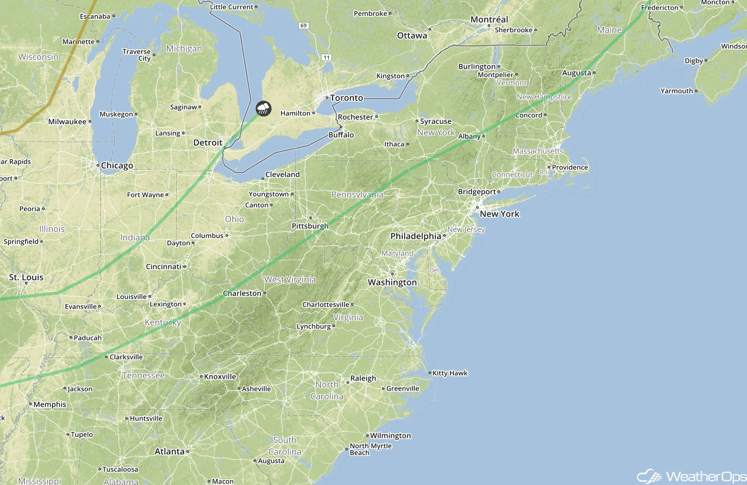
SPC Convective Outlook for Friday
This is just a brief look at current weather hazards. We can provide you site-specific forecast information. Try a 7-day demo right away.


