National Weather Summary for Wednesday, February 24, 2016
by David Moran, on Feb 24, 2016 11:51:38 AM
Severe thunderstorms with the potential for large hail, damaging winds, and tornadoes are currently ongoing across portions of the Southeast and Mid Atlantic. Snow will continue from the Mid Mississippi Valley. Across the Northeast, a mix of freezing rain, sleet, and snow will continue.
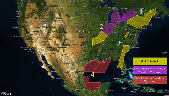
US Hazards
Region 1
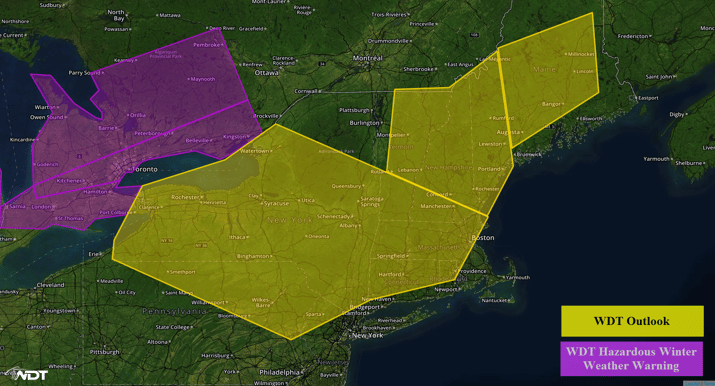
A mixture of freezing rain, sleet, and snow will come to an end across Region 1 as precipitation transitions to liquid rain through early afternoon. While ice and snow accumulations should be light, travel conditions may be difficult, especially on bridges and overpasses.
Region 1
Region 2
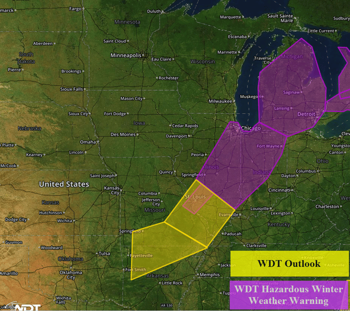
An area of low pressure moving through the Ohio Valley will allow for a swath of moderate to heavy snowfall from the Middle Mississippi Valley northeastward into the Great Lakes through Thursday morning. Snowfall accumulations of 4-8 inches of snow will be possible with locally higher amounts in excess of 10 inches will be possible. In addition, northerly winds of 25-30 mph with gusts in excess of 40 miles per hour will create visibilities of less than a mile.
Across the Lower Peninsula of Michigan, snow accumulations of 6-10 inches with locally higher accumulations in excess of 12 inches will be possible through Thursday afternoon. Winds of 15-25 miles per hour with gusts in excess of 30 miles per hour will be possible. Visibilities will be reduced in areas of blowing snow.
Region 2
Region 3
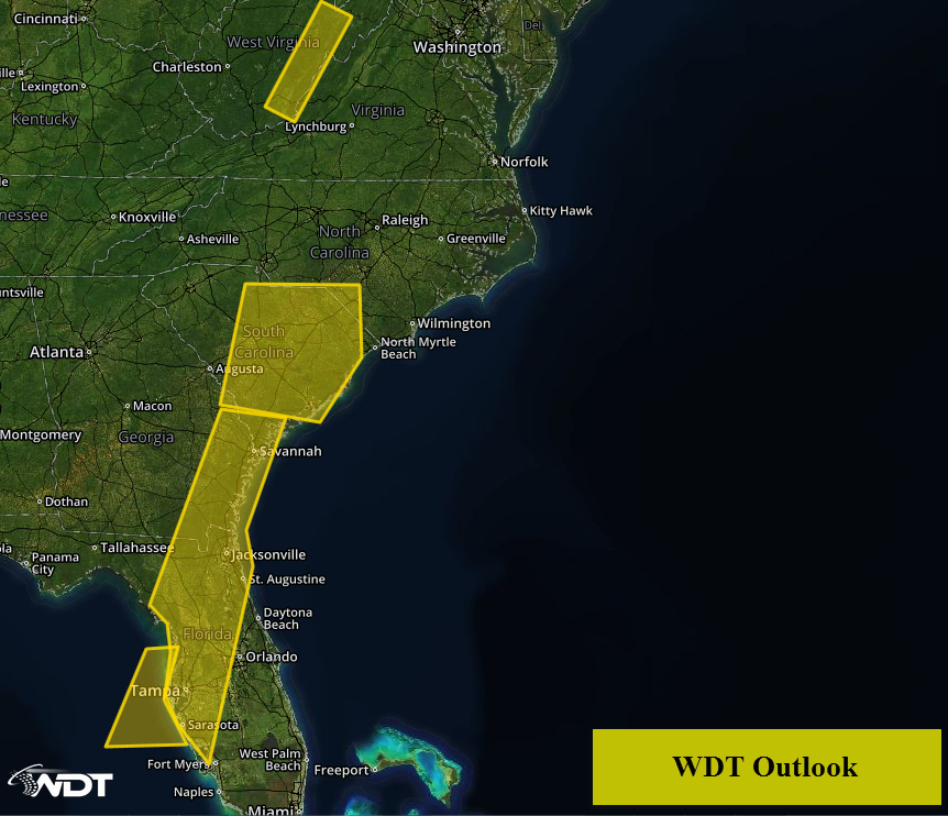
A widespread area of strong to severe thunderstorms is progressing eastward across Region 3 into the afternoon. Any thunderstorms that develop will have the potential for tornadoes, large hail, damaging winds, frequent lightning, and heavy rainfall.
Across portions of West Virginia, snow will be possible as an area of low pressure moves to the northeast of the area. Snow accumulations of 3-6 inches, winds of 15-25 miles per hour with gusts in excess of 30 miles per hour, and reduced visibilities will be possible.
Region 3
Region 4
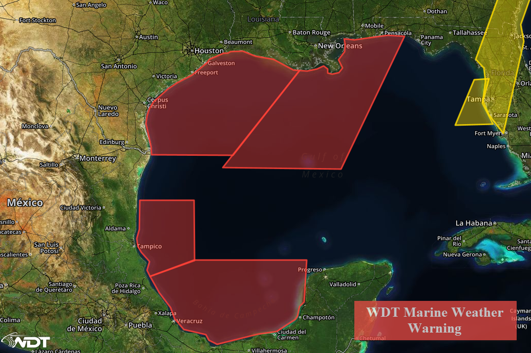
A strong area of low pressure moving across the Southeast will bring northwesterly winds of 30-40 knots with gusts in excess of 50 knots to northern portions of Region 4. Swells of 12-16 will be possible throughout the day. Further south across the Bay of Campeche, northerly winds of 25-35 knots with gusts in excess of 45 knots will be possible. Seas will build to 10-12 feet through Wednesday evening, but should improve by Thursday morning.
Region 4


