National Weather Summary for Wednesday, December 7, 2016
by David Moran, on Dec 7, 2016 11:47:16 AM
Snow will continue through the day on Wednesday across portions of the Central Rockies and High Plains, as an area of low pressure moves through the region. An area of low pressure moving northeastward into southern Canada will bring heavy snow and strong winds to portions of Manitoba. Lake effect snow is expected across portions of the Great Lakes and Upstate New York on Thursday into Friday. By Friday, a strong winter storm will impact portions of the Pacific Northwest and Northern Rockies.
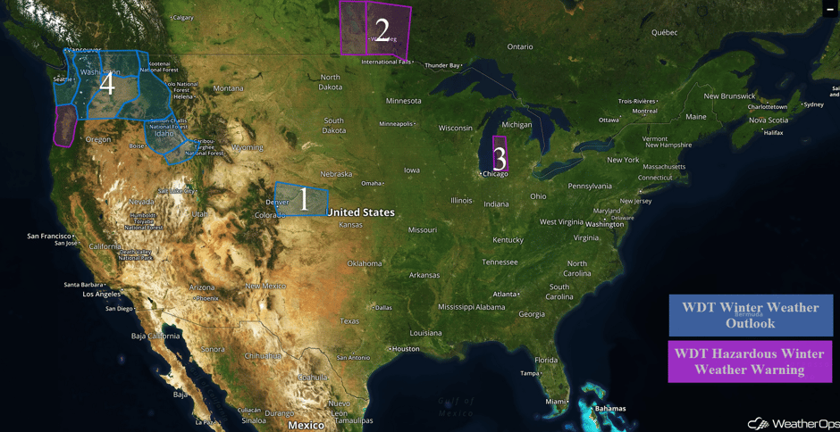 US Hazards
Region 1
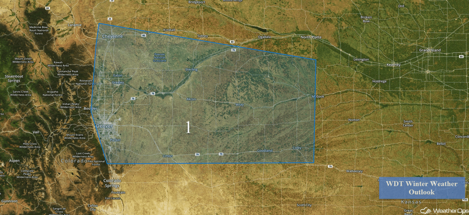
Snow will continue across portions of the Central Rockies and High Plains through tonight as an area of low pressure moves through the region. Snowfall accumulations of 1-3 inches, with locally higher amounts in excess of 4 inches, will be possible. While significant travel impacts are not anticipated, this event will bring a very cold air mass into the region, allowing for low temperatures to fall into the single digits later tonight. Wind chills will be well below zero. Gusty winds will cause periods of blowing snow and reduced visibilities below a mile at times.
Major Cities in Region: Denver, CO, Goodland, KS
 Region 1
Region 2
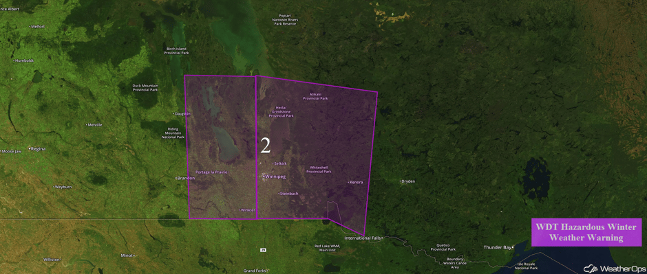
Snow will continue across Region 2 through the early afternoon on Wednesday. Total snowfall accumulations of 4-8 inches, with isolated higher amounts in excess of 12 inches, will be possible. Winds of 20-25 mph, with higher gusts in excess of 30 mph, will be possible, in addition to wind chills as low as -20°F.
Major Cities in Region: Winnipeg, MB
 Region 2
Region 3
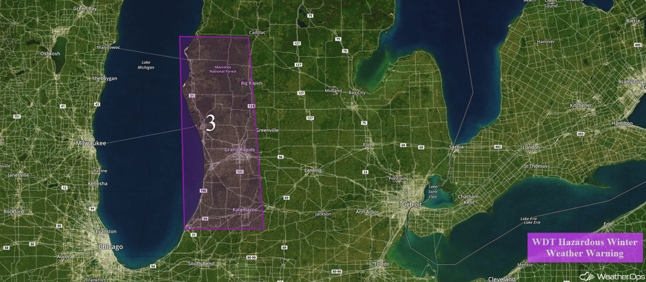
Lake effect snow is expected to begin Wednesday night into Thursday morning and will then continue through Friday morning before the area of low pressure moves out of the region. Snowfall rates of 1-2 inches will be possible in the heaviest bands, with overall snowfall totals exceeding 6 inches. Locally higher amounts in excess of a foot will be possible. Gusty westerly winds will cause periods of limited visibilities and wind chills in the single digits.
Major Cities in Region: Grand Rapids, MI
 Region 3
Region 4
A strong winter storm will impact much of the Pacific Northwest into the Northern Rockies from Thursday into the weekend. With the cold air in place over coastal Washington and the lowlands, snow is expected to spread across the region from south to north beginning Thursday afternoon. Snow may fall for 12 hours in most locations, with snow transitioning to rain as the warm front moves northward. Rain should be the dominant precipitation type by late Friday morning. Snow accumulations of 2 inches will be common, with isolated higher amounts in excess of 5 inches possible. Significant travel hazards are expected Thursday evening and Friday morning. Further inland, snow accumulations of 5-12 inches will be possible in the valleys and 1-2 feet in the mountainous regions.
Major Cities in Region: Seattle, WA, Portland, OR, Spokane, WA, Idaho Falls, ID
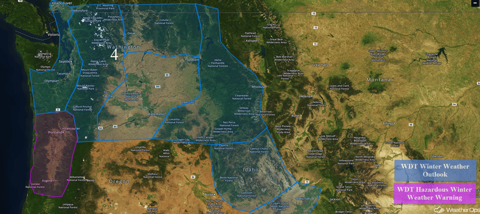 Region 4
Significant Snowfall Possible for the Great Lakes and Upstate New York Thursday and Friday
Strong northwesterly breezes across the Great Lakes will result in significant lake effect snow for the southeastern shores. Areas from Upper Michigan into Lower Michigan and eastward into Pennsylvania and New York will likely see locally heavy lake effect snow. Snowfall accumulations will approach or exceed 6-8 inches on Thursday. An additional 6-8 inches will be possible on Friday.
Major Cities in Region: Green Bay, WI, Milwaukee, WI, Detroit, MI, Buffalo, NY
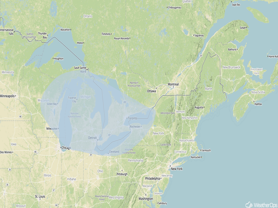 Significant Snowfall Risk Outline for Thursday and Friday
A Look Ahead
By the weekend, light to moderate snowfall will continue for portions of the Northern Plains and Upper Midwest. Mountain snow will continue across the Northern Cascades and Northern Rockies on Saturday with accumulations approaching a foot from the Cascades into Northern Idaho. As an area of low pressure continues to move eastward on Sunday, snow will be possible from portions of the Ohio Valley into the Northeast. Snowfall accumulations of 3-6 inches with locally higher amounts in excess of 8 inches are currently forecast across New England. Snow is expected across the Northwest from Oregon into Utah and into the Great Basin. Snowfall accumulations of 4-8 inches will be possible.
This is just a brief look at current weather hazards. We can provide you site-specific forecast information for the purpose of protecting your personnel and assets. Try a 7-day demo right away and learn how timely precision weather information can enhance your bottom line.


