


by David Moran, on Aug 22, 2018 11:35:21 AM
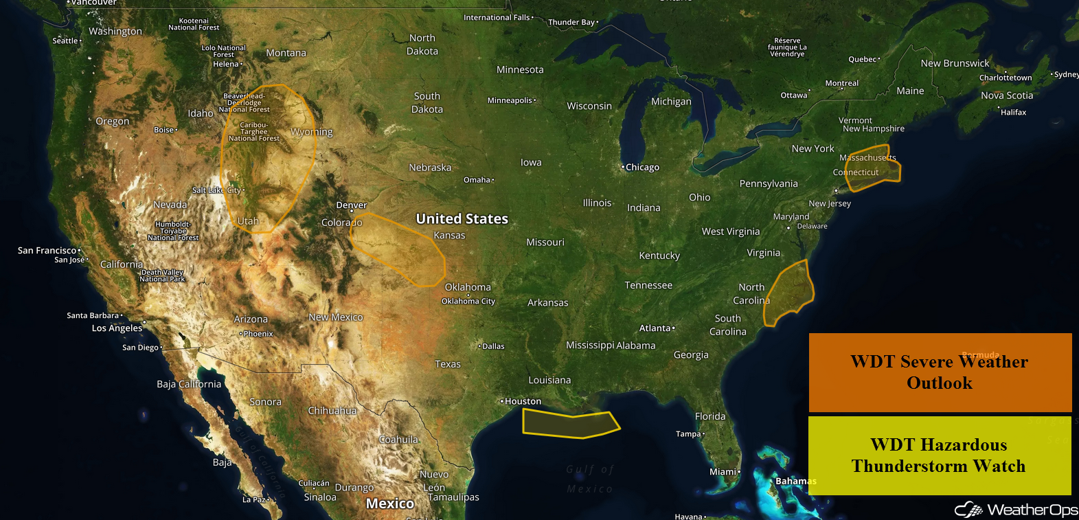
Thunderstorms will continue across the North Central Gulf of Mexico through midday Wednesday. Plentiful moisture and daytime heating will allow for the development of thunderstorms across the Southern High Plains. A cold front will be the focus for thunderstorm development across New England. Storms are expected to develop from the eastern Carolinas into Chesapeake Bay along a cold front. There will be a risk for thunderstorms across the Northern Rockies as an upper level low moves across the region. Heavy rain is expected across portions of Arizona through Thursday as a series of weak disturbances move eastward.
- Thunderstorms Continuing for the North Central Gulf of Mexico through Wednesday Morning
- Risk for Thunderstorms Wednesday across the Southern High Plains
- Thunderstorms across New England Wednesday
- Potential for Thunderstorms Wednesday from the Eastern Carolinas into Chesapeake Bay
- Thunderstorms for the Northern Rockies Wednesday
- Excessive Rainfall through Thursday for Arizona
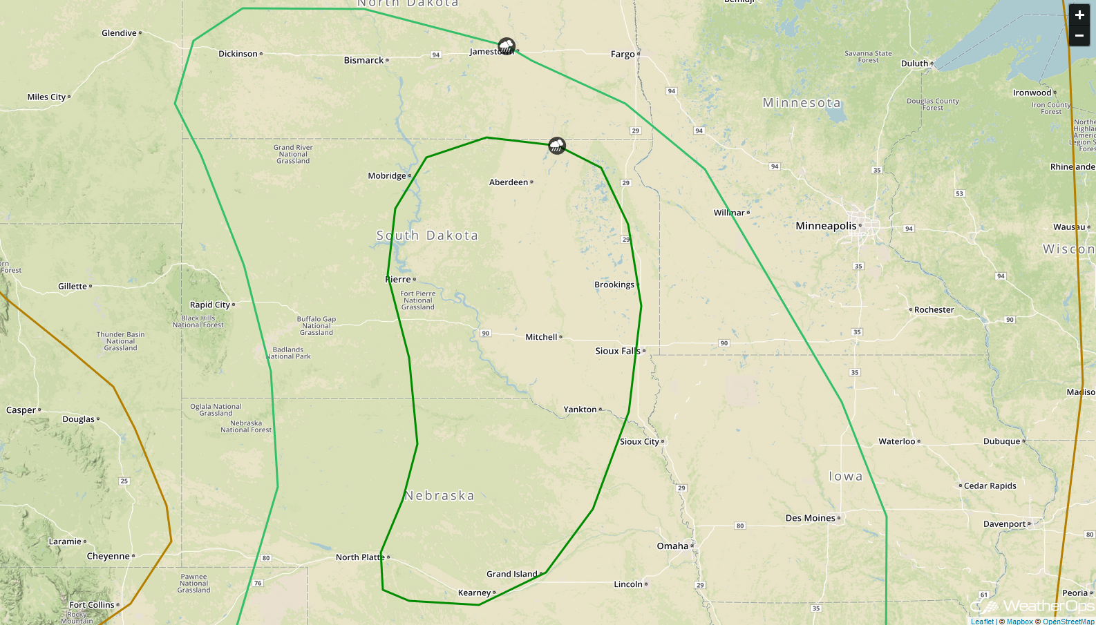
- Thunderstorm Potential for the Northern Plains on Thursday
- Potential for Thunderstorms Friday from the Upper Mississippi Valley into the Central Plains
- Tropical Update
US Hazards
Thunderstorms Continuing for the North Central Gulf of Mexico through Wednesday Morning
Thunderstorm activity will continue across the north central Gulf of Mexico through Wednesday morning. Winds in excess of 35 knots, frequent lightning, waterspouts, and heavy rainfall will be the primary hazards with these storms.
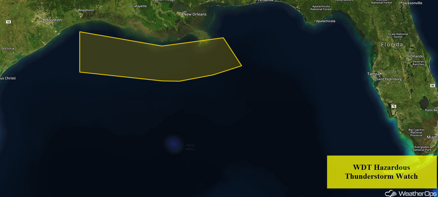
WDT Hazardous Thunderstorm Watch
Risk for Thunderstorms Wednesday across the Southern High PlainsSoutheasterly winds will keep moisture flowing into the region throughout the day on Wednesday. This moisture, combined with daytime heating, will allow instability to build. With westerly winds aloft, shear should be strong enough for the development of isolated strong to severe thunderstorms. Activity will develop during the afternoon with damaging winds and large hail the primary hazards. These storms should move eastward and weaken during the overnight hours.
Major Cities in Region: Trinidad, CO, Goodland, KS, Guymon, OK, Dodge City, KS
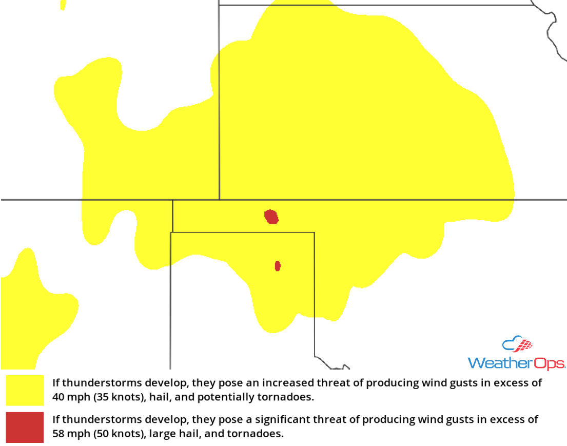
Thunderstorm Risk for Wednesday
Thunderstorms across New England Wednesday
A cold front will be moving across the region today. Rich low level moisture and daytime heating will allow instability to increase across the region. Thunderstorms will develop ahead of the front and associated upper level trough. Damaging winds will be the primary hazard with these storms, but an isolated tornado or two cannot be ruled out.
Major Cities in Region: Manchester, NH, Portland, ME, Bangor, ME
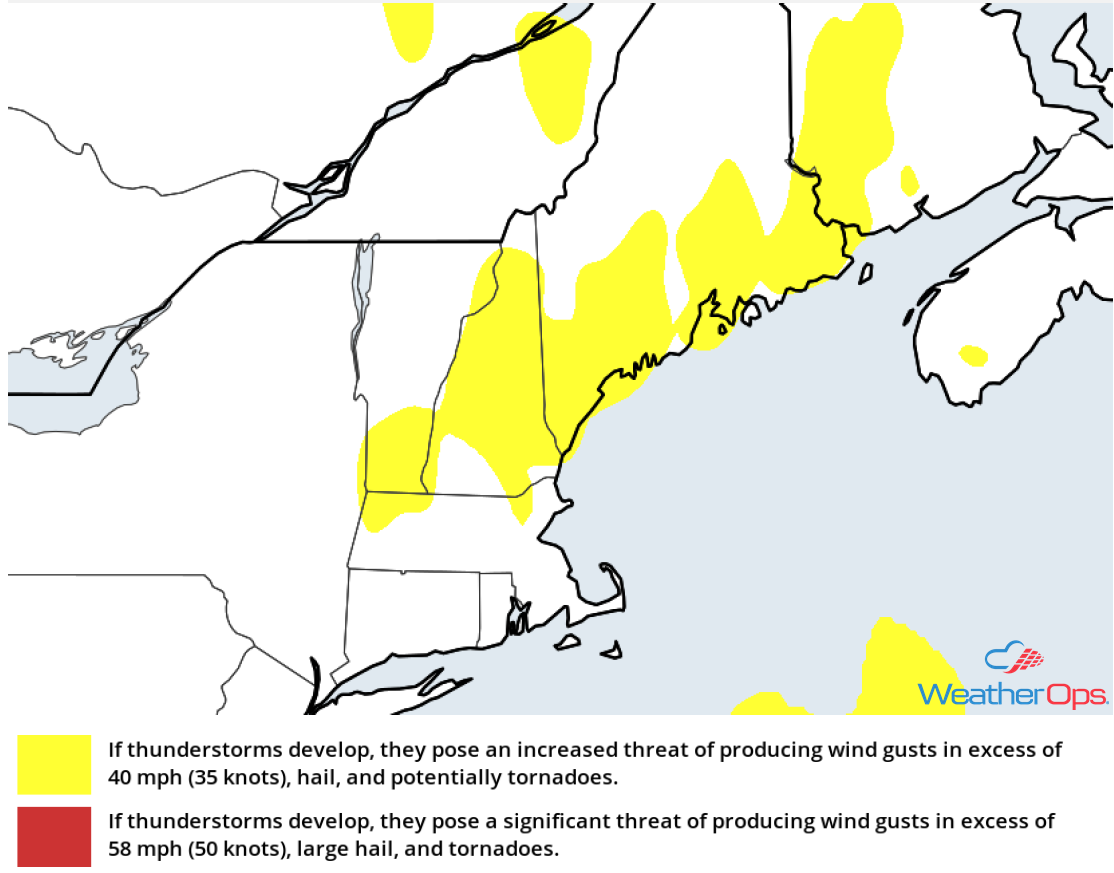
Thunderstorm Risk for Wednesday
Potential for Thunderstorms Wednesday from the Eastern Carolinas into Chesapeake Bay
Instability should be sufficient for the development of strong to severe thunderstorms across the region on Wednesday. Thunderstorms will develop during the afternoon ahead of a cold front and upper level trough. Damaging winds will be the primary hazards with these storms.
Major Cities in Region: Wilmington, NC, Norfolk, VA
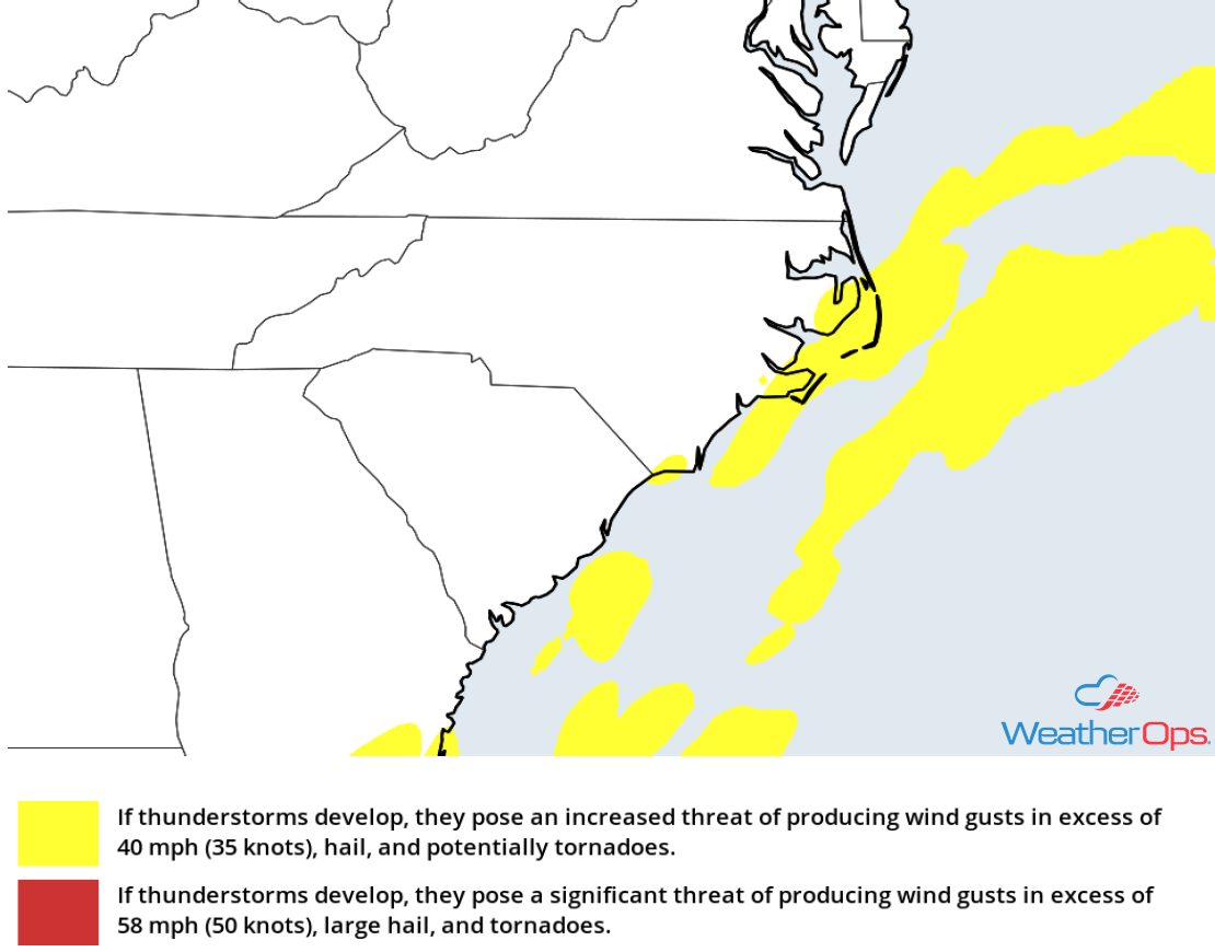
Thunderstorm Risk for Wednesday
Thunderstorms for the Northern Rockies Wednesday
An upper level low will continue to develop across the region. As it does, instability will increase with daytime heating, allowing for the development of thunderstorms. As thunderstorms develop, some will become strong to severe with damaging winds and large hail the primary hazards.
Major Cities in Region: Salt Lake City, UT, Idaho Falls, ID
Thunderstorm Risk for Wednesday
Excessive Rainfall through Thursday for Arizona
Moist air is being pulled in from the south, and with northeasterly upper level flow, weak waves will move over the region. This will result in showers and thunderstorms capable of producing heavy rainfall through Thursday. Two day rainfall totals of 1-2 inches are expected with locally higher amounts in excess of 3 inches.
Major Cities in Region: Flagstaff, AZ, Phoenix, AZ, Tucson, AZ
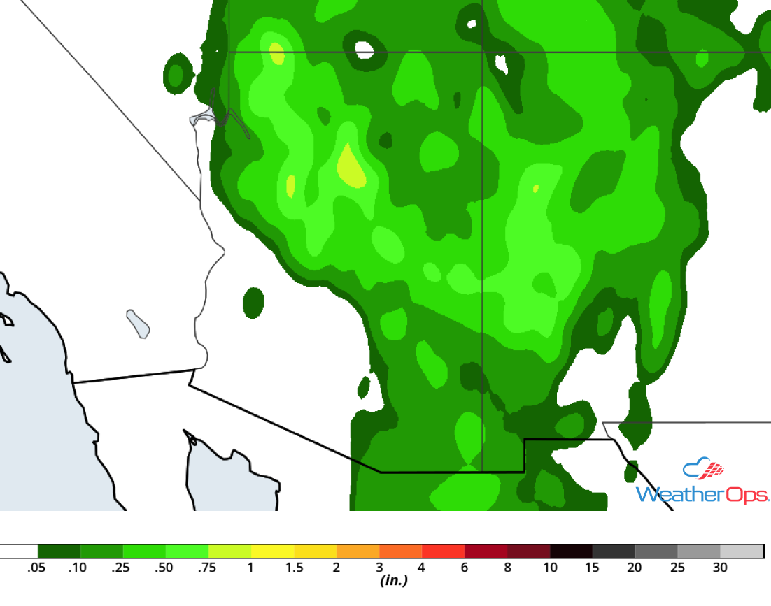
Rainfall Accumulation through Thursday
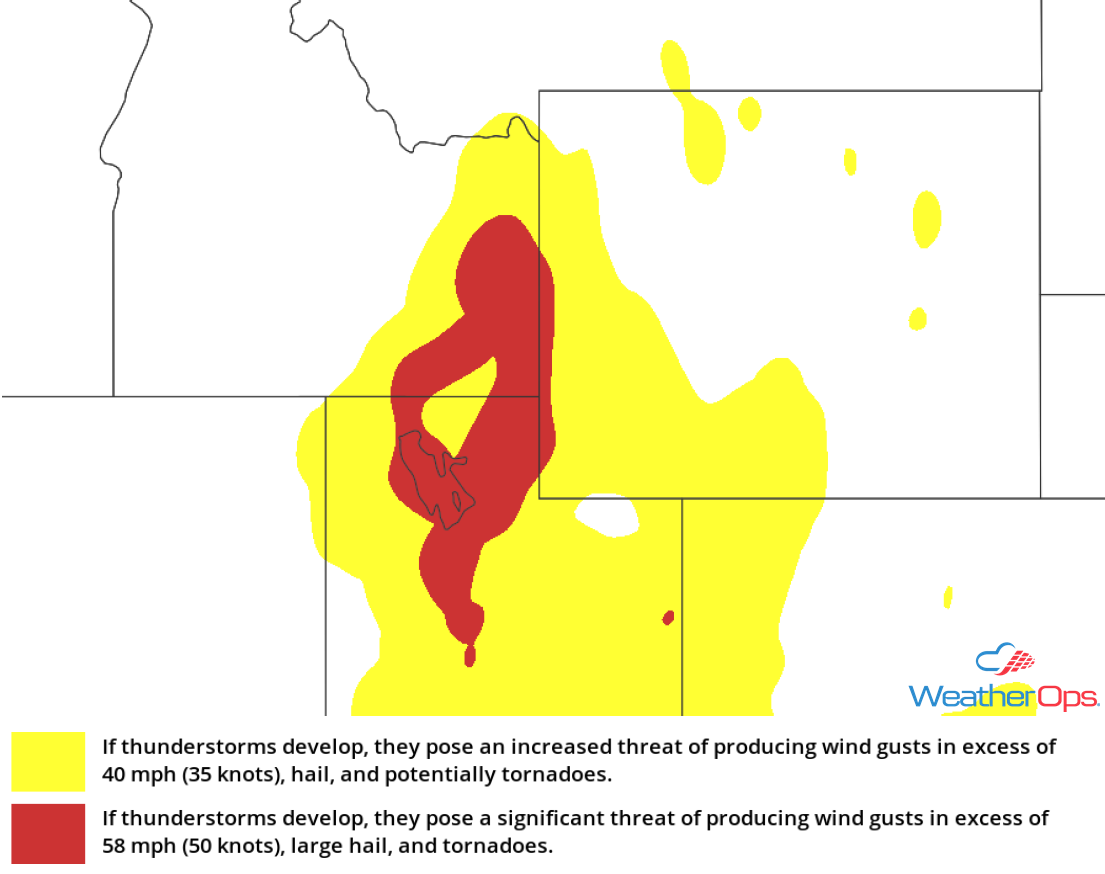
Thunderstorm Potential for the Northern Plains on Thursday
An upper level trough is forecast to move across the Northern Plains on Thursday. The associated surface low will move eastward across the region and a cold front will extend to the southwest of the low. Moisture should be moving northward to the east of the low. As a result, strong to severe thunderstorms are expected to develop. Damaging winds and large hail will be the primary hazards, but an isolated tornado or two cannot be ruled out.
Major Cities in Region: North Platte, NE, Bismarck, ND, Pierre, SD, Kearney, NE, Grand Island, NE, Sioux Falls, SD, Omaha, NE, Des Moines, IA
SPC Convective Outlook for Thursday
Potential for Thunderstorms Friday from the Upper Mississippi Valley into the Central Plains
A shortwave trough and associated surface low will be moving eastward across the Upper Mississippi Valley on Friday. Southerly winds east of the low will bring moisture into the region; with daytime heating, instability will build. Strong to severe thunderstorms are forecast to develop to the east of the low and ahead of the associated cold front. Large hail and damaging winds will be the primary hazards, but an isolated tornado or two cannot be ruled out.
Major Cities in Region: Topeka, KS, Kansas City, MO, Des Moines, IA, Columbia, MO, Cedar Rapids, IA, Madison, WI
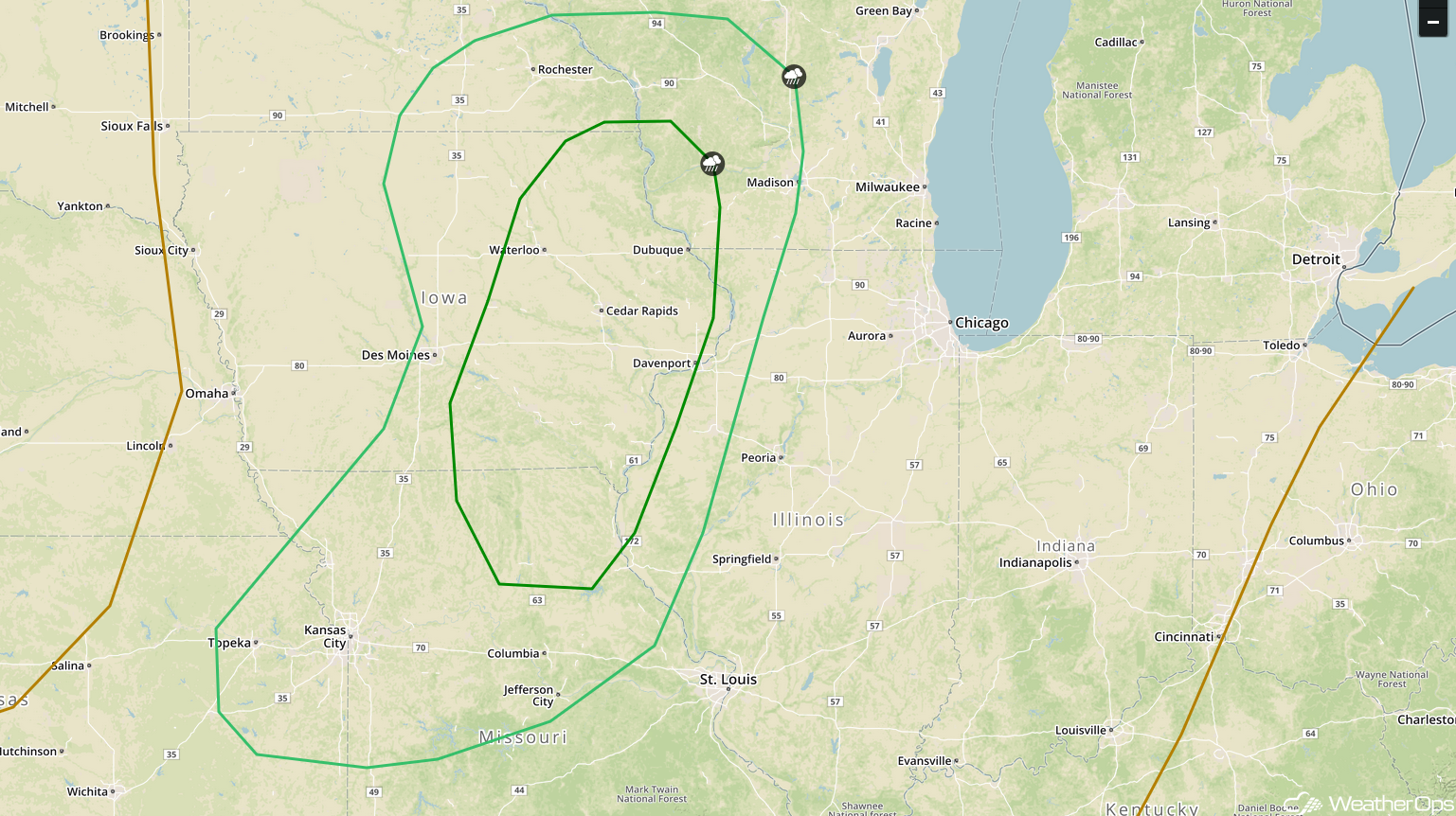
SPC Convective Outlook for Friday
Tropical Update
Hurricane Lane is 460 miles south-southeast of Honolulu, HI with maximum sustained winds of 155 mph. Lane is moving west-northwestward at 9 mph. Some weakening is expected as Lane approaches the Hawaiian Islands, however even with this weakening, it is expected to remain a dangerous hurricane. Rainfall amounts of 10-15 inches with locally higher amounts in excess of 20 inches are forecast. Hurricane conditions are expected across Hawaii late Thursday night into Friday. A Hurricane Warning is in effect for the southern Islands of Hawaii and a Hurricane Watch is in effect for the northern Islands.
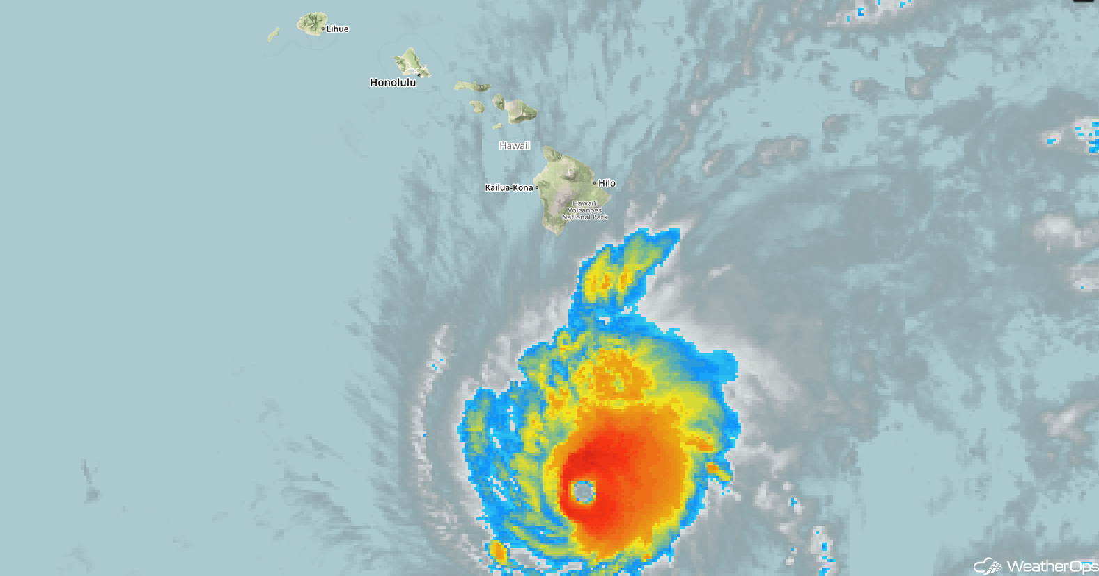
Enhanced Infrared Satellite
A Look Ahead
As the surface low over the Plains continues to move northeastward on Saturday, showers and thunderstorms are expected to move into portions of the Great Lakes. Thunderstorms may develop across portions of the Northern Plains on Sunday as an area of low pressure moves across the region. An upper level system may bring a potential for showers and thunderstorms to portions of the Northern Rockies on Monday. By Tuesday, the thunderstorm risk will shift into portions of the Northern Plains and Upper Midwest.
