National Weather Summary for Tuesday, May 16, 2017
by David Moran, on May 16, 2017 11:06:49 AM
Strong to severe thunderstorms are expected for portions of the Plains on Tuesday, as an area of low pressure continues to move eastward. This same area of low pressure may bring heavy to excessive rainfall to portions of the Plains and Upper Midwest on Tuesday.
- Severe Thunderstorms Expected for the Plains on Tuesday
- Elevated Winds and Seas for the Northwestern Gulf of Mexico Late Tuesday Through Wednesday Morning
- Excessive Rainfall Tuesday for Portions of the Plains and Upper Midwest
- Thunderstorm Potential for the Ozarks into the Midwest on Wednesday
- Severe Thunderstorms Expected Thursday Across the Southern Plains
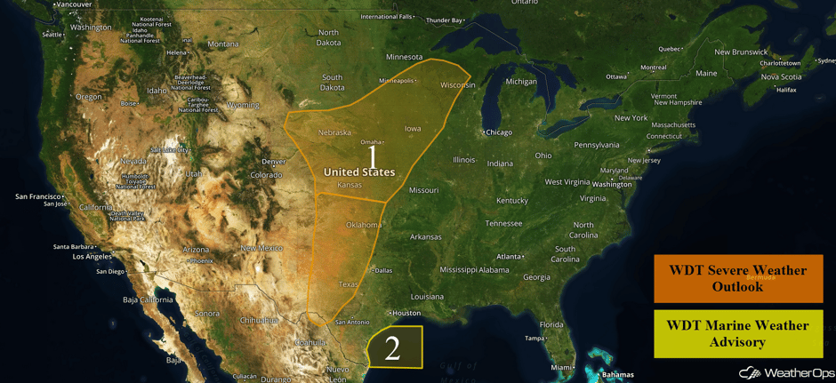 US Hazards
Severe Thunderstorms Expected for the Plains on Tuesday
Strong to severe thunderstorms are expected for a large portion of the Plains today. The main area of concern will be from southwestern Kansas into west Texas. Thunderstorm development is expected to begin along the dryline during the mid afternoon over the Texas Panhandle and spread northeastward. Large hail, damaging winds, and tornadoes will all be possible in the Texas Panhandle, western Oklahoma, and southwestern Kansas. Later in the evening, a cold front will approach from the west, bringing a second round of thunderstorms that will spread toward central Oklahoma and north central Texas. Severe wind and large hail will be the primary hazards. These storms will likely weaken by early Wednesday morning.
Further north, thunderstorms are expected to develop across portions of Kansas and Nebraska ahead of a cold front and move northeastward into Iowa and Minnesota this evening and into the overnight hours. Strong to severe winds and large hail will be the primary hazards. Later this evening, thunderstorms are expected to move into southeastern Minnesota and western Wisconsin. Severe winds and hail will be the primary hazards.
Update 2:16pm CDT: PDS Tornado Watch in effect for portions of Oklahoma and Texas until 10pm CDT.
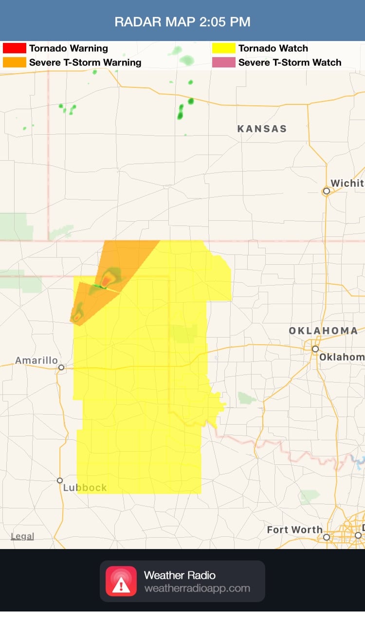 Tornado Watch
Update 2:22pm CDT: Tornado Watch for portions of West Central Kansas until 10pm CDT.
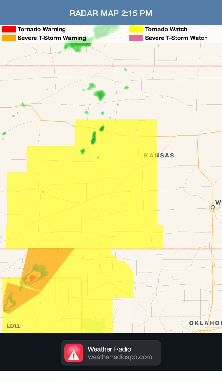 Tornado Watch
Update 2:53pm CDT: Severe Thunderstorm Warnings extending from Texas Panhandle to SW Kansas.
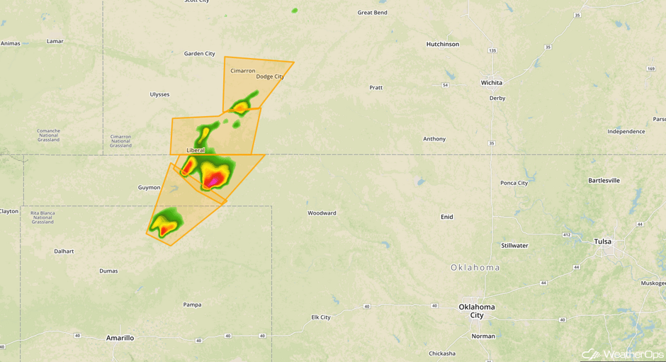 Radar 2:53pm CDT
Update 3:04pm CDT: Tornado Warning in the Oklahoma Panhandle until 3:45pm CDT.
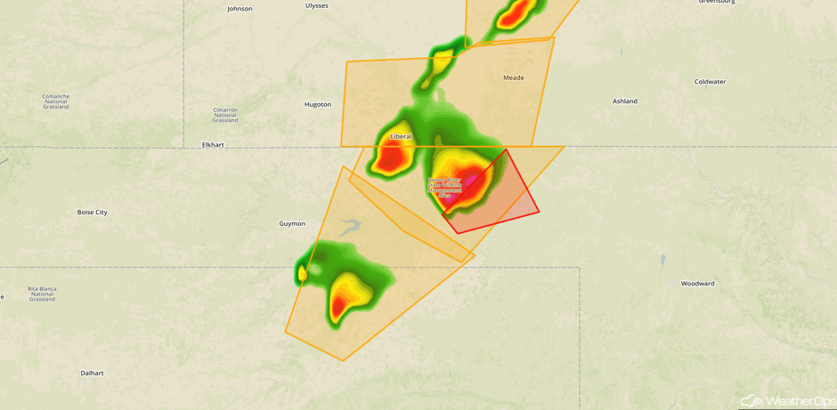 Radar 3:04pm CDT
Update 3:20pm CDT: New Tornado Warning for Oklahoma and Texas Panhandles until 4pm CDT.
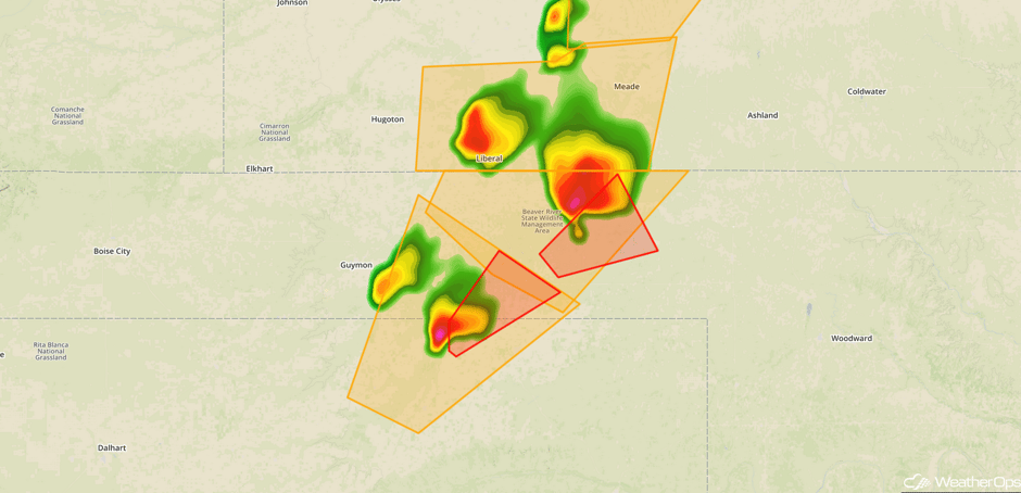 Radar 3:20pm CDT
Update 3:35pm CDT: Tornado Warning in SW Kansas until 4:15pm CDT.
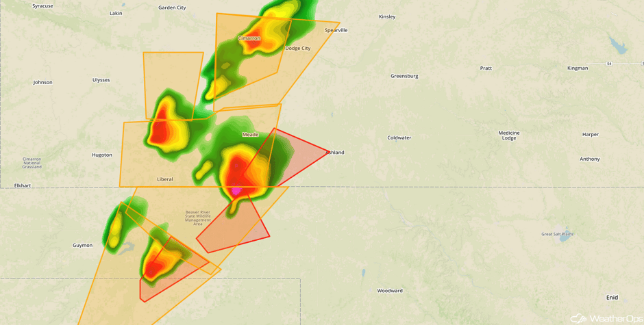 Radar 3:35pm CDT
Update 3:39pm CDT: Tornado Warning east of Amarillo, TX until 4pm CDT.
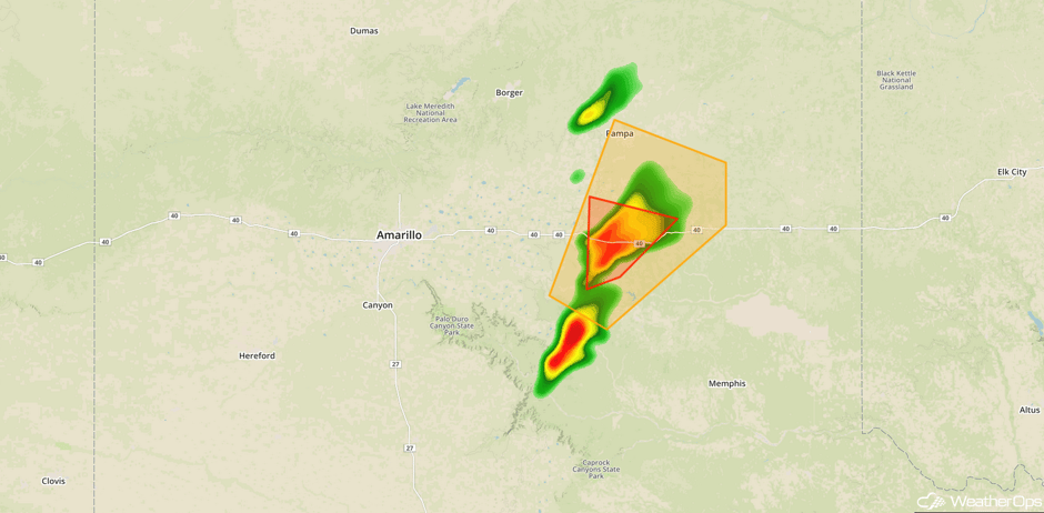 Radar 3:39pm CDT
Update 4:12pm CDT: Tornado Watch for portions of Wisconsin and Severe Thunderstorm Watch for portions of Minnesota until 10pm CDT.
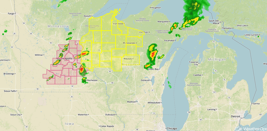 Watches
Update 4:39pm CDT: Developing supercell approaching Memphis, TX.
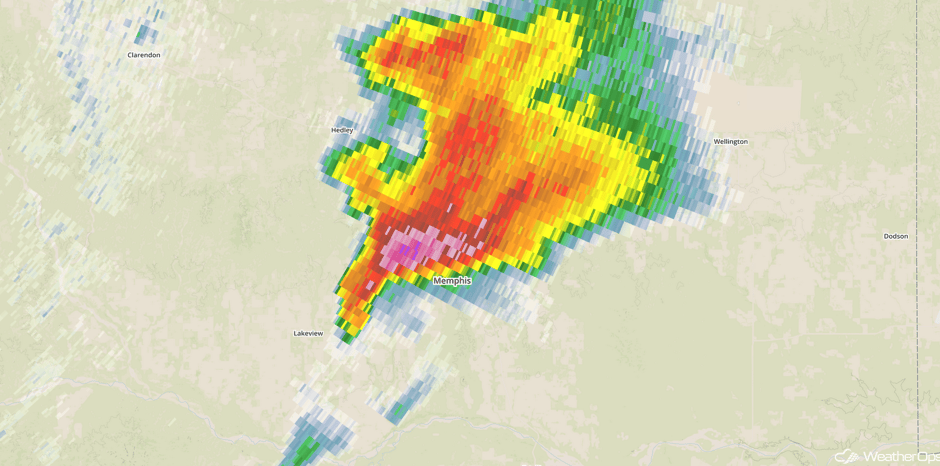 Radar 4:39pm CDT
Update 4:49pm CDT: Tornado reported near McLean, TX.
Major Cities in Region: Lubbock, TX, Amarillo, TX, Dodge City, KS, North Platte, NE, Oklahoma City, OK, Sioux Falls, SD, Omaha, NE, Kansas City, MO, Des Moines, IA, Minneapolis, MN
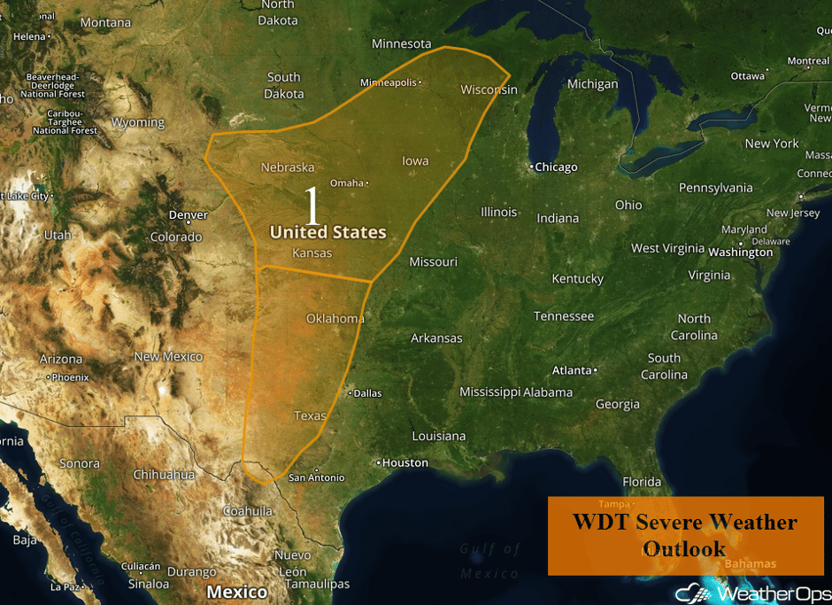 Region 1
Elevated Winds and Seas for the Northwestern Gulf of Mexico Late Tuesday Through Wednesday Morning
Increasing southwesterly winds and seas are forecast late Tuesday through midday Wednesday in response to an area of low pressure moving through the Central US. Sustained winds of 20-25 knots with gusts in excess of 30 knots are forecast. Seas will build to 7-8 feet, but will gradually subside by midday Wednesday.
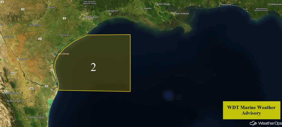 Region 2
Excessive Rainfall Tuesday for Portions of the Plains and Upper Midwest
The combination of increasing shower and thunderstorm development later today and tonight will result in a threat for excessive rainfall for portions of the Central Plains. Rainfall accumulations of 1-2 inches, with locally higher amounts, are forecast. This will pose a risk for flooding and local runoff.
Major Cities in Region: Topeka, KS, Omaha. NE, Minneapolis, MN
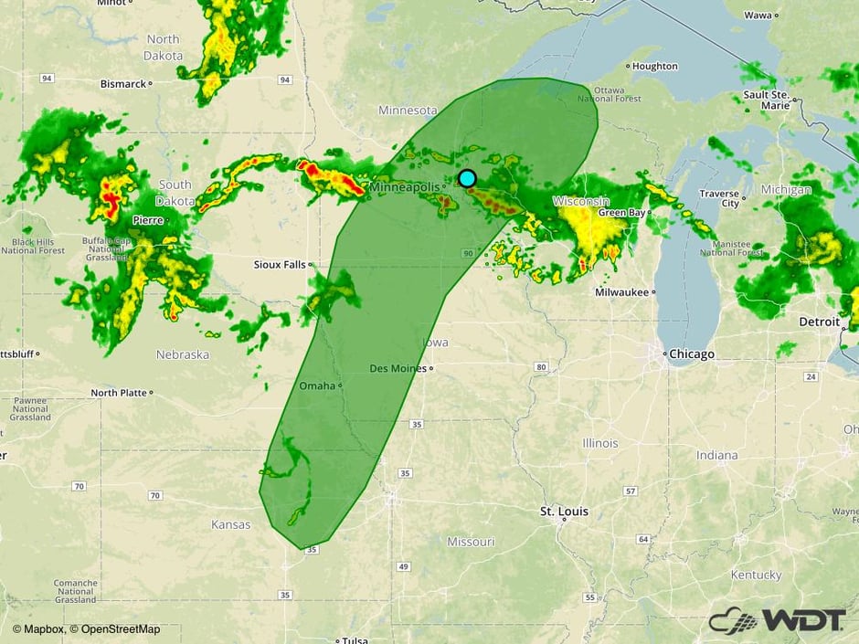 Excessive Rainfall Risk Outline for Tuesday
Thunderstorm Potential for the Ozarks into the Midwest on Wednesday
The upper level low described above is expected to move into the Upper Midwest while an upper level trough over the western US begins to reorganize. As a result, the threat for severe weather will shift into Iowa, Minnesota, and Wisconsin. While instability will be weak, strong wind shear and the strong upper level low that will support scattered shower and thunderstorm development is expected by late morning or early afternoon. Multiple bands of storms may lift northeastward across the region with damaging winds the primary hazard, but isolated large hail and tornadoes cannot be ruled out. In addition, heavy rainfall will be a concern. Rainfall amounts of 1-2 inches with isolated higher amounts in excess of 3 inches are forecast. There will once again be a threat for flooding and local runoff.
Major Cities in Region: Omaha, NE, Des Moines, IA, Cedar Rapids, IA, Davenport, IA, Madison, WI
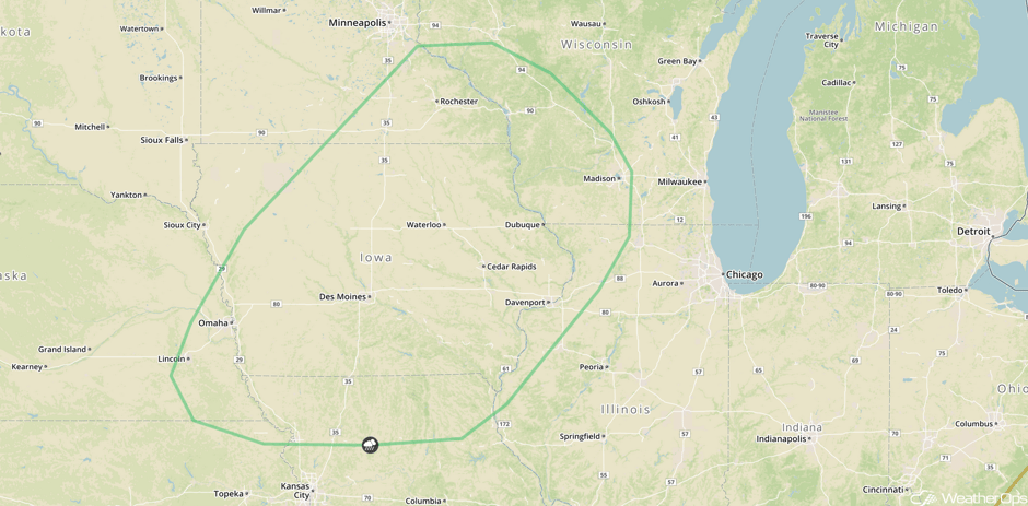 SPC Convective Outlook for Wednesday
Severe Thunderstorms Expected Thursday Across the Southern Plains
By Thursday, the threat for severe weather will return to the Southern Plains as an area of low pressure continues to develop over the Rockies and the next upper level disturbance continues to push into the region. Moisture will remain in abundance over portions of Oklahoma. This will promote a highly unstable environment from southeast Kansas southwestward into much of Texas. A nearly stationary front should extend from eastern Kansas southwestward into Oklahoma, intersecting a dryline that extends into Texas. Thunderstorm initiation will commence during the late afternoon or early evening across Oklahoma and quickly become severe. Storms will pose a threat for very large hail, damaging winds, and tornadoes. The threat for severe impacts is forecast to persist into the overnight hours as activity pushes across Central Oklahoma. Storms may expand northward into Kansas and southward into West Texas through Midnight.
Major Cities in Region: Amarillo, TX, Lubbock, TX, Wichita, KS, Oklahoma City, OK, San Antonio, TX, Dallas. TX, Tulsa, OK, Kansas City, MO
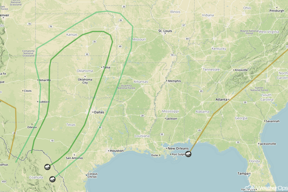 SPC Convective Outlook for Thursday
A Look Ahead
The risk for severe thunderstorms will continue for portions of the Southern Plains and Missouri Valley into Friday ahead of a cold front. Further to the east, a stalled front across the Ohio Valley will be the focus for thunderstorms from Illinois into the Delmarva Peninsula. As the cold front continues to progress eastward on Saturday, thunderstorms may develop from the Great Lakes to Texas.
This is just a brief look at current weather hazards. We can provide you site-specific weather forecast information for the purpose of protecting your personnel and assets and to assess your weather risk. Try a 7-day demo right away and learn how timely precision weather information can enhance your bottom line.


