


by David Moran, on Mar 27, 2018 10:56:26 AM
Thunderstorms may develop from Texas into Arkansas on Tuesday ahead of a cold front. As this cold front continues to move southeastward, the threat for excessive rainfall will continue from the Southern Plains to the Ohio Valley. Elevated winds and seas will continue for portions of the Gulf of Mexico through early Thursday morning.
- Thunderstorms from Texas into Arkansas on Tuesday
- Excessive Rainfall through Thursday for the Southern Plains through the Ohio Valley
- Elevated Winds and Seas for Portions of the Gulf of Mexico through Early Thursday Morning
- Potential for Thunderstorms Wednesday from Texas into the Southeast
- Thunderstorms for the Gulf Coast and Deep South on Thursday
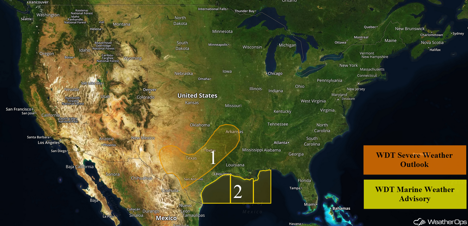 US Hazards

Thunderstorms from Texas into Arkansas on Tuesday
A cold front moving southeastward into the region will allow for the development of thunderstorms throughout the day. While ongoing activity should not become severe, daytime heating may allow for the development of severe thunderstorms this afternoon and evening. This activity should continue into the overnight hours. Hail and damaging winds will be the primary hazards with these storms, but an isolated tornado cannot be ruled out.
Major Cities in Region: Del Rio, TX, Austin, TX, Dallas, TX, Shreveport, LA, Little Rock, AR
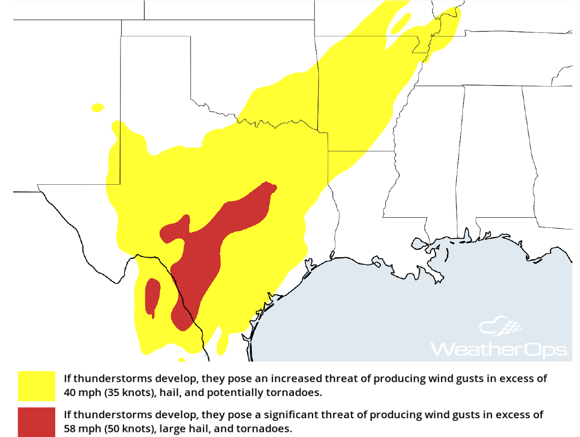 Thunderstorm Potential for Tuesday
Excessive Rainfall through Thursday for the Southern Plains through the Ohio Valley
Scattered to widespread showers and thunderstorms will continue across the eastern portions of the Southern Plains today and Wednesday along and ahead of a slow moving cold front. This activity will spread across the Southeast and into the Ohio Valley through Thursday. With deep moisture in place ahead of the front, there will be an increased risk for excessive rainfall throughout the region. Widespread amounts of 2-4 inches with locally higher amounts in excess of 5 inches are expected.
Major Cities in Region: Dallas, TX, Houston, TX, Shreveport, LA, Little Rock, AR, Memphis, TN, Nashville, TN, Louisville, KY
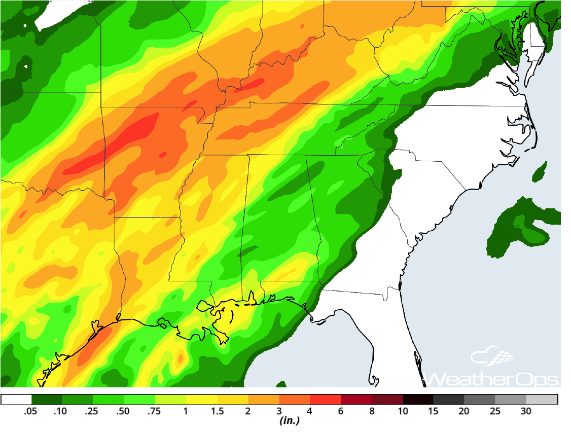 Rainfall Accumulations through Thursday
Elevated Winds and Seas for Portions of the Gulf of Mexico through Early Thursday Morning
High pressure building into the Gulf of Mexico and an approaching cold front will allow for a prolonged period of elevated winds and seas. Winds will range 20-30 knots with gusts in excess of 35 knots across the western areas. Seas will range 5-8 feet near the shore and 7-10 feet in the deeper waters. Further east, winds will range 22-27 knots with gusts in excess of 35 knots. Seas of 5-7 feet are expected near the shore and 7-9 feet in the deeper waters. Conditions should subside Thursday morning.
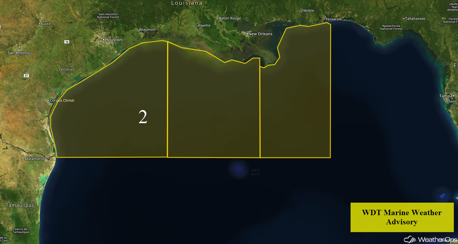 Region 2
Potential for Thunderstorms Wednesday from Texas into the Southeast
As a cold front continues to track slowly to the southeast on Wednesday, thunderstorms will continue to develop along and ahead of it.. A few strong to severe thunderstorms will be possible during the morning, but more robust thunderstorms are anticipated by the afternoon and evening. Activity will likely continue into the overnight hours with large hail and damaging winds the primary hazards, but an isolated tornado or two cannot be ruled out.
Major Cities in Region: Austin, TX, Corpus Christi, TX, Houston, TX, Shreveport, LA, Little Rock, AR, Memphis, TN, Jackson, MS
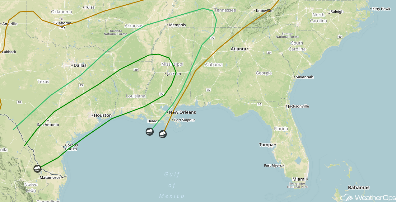 SPC Convective Outlook for Wednesday
Thunderstorms for the Gulf Coast and Deep South on Thursday
A cold front will continue to slowly make its way southeastward on Thursday, with the severe thunderstorm threat shifting into the central Gulf Coast and Deep South. Thunderstorms may develop during the morning, but the primary risk for severe weather will likely be in the afternoon and evening if cloud cover erodes and instability increases. Hail and damaging winds will be the primary hazards, but isolated tornadoes cannot be ruled out.
Major Cities in Cities: Lafayette, LA, Baton Rouge, LA, Jackson, MS, New Orleans, LA, Mobile, AL, Birmingham, AL, Montgomery, AL, Atlanta, GA
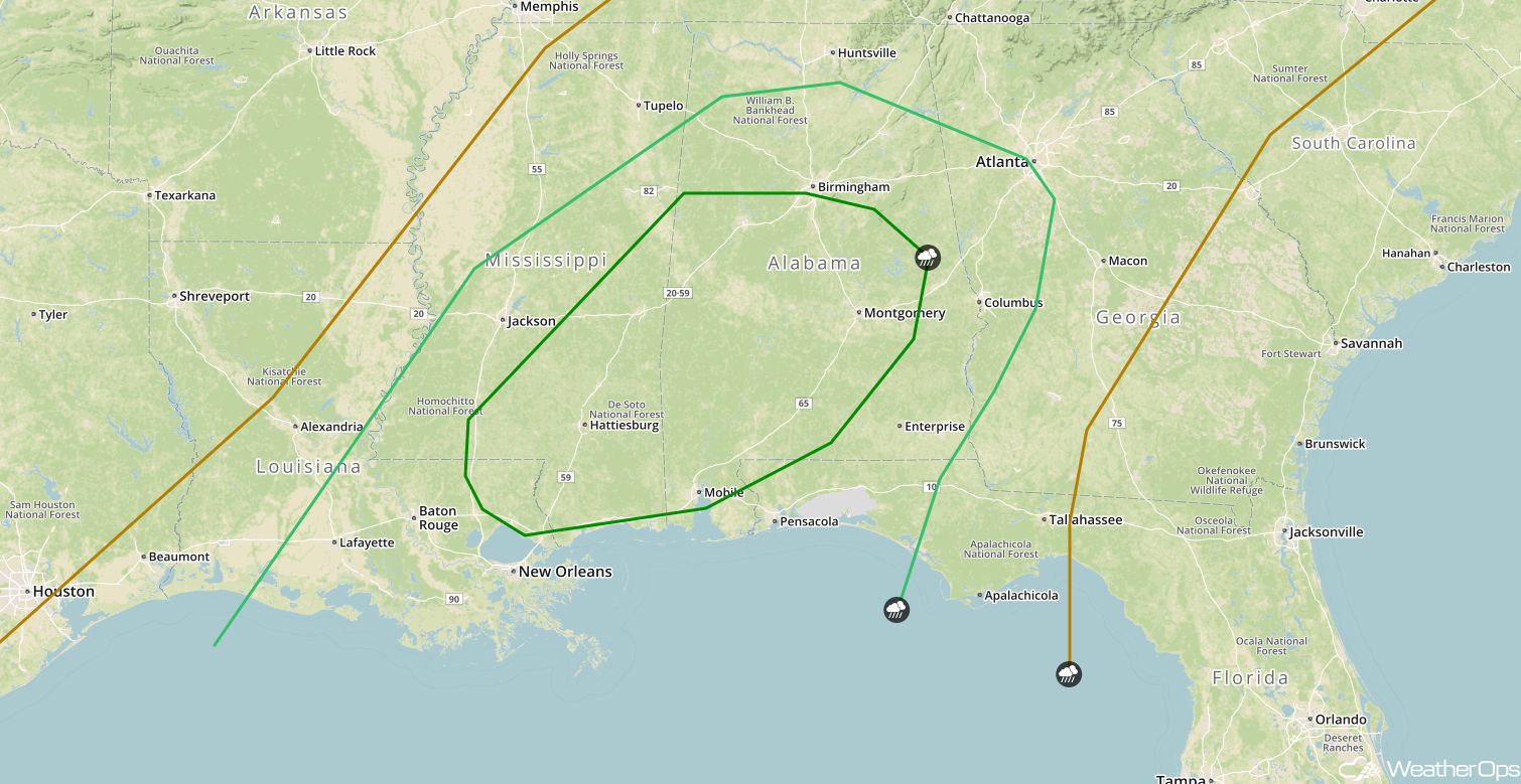 SPC Convective Outlook for Thursday
A Look Ahead
An area of low pressure moving into the Northern Plains may bring some snow to the region Friday into Saturday. By Sunday, an area of low pressure will develop off the Northeast coast. This system will bring the potential for snow to portions of the Northeast Sunday and Monday.
This is just a brief look at current weather hazards. We can provide you site-specific weather forecast information for the purpose of protecting your personnel and assets and to assess your weather risk. Try a 7-day demo right away and learn how timely precision weather information can enhance your bottom line.
