National Weather Summary for Tuesday, June 21, 2016
by David Moran, on Jun 21, 2016 1:48:59 PM
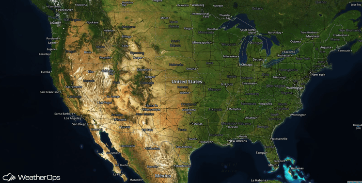
No hazards are currently in effect. An area of low pressure developing in the North Central Plains will allow for the potential for the development of strong to severe thunderstorms on Tuesday for the Great Plains. Further to the east, thunderstorms will be possible across portions of the Ohio Valley and into the Midwest. On Wednesday, the area of low pressure that developed over the Plains will move eastward, bringing the potential for strong to severe thunderstorms from portions of the Plains into the Ohio Valley with the greatest severe thunderstorm potential across the Southern Great Lakes. On Thursday, the low pressure mentioned above will move into New England. The cold front associated with this low pressure will be the focal point for thunderstorm development from the Mid Atlantic into the Central Plains.
US Hazards
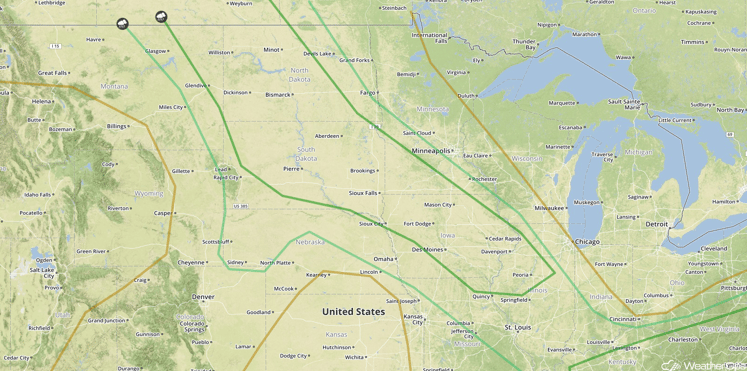
Strong to Severe Thunderstorms Possible on Tuesday for the Great Plains, Midwest, and Mid Atlantic
An area of low pressure developing in the Northern Plains will pull warm air northward. With stronger winds and cooler temperatures aloft, instability will build through the day. Thunderstorms will develop during the late afternoon with large hail and damaging winds the primary threats. From the Ohio Valley eastward, thunderstorms will be possible ahead of a cold front. Large hail and damaging winds will be the primary hazards with these storms. In addition to the severe weather potential, locally heavy rainfall will be possible. Rainfall amounts of 1-2 inches with locally heavier amounts in excess of 3 inches possible.
SPC Convective Outlook for Tuesday
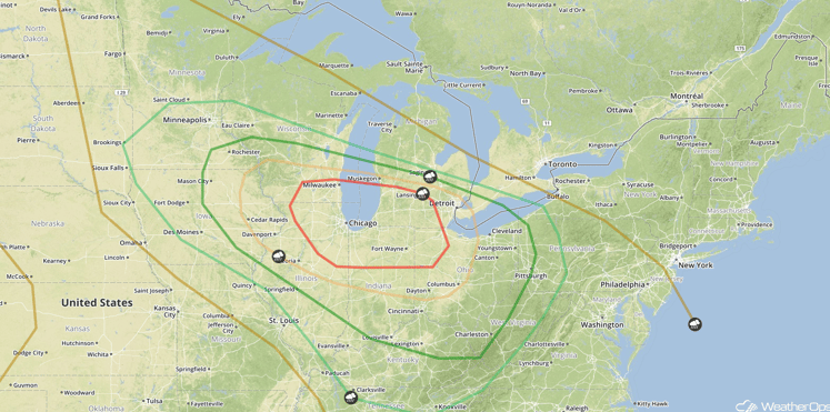
Strong to Severe Thunderstorms Possible on Wednesday for the Great Plains and Ohio Valley
Thunderstorms are expected Wednesday morning from southern Minnesota and eastern Iowa across Illinois and southern Indiana. The main hazard with these storms will be hail with damaging winds possible. More widespread and intense severe thunderstorms are expected later in the day as an area off low pressure that will develop on Tuesday moves eastward. A warm front will move northward ahead of the low and bring warm, moist air into the region. With an upper level system moving over the region, strong to severe thunderstorms are expected to develop during the afternoon and continue into the evening.
SPC Convective Outlook for Wednesday
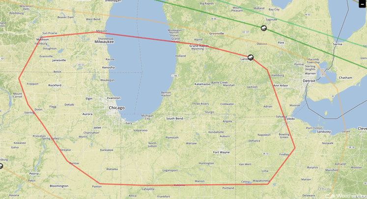
Severe Thunderstorms Expected for Southern Great Lakes on Wednesday
The greatest severe threat will exist from southeastern Wisconsin and northeastern Illinois into northern Indiana, portions of Southern Michigan, and northwestern Iowa. With this area close to the track of the low pressure system and strong instability in place, rapid development of supercell thunderstorms capable of large hail, damaging winds, and tornadoes is expected in this region. These storms will likely cluster and move to the southeast overnight, with damaging winds the primary hazards. In addition to the severe weather potential, locally heavy rain will be possible. Rainfall accumulations of 1-3 inches with locally heavier amounts in excess of 4 inches will be possible.
SPC Convective Outlook for Wednesday
Strong to Severe Thunderstorms Possible for Mid Atlantic through Central High Plains on Thursday
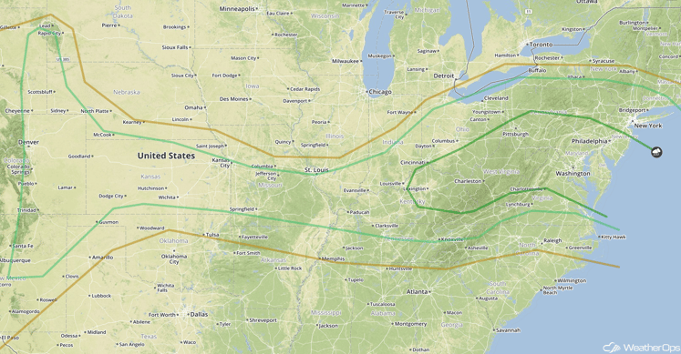
After a morning round of strong to severe thunderstorms, an area of low pressure moving into New England will be the focus for the development of strong to severe thunderstorms as it moves eastward and the attendant cold front moves to the southeast. Storms are expected to develop during the afternoon with large hail and damaging winds the primary hazards.
Heavy rain will be possible across portions of West Virginia where locally heavy amounts in excess of 3 inches will be possible. This could result in isolated flash flooding in the higher elevations.
Further west, from the High Plains eastward into the lower Ohio Valley, instability will build throughout the day, possibly allowing for the development of isolated severe thunderstorms with large hail being the main threat.
SPC Convective Outlook for Thursday


