National Weather Summary for Tuesday, January 16, 2018
by David Moran, on Jan 16, 2018 10:53:07 AM
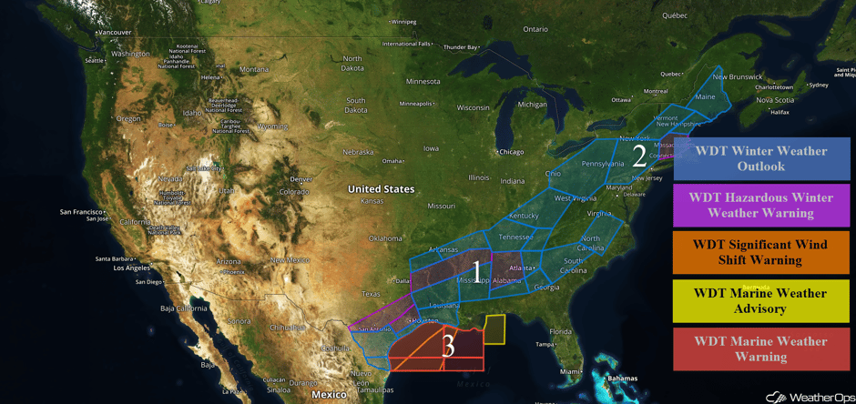
Wintry precipitation will continue from Texas into the Southeast through Wednesday behind a cold front. Snow is expected across the Northeast Tuesday into Wednesday as an area of low pressure and a cold front moves through the region. Elevated winds and seas will continue for portions of the Gulf of Mexico through Wednesday evening in the wake of a cold front.
- Wintry Precipitation Continuing from Texas into the Southeast through Wednesday
- Snow Tuesday and Wednesday for the Northeast
- Elevated Winds and Seas for the Gulf of Mexico through Wednesday
 US Hazards
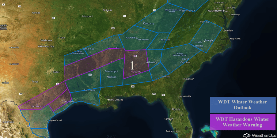
Wintry Precipitation Continuing from Texas into the Southeast through Wednesday
Wintry precipitation will continue from Texas into the Southeast behind a cold front through Wednesday. Across Central Texas, snow accumulations up to 2 inches with locally higher amounts in excess of 3 inches are expected. In addition, ice accumulations up to a tenth of an inch are forecast. From eastern Texas into Mississippi, 2-4 inches of snow with ice accumulations up to 0.05 inch are expected. Snow accumulations of 1-2 inches with locally higher amounts in excess of 3 inches are forecast from portions of Arkansas into West Virginia. Across central and southern Louisiana, only a dusting of snow and ice accumulations up to 0.05 inch are forecast. Further east across central Mississippi, snow accumulations will range 0.5-2 inches through Tuesday evening. Snow accumulations of 1-2 inches are expected for portions of central Alabama. For western Georgia, snow accumulations up to an inch are expected. From eastern Georgia into Virginia, snow accumulations up to 2 inches are expected with locally higher amounts in excess of 3 inches.
Major Cities in Region: San Antonio, TX, Corpus Christi, TX, Houston, TX, Shreveport, LA, Little Rock, AR, Memphis, TN, Jackson, MS, Nashville, TN, Birmingham, AL, Atlanta, GA, Knoxville, TN, Charleston, WV, Raleigh, NC
 Region 1
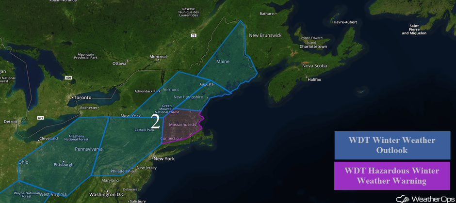
Snow Tuesday and Wednesday for the Northeast
Snow will continue for portions of the Northeast through Wednesday as an upper level system moves across the region. Snowfall totals of 2-3 inches with locally higher amounts in excess of 4 inches are forecast for portions of eastern Ohio, northern West Virginia, and western Pennsylvania. From eastern Pennsylvania into New Hampshire, accumulations will range 3-6 inches. Across Connecticut, Massachusetts, and southern New Hampshire, accumulations will range 4-6 inches with locally higher amounts in excess of 8 inches. Snow accumulations will range 4-6 inches with locally higher amounts in excess of 7 inches across much of Maine.
Major Cities in Region: Pittsburgh, PA, Albany, NY, Boston, MA, Portland, ME, Augusta, ME, Bangor, ME
 Region 2
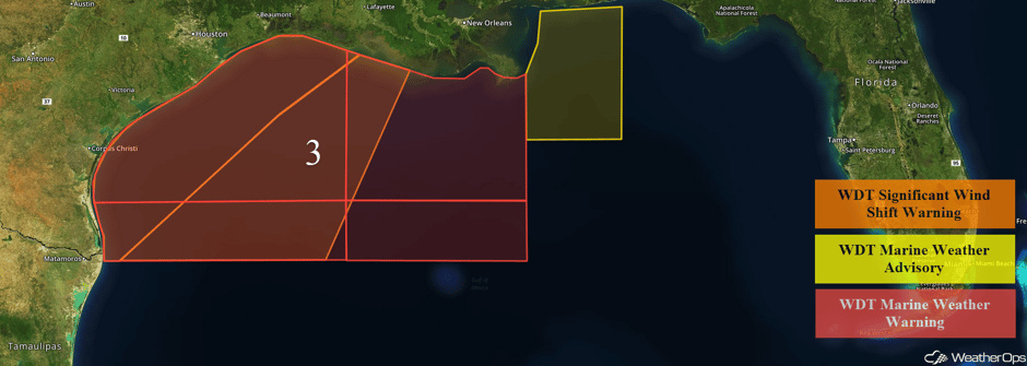
Elevated Winds and Seas for the Gulf of Mexico through Wednesday
A cold front is moving through the western and central Gulf of Mexico this morning. Ahead of the front, winds will be southeasterly at 10-15 knots. Behind the front, winds will become northeasterly at 25-35 knots with gusts in excess of 40 knots. Seas will range 6-9 feet in near the shore and 10-13 feet in the deeper waters.
 Region 3
A Look Ahead
As a potent upper level disturbance ejects out of the Four Corners region and tracks into the Central Plains on Saturday the associated surface low will slowly track eastward from the High Plains to the Central Plains. On the northern periphery of the low, ample cold air and moisture will be in place resulting in an increase in coverage of light to moderate snow beginning from west to east across the High Plains and into the Central Plains. As the low moves northeastward and intensifies Sunday and Monday, wintry precipitation is forecast from the Central Plains into the Great Lakes. At this time, model guidance suggests several inches of snow will be possible with some freezing rain and sleet as well.
This is just a brief look at current weather hazards. We can provide you site-specific weather forecast information to protect your staff and assets and to assess your weather risk. Try a 7-day demo right away and learn how timely precision weather information can enhance your bottom line.


