


by David Moran, on Apr 24, 2018 9:59:23 AM
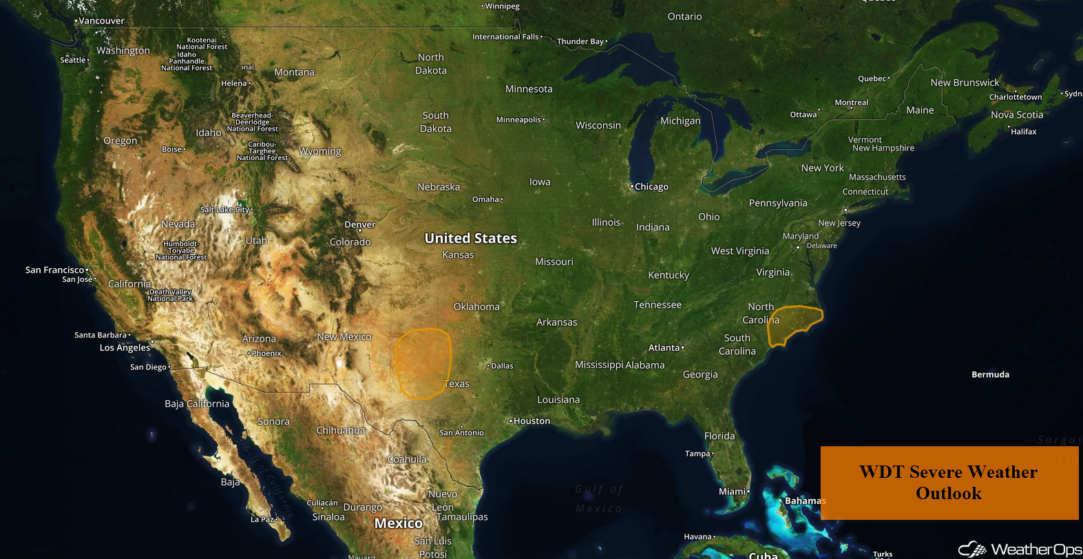
A cold front will be the focus for thunderstorm development across portions of Texas on Tuesday. Showers and thunderstorms will continue across the Carolinas as an area of low pressure remains in place over the region.
- Thunderstorms across Portions of Texas on Tuesday
- Potential for Thunderstorms Tuesday across the Carolinas
 US Hazards

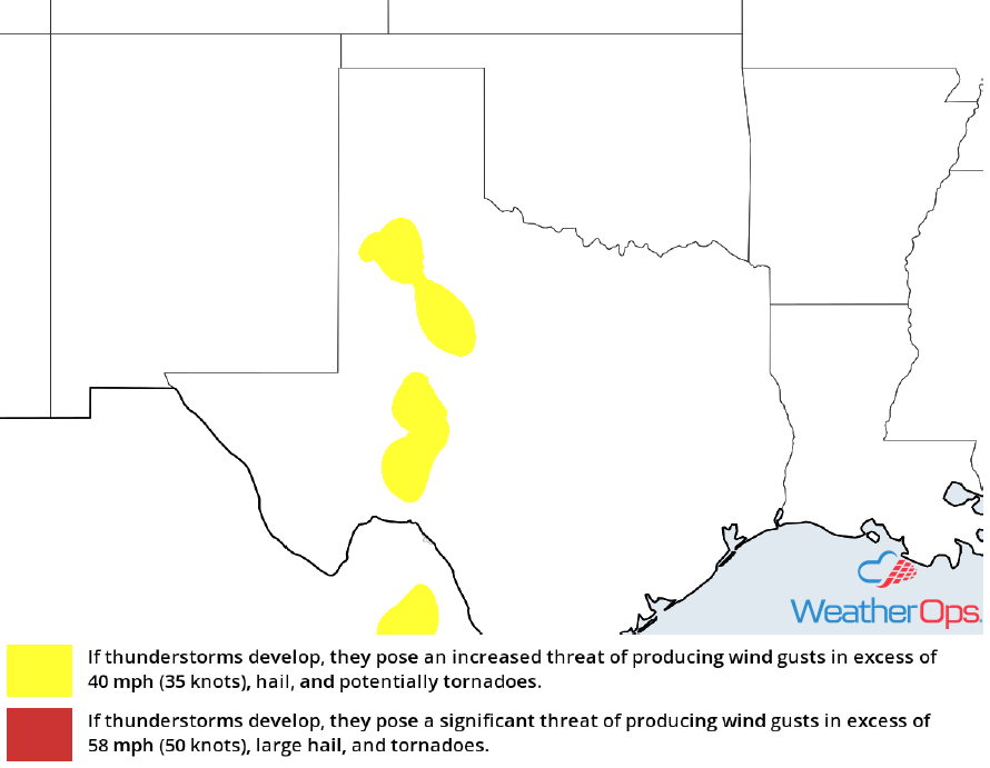
Thunderstorms across Portions of Texas on Tuesday
Scattered thunderstorms may develop across portions of the High Plains of Texas into the Red River Valley on Tuesday. While moisture is limited, instability should be sufficient for the development of some strong to severe thunderstorms during the afternoon. Hail and damaging winds will be the primary hazards with these storms.
Major Cities in Region: Midland, TX, Lubbock, TX, Abilene, TX
 Thunderstorm Potential For Tuesday
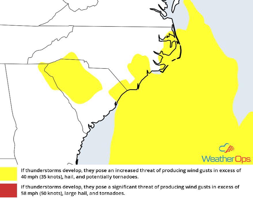
Potential for Thunderstorms Tuesday across the Carolinas
Ongoing showers and thunderstorms will continue as an area of low pressure remains in place over the region. By the afternoon a warm front will lift northward. Where the clouds break, instability may be sufficient for the development for strong to marginally severe thunderstorms along and ahead of the front. Damaging winds will be the primary hazards with these storms.
Major Cities in Region: New Bern, NC, Wilmington, NC
 Thunderstorm Potential For Tuesday
A Look Ahead
Generally quiet conditions will persist for the next several days. Showers and thunderstorms may develop across portions of the Plains on Wednesday as an area of low pressure approaches. This activity will move into the Southeast on Thursday. As this low pressure moves northeastward on Friday, showers and thunderstorms will move into the Mid Atlantic. Across the Pacific Northwest, some high elevation snow may develop across portions of Oregon on Saturday as an area of low pressure moves into the region.
This is just a brief look at current weather hazards. We can provide you site-specific weather forecast information for the purpose of protecting your personnel and assets and to assess your weather risk. Try a 7-day demo right away and learn how timely precision weather information can enhance your bottom line.
