by David Moran, on Oct 4, 2018 11:06:32 AM
Thunderstorms are forecast from the Central Plains into the Upper Mississippi Valley on Thursday as a cold front moves eastward.
- Thunderstorms from the Central Plains into the Upper Mississippi Valley on Thursday
- Snow Thursday across North Dakota
- Potential for Thunderstorms from the Central Plains into the Upper Mississippi Valley Friday
- Excessive Rainfall Friday and Saturday from the Central Plains into the Midwest
- Thunderstorms for the Great Lakes Saturday
- Excessive Rainfall for the Great Basin Saturday
- Thunderstorm Potential Saturday for Texas
- Tropical Update
US Hazards
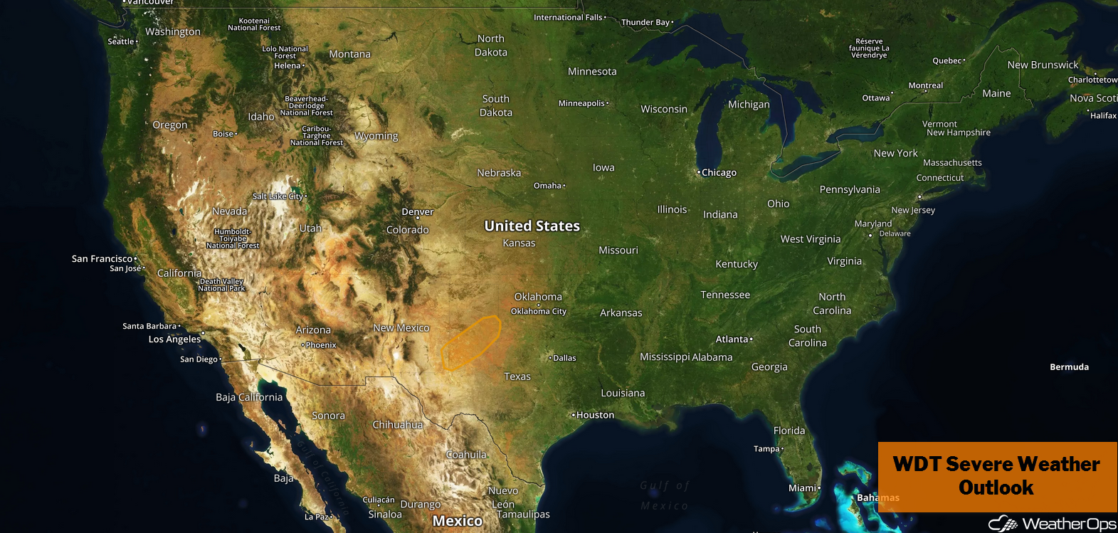
Thunderstorms from the Central Plains into the Upper Mississippi Valley on Thursday
Widely scattered strong thunderstorms are likely across much of Nebraska late Thursday evening into Friday ahead of a cold front. This activity will produce moderate to heavy rainfall, strong winds, and lightning as it progresses northeastward into the Upper Mississippi Valley overnight.
Major Cities in Region: Lubbock, TX. Amarillo, TX Dodge City, KS, Omaha, NE, Kansas City, MO, Des Moines, IA, Cedar Rapids, IA
Thunderstorm Risk for Thursday
Snow Thursday across North Dakota
As an area of low pressure develops in the lee of the Rockies and tracks northeastward, cold air will filter in behind it. This will bring light to moderate snowfall across central North Dakota this afternoon and into the overnight hours. Snowfall totals will range 1-3 inches with locally higher amounts in excess of 4 inches. In addition, ice accumulations up to 0.10 inch are expected.
Major Cities in Region: Minot, ND, Bismarck, ND, Fargo, ND
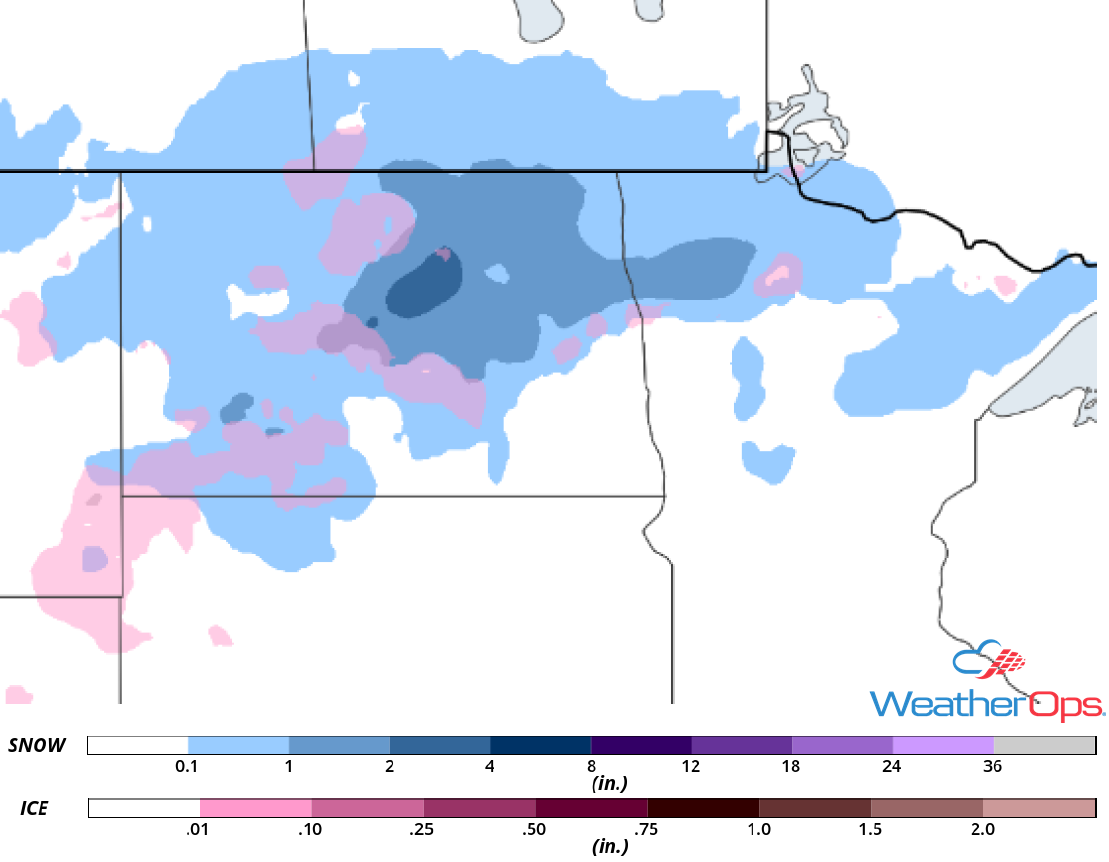
Snow Accumulation for Thursday
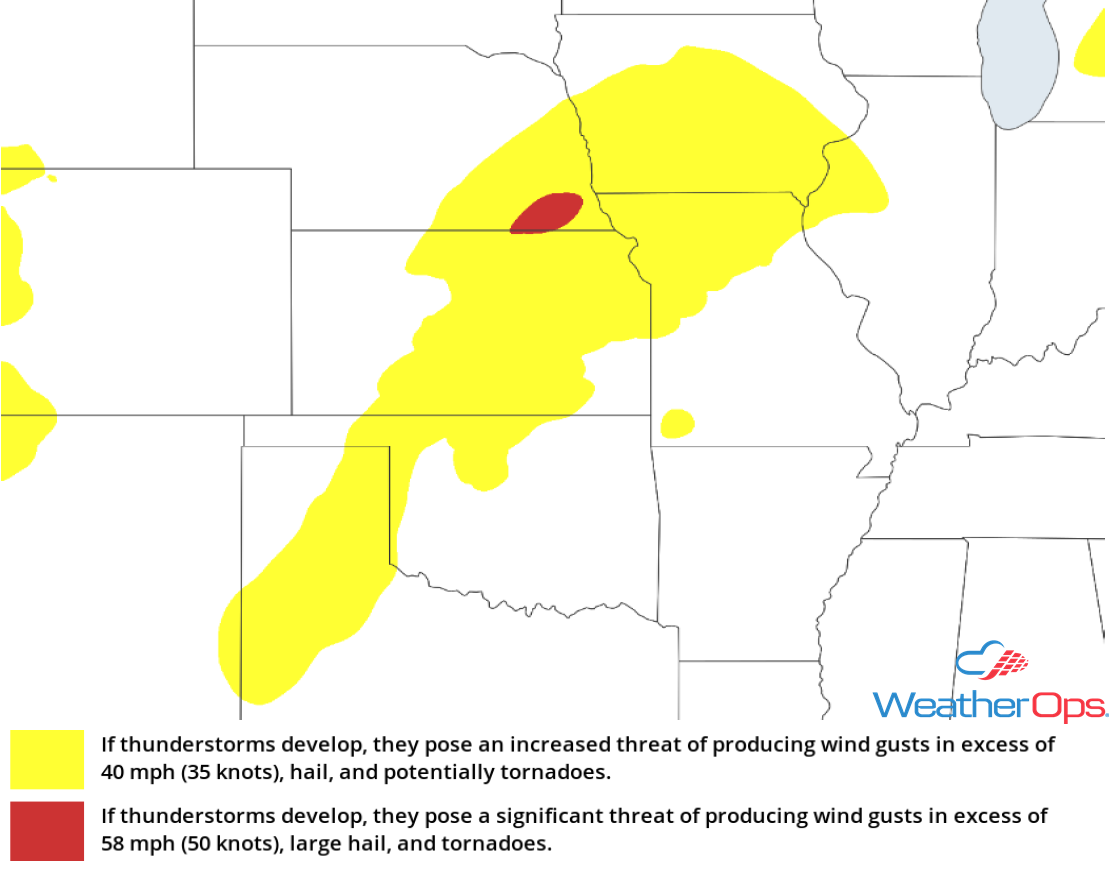
Potential for Thunderstorms from the Central Plains into the Upper Mississippi Valley Friday
As the system described above continues to propagate eastward on Friday, strong to severe thunderstorms will be likely across the Plains and into the Upper Midwest. Strong winds, heavy rain, and lightning will be the primary hazards with these storms. Some of the stronger storms may produce small hail. This activity will become linear and move eastward along the front into the late evening.
Major Cities in Region: Amarillo, TX, Dodge City, KS, Omaha, NE, Kansas City, MO, Des Moines, IA, Cedar Rapids, IA, Madison, WI
SPC Convective Outlook for Friday
Excessive Rainfall Friday and Saturday from the Central Plains into the Midwest
In addition to the thunderstorms described above, there will be a risk for excessive rainfall Friday into Saturday. Two day rainfall totals will range 1-3 inches with locally higher amounts in excess of 4 inches. The highest rainfall totals will extend from the Oklahoma Panhandle into Wisconsin.
Major Cities in Region: Dodge City, KS, Omaha, NE, Kansas City, MO, Des Moines, IA, Madison, WI
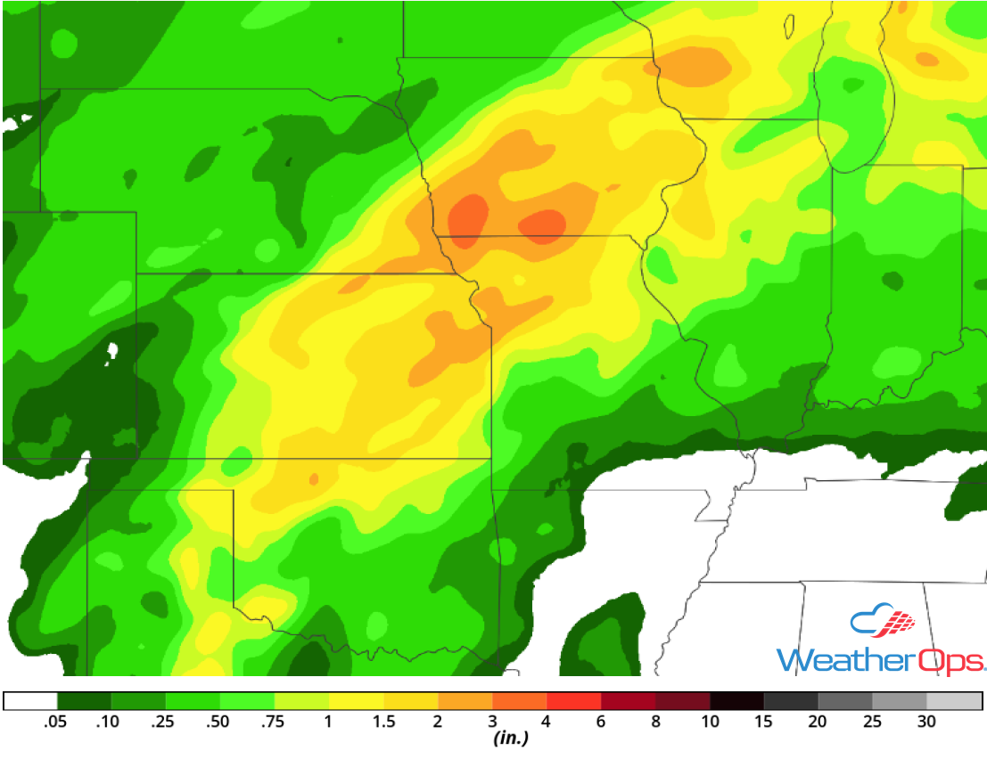
Rainfall Accumulation for Friday and Saturday
Thunderstorms for the Great Lakes Saturday
As an area of low pressure passes slowly to the northeast and weakens, instability ahead of the associated cold front could lead to the development of strong thunderstorms on Saturday. Strong winds and small hail will be the primary hazards with the strongest storms as they track eastward overnight.
Major Cities in Region: Chicago, IL, Toledo, OH, Detroit, MI, Cleveland, OH, Buffalo, NY
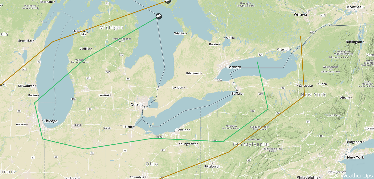
SPC Convective Outlook for Saturday
Excessive Rainfall for the Great Basin Saturday
A strong upper level trough moving over the Great Basin region is expected to bring widespread rainfall on Saturday. The highest rainfall totals are expected to fall from central Arizona into southern Utah. Rainfall amounts will range 0.50-1.50 inches with locally higher amounts.
Major Cities in Region: St. George, UT, Flagstaff, AZ
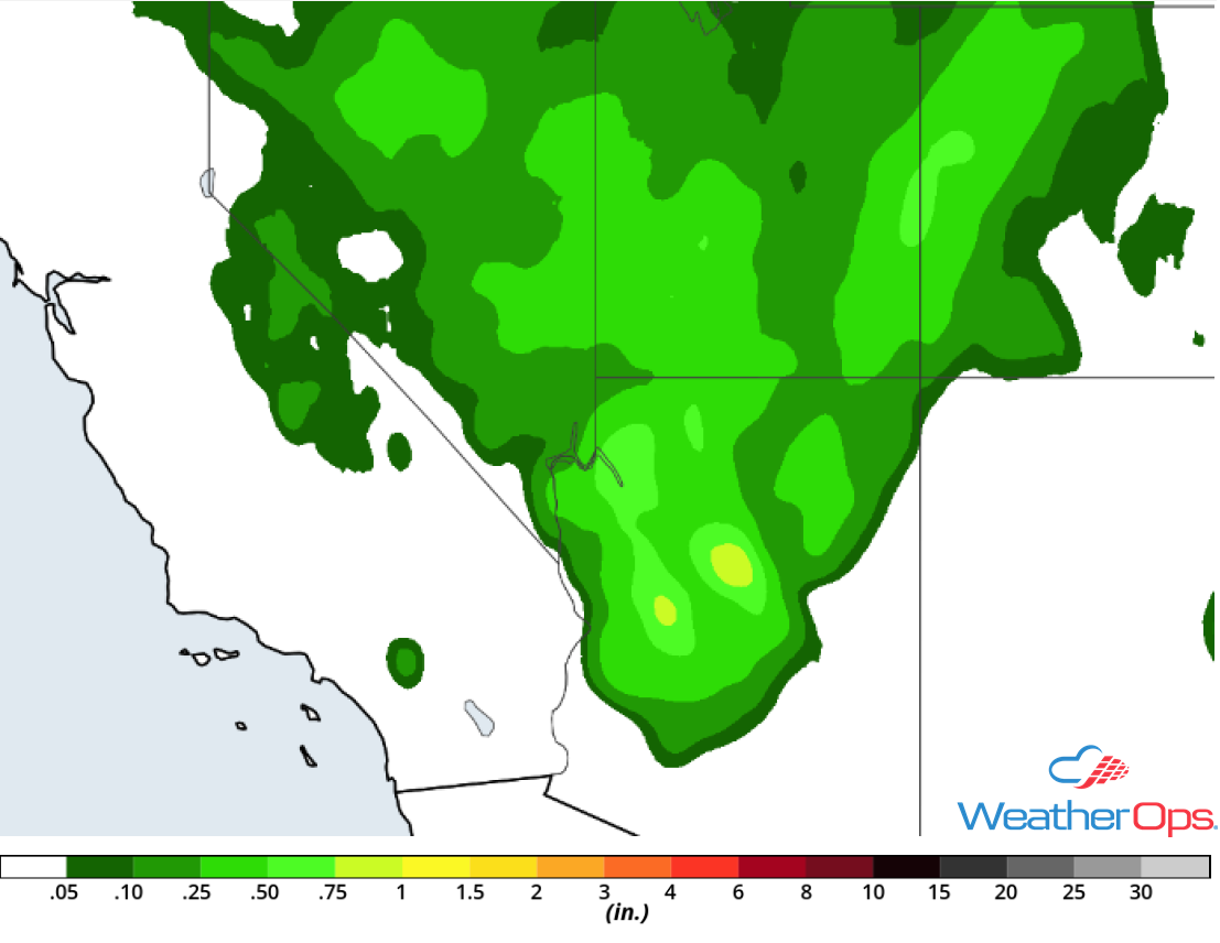
Rainfall Accumulation for Saturday
Thunderstorm Potential Saturday for Texas
The southern end of a cold front associated with the area of low pressure moving across the Plains described above will move through western Texas Saturday afternoon and evening. Instability will build ahead of the front, allowing for the development of isolated strong thunderstorms. Small hail and severe winds will be the primary hazards with this activity.
Major Cities in Region: Midland, TX, Lubbock, TX
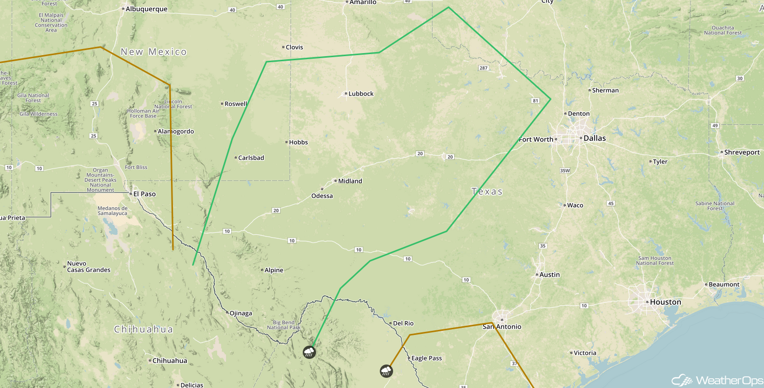
SPC Convective Outlook for Saturday
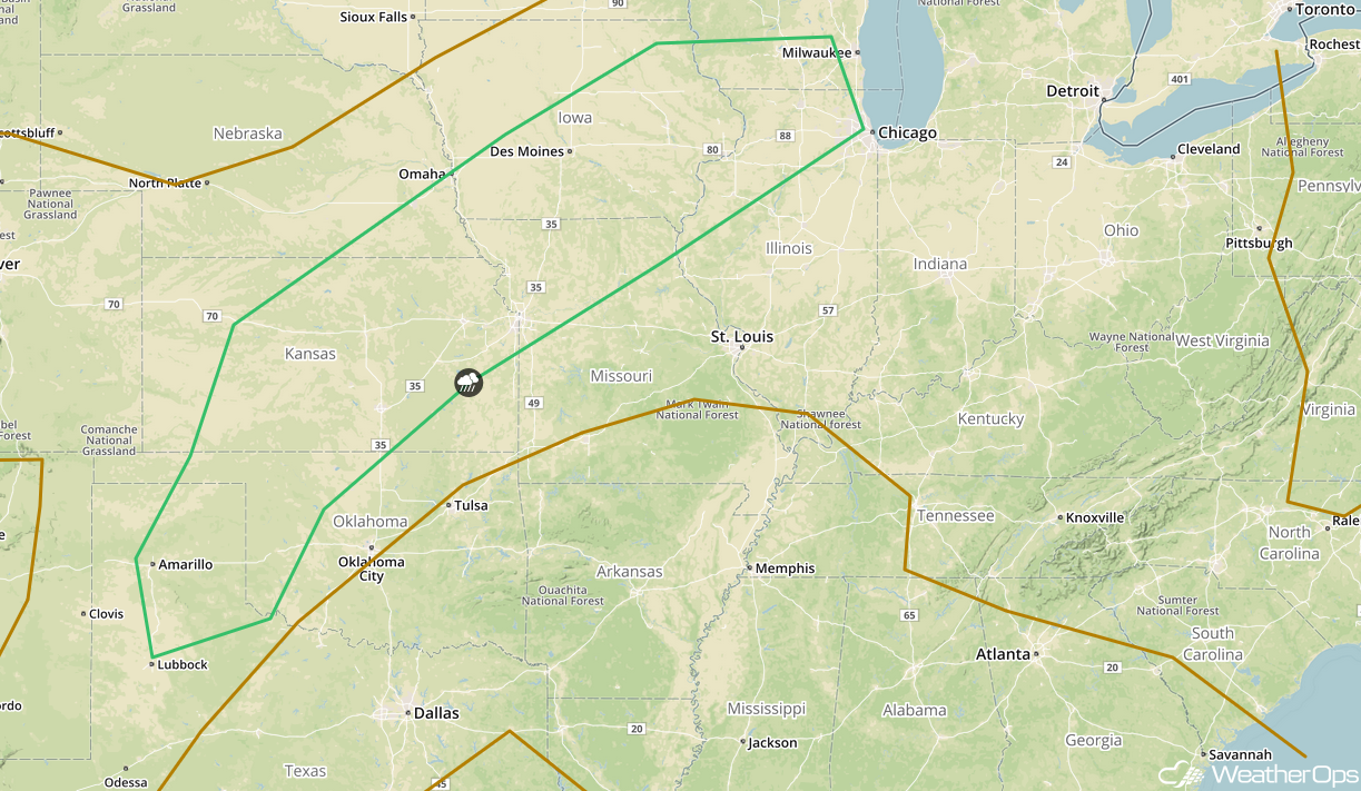
Tropical Update
Hurricane Leslie (green oval) is 445 miles east of Bermuda and is moving northward at 9 mph. This motion is expected to continue with an increase in forward speed through tonight. A reduction in speed is forecast on Friday and Friday night with Leslie turning toward the east or east-southeast over the weekend. Maximum sustained winds are at 75 mph with higher gusts. Gradual weakening is expected during the next several days and Leslie could weaken to a tropical storm on Friday.
A broad area of low pressure covering portions of Central America and the western Caribbean Sea is producing an extensive area of disorganized clouds and thunderstorms (red oval). Upper level winds are currently not favorable for development, but conditions may become more favorable this weekend or early next week. Some slow development of the system may occur as it moves northwestward across the northwestern Caribbean Sea and the southern Gulf of Mexico.
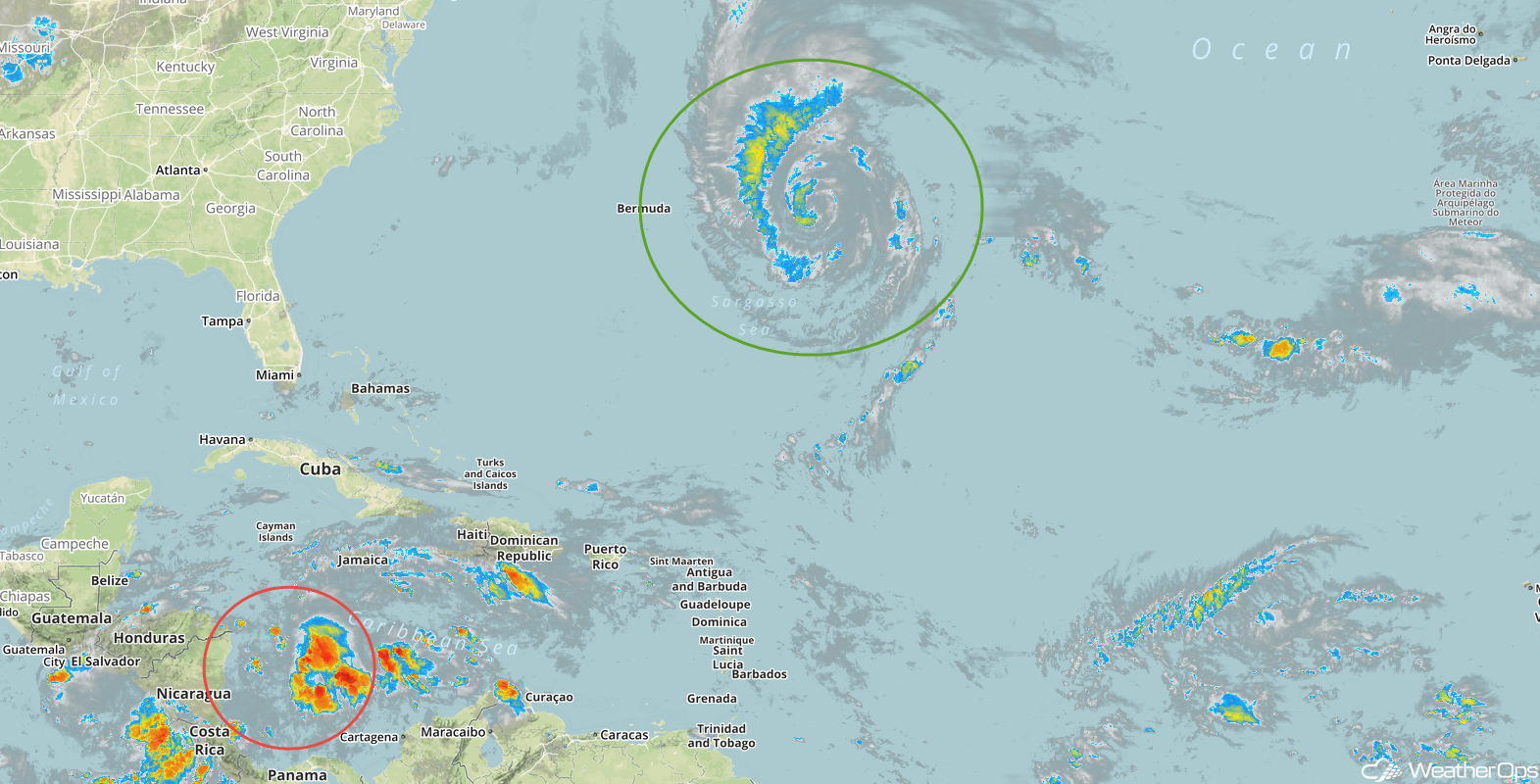
Enhanced Infrared Satellite
A Look Ahead
An upper level trough will bring a chance for snow across portions of the Northern Rockies and High Plains on Sunday. While amounts are uncertain, there will be a potential for several inches of snow. Heavy rain is expected across much of the Plains beginning Sunday and continuing through Wednesday as an area of low pressure moves over the region. Four day rainfall totals will range 4-8 inches with locally higher amounts in excess of 10 inches, resulting in a risk for flooding.