


by David Moran, on Oct 25, 2018 10:35:24 AM
An area of low pressure and warm front will be the focus for thunderstorm development along the North Central Gulf Coast on Thursday. Thunderstorms will continue for the North Central Gulf of Mexico through early Thursday afternoon.
- Thunderstorms for the North Central Gulf Coast on Thursday
- Continued Thunderstorms through Early Thursday Afternoon for the North Central Gulf of Mexico
- Potential for Thunderstorms across the Southeast on Friday
- Snow Saturday for the Northeast
- Tropical Update
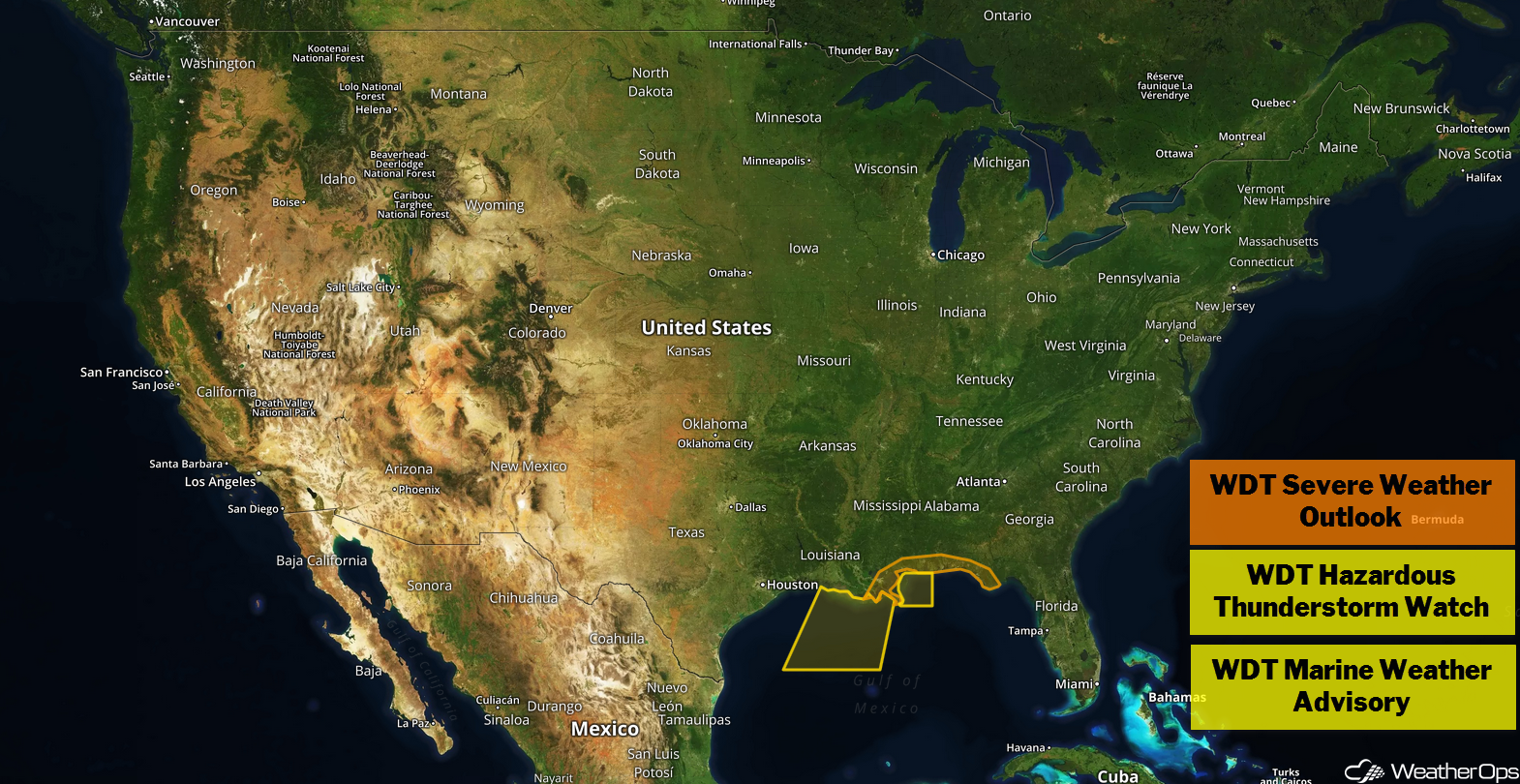
US Hazards
Thunderstorms for the North Central Gulf Coast on Thursday
An area of low pressure is developing along a stalled front in the northwestern Gulf of Mexico. Southerly winds east of the low should push the front northward as a warm front. With warm moist air moving northward, the front may serve as a focus for shower and thunderstorm development. Strong shear may allow for the development of a few severe storms with damaging winds the primary hazard. However, a few tornadoes cannot be ruled out.
Major Cities in Region: New Orleans, LA, Mobile, AL, Panama City, FL
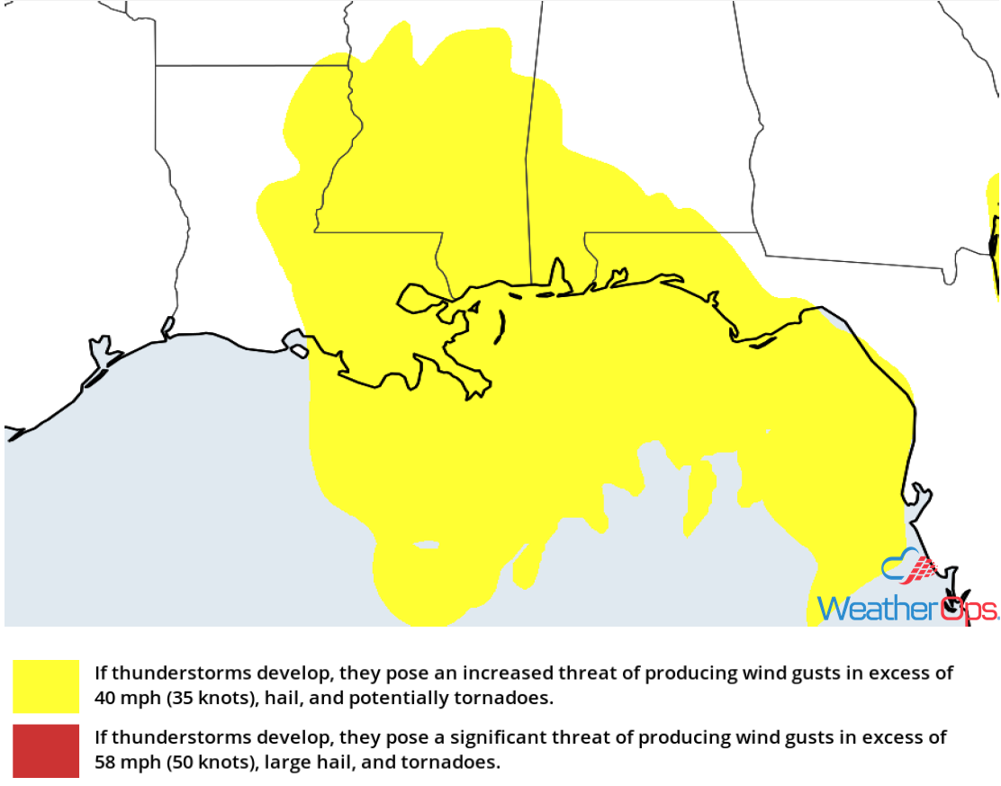
Thunderstorm Risk for Thursday
Continued Thunderstorms through Early Thursday Afternoon for the North Central Gulf of Mexico
The area of low pressure described above is moving northeastward. Thunderstorms have started to develop this morning near the low and ahead of the associated cold front. Some of these storms could be heavy with wind gusts in excess of 40 knots, frequent lightning, and heavy rain. There is also a risk for waterspouts. Seas will range 6-8 feet.
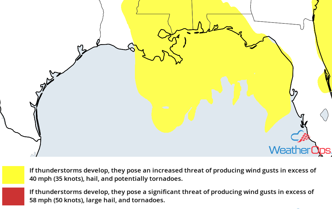 Thunderstorm Risk for Thursday
Potential for Thunderstorms across the Southeast on Friday
The area of low pressure that is expected to bring severe thunderstorms to the central Gulf Coast today will move northeastward on Friday. At the same time, an upper level trough will move into the region from the northwest. East of the low's path, southerly to southeasterly winds will bring moist air northward; with daytime heating, instability will build. This will allow for the development of isolated strong to severe thunderstorms. Damaging winds will be the primary hazard, but there will be a low threat for large hail and isolated tornadoes.
Major Cities in Region: Jacksonville, FL, Savannah, GA, Charleston, SC, Myrtle Beach, SC, Wilmington, NC
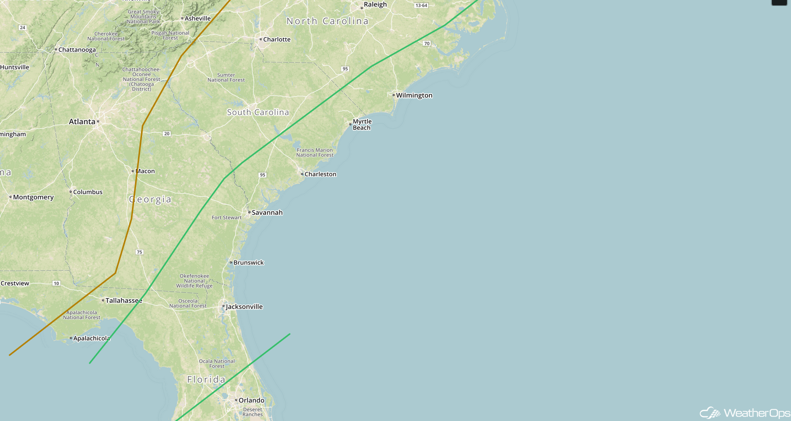
SPC Convective Outlook for Friday
Snow Saturday for the Northeast
An upper level trough and associated surface low will be moving across the Northeast this weekend, bringing a wintry mix of precipitation to portions of Vermont, New Hampshire, and Maine. Although amounts and precipitation type are dependent on the path of the low, snow accumulations of 2-4 inches are expected across the higher elevations of Vermont and New Hampshire. The snow should move northeastward into Maine later in the morning with 1-3 inches forecast. In addition, there may be light ice accumulations.
Major Cities in Region: Burlington, VT, Bangor, ME, Presque Isle, ME
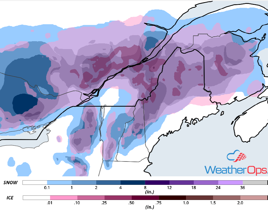
Snow and Ice Accumulation for Saturday
Tropical Update
An area of low pressure about 900 miles east-northeast of the northern Leeward Islands is gradually becoming better defined. The associated showers and thunderstorm activity are showing signs of organization. This low is expected to move generally northward over the next couple of days where conditions are expected to become more favorable for further development. A tropical or subtropical storm is expected to develop by early this weekend. After that time, the system is expected to turn westward to the north or northeast of the Lesser Antilles through early next week.
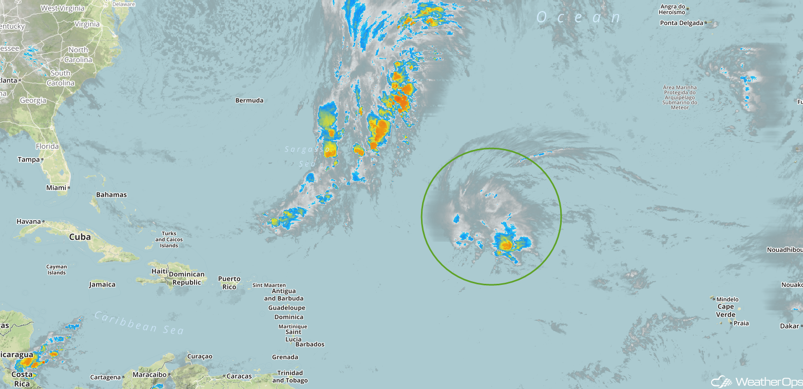
Enhanced Infrared Satellite
A Look Ahead
A wintry mix will continue across the Northeast on Sunday as an area of low pressure moves northeastward. By Monday, an area of low pressure will bring rain to portions of the Mid Atlantic and Northeast. Light rain is forecast across portions of the Plains and Great Lakes on Tuesday ahead of a cold front. Snow could develop across the Central Rockies late Tuesday into Wednesday.
