National Weather Summary for Thursday, November 9, 2017
by David Moran, on Nov 9, 2017 10:35:33 AM
Thunderstorms, as well as elevated winds and seas, are forecast for Thursday off the coasts of Texas and Louisiana. Moderate to heavy snow is expected for portions of the Northern Great Lakes as an area of low pressure moves across the region.
- Elevated Winds and Seas for the Western Gulf of Mexico on Thursday
- Heavy Snow Thursday across the Great Lakes
- Snow for the Northern Great Lakes Saturday into Sunday
- Tropical Update
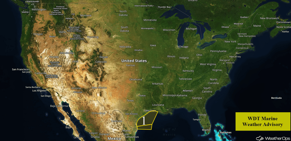 US Hazards
Elevated Winds and Seas for the Western Gulf of Mexico on Thursday
Showers and thunderstorms will continue for portions of the western Gulf of Mexico through Thursday afternoon. Sustained winds of 25-30 knots with gusts in excess of 30 knots are expected. Swells will range 3-5 feet near the shore and 6-9 feet in the deeper waters.
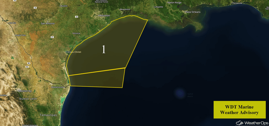 Region 1
Heavy Snow Thursday across the Great Lakes
Areas of moderate to heavy snow may develop today for the extreme northern Great Lakes in response to an area of low pressure. This will produce not only general snowfall, but some lake effect snow as well. Accumulations of 2-6 inches are expected with locally higher amounts in excess of 8 inches in the heaviest bands.
Major Cities in Region: Wausau, WI, Green Bay, WI, Traverse City, MI, Sault Ste. Marie, MI
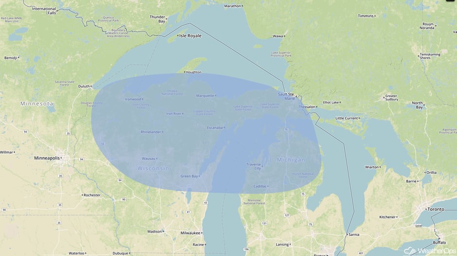 Snow Outline for Thursday
Snow for the Northern Great Lakes Saturday into Sunday
Moderate to heavy snowfall is forecast once again across the northern Great Lakes Saturday into Sunday as an area of low pressure moves across the region. Snow accumulations of 2-4 inches with locally higher amounts in excess of 6 inches are forecast.
Major Cities in Region: Wausau, WI, Green Bay, WI, Traverse City, MI, Sault Ste. Marie, MI
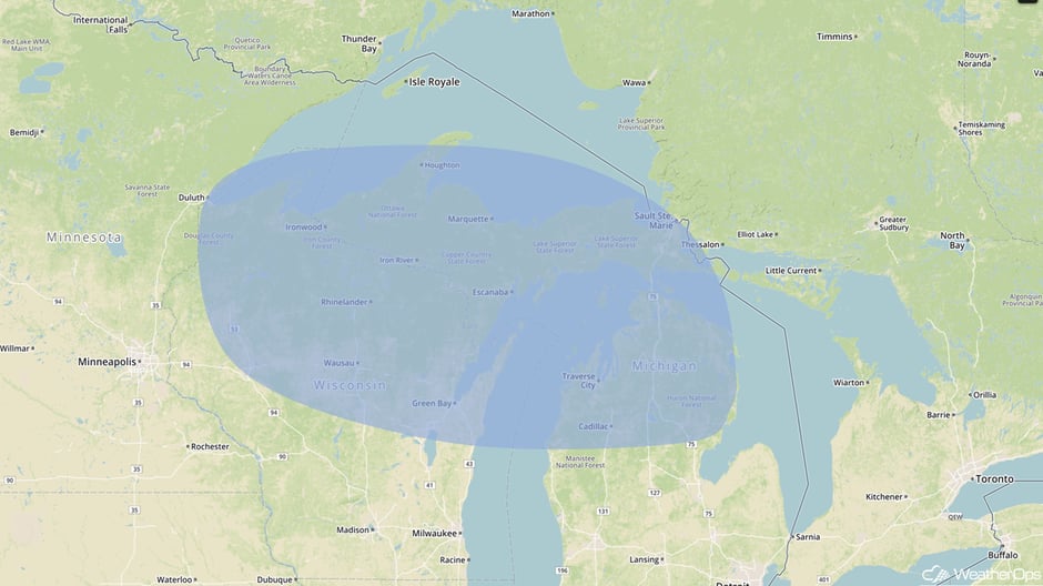 Snow Outline for Saturday
Tropical Update
Post-Tropical Cyclone Rina is 360 miles east of Cape Race, Newfoundland and is moving northeastward at 40 mph. A faster northeastward or east-northeastward motion is expected until dissipation tomorrow. Maximum sustained winds are at 45 mph with higher gusts. Little change in strength is forecast before the system dissipates on Friday.
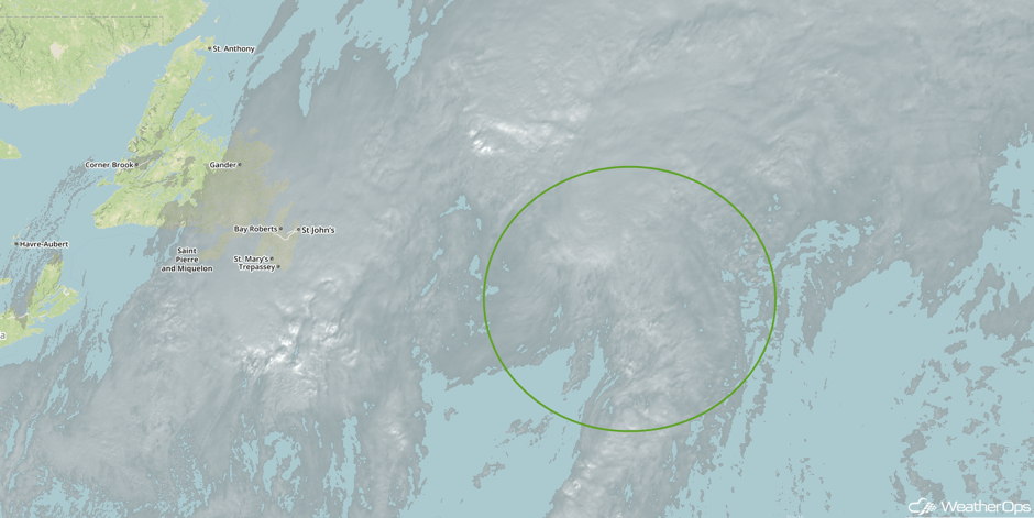 Tropical Visible Satellite
A Look Ahead
Showers and thunderstorms may develop across portions of the Plains on Sunday as an area of low pressure moves through the region. A strong area of low pressure may bring rainfall and high elevation snow to portions of the Pacific Northwest Sunday into Monday. Rain and snow may develop across portions of the Northeast on Monday in association with a weak system.
Learn what to expect this winter by signing up for our Winter Weather Outlook webinar today.
This is just a brief look at current weather hazards. We can provide you site-specific weather forecast information for the purpose of protecting your personnel and assets and to assess your weather risk. Try a 7-day demo right away and learn how timely precision weather information can enhance your bottom line.


