National Weather Summary for Thursday, November 3, 2016
by David Moran, on Nov 3, 2016 11:06:21 AM
An upper level low moving into the Desert Southwest will provide lift leading to the development of showers and thunderstorms on Thursday. Further to the east, rich moisture will allow for excessive rainfall across west Texas. As the upper level low continues to move eastward on Friday, another round of showers and thunderstorms will be possible across the Desert Southwest.
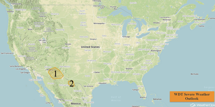
US Hazards

Region 1
Although ongoing thunderstorm activity from this morning may limit further development this afternoon, latest model guidance suggests that there should be sufficient destabilization to allow for the development of thunderstorms from Arizona into New Mexico. Wind shear and instability will be sufficient to produce rotating supercells, with large hail and damaging winds the primary hazards before the storms weaken into the overnight hours.
Major Cities in Region: Tucson, AZ, El Paso, TX
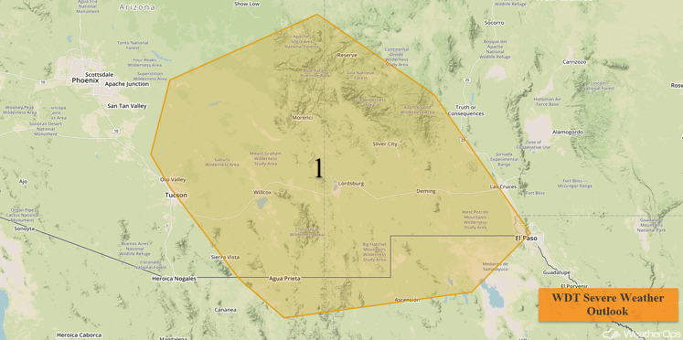
Region 1
Region 2
Upslope flow south of a cold front will allow for a few thunderstorms across the Big Bend region of Texas this afternoon, with a few storms potentially becoming severe. Large hail and damaging winds will be possible before the storms weaken and move out of the region overnight.
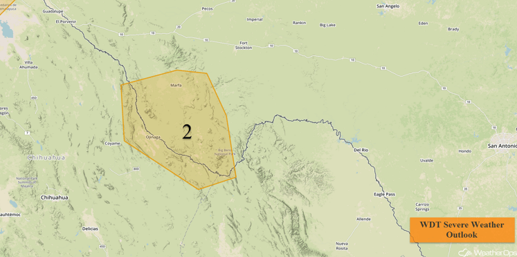
Region 2
Excessive Rainfall Possible Thursday for Portions of West Texas
Increasing easterly winds, in response to a weak but developing area of low pressure over northern Mexico, will transport rich Gulf moisture into west Texas. An upper level low moving into the Desert Southwest will provide the needed lift to initiate shower and thunderstorm activity across the region. Widespread rainfall accumulations of 1-2 inches can be expected, with locally higher amounts in excess of 3 inches possible in some locations.
Major Cities in Region: Midland, TX, San Angelo, TX
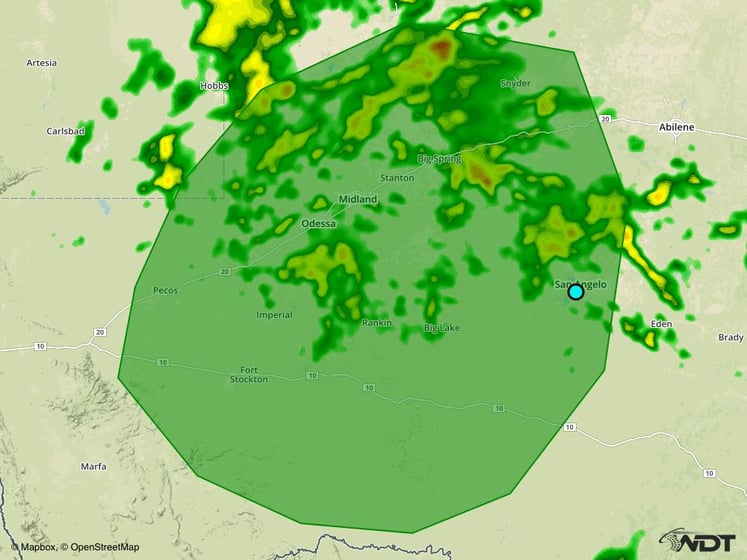
Excessive Rainfall Risk Outline for Thursday
Strong to Severe Thunderstorms Possible for the Desert Southwest on Friday
An upper level low over Arizona will drift to the east slowly. Thunderstorms will develop across portions of southern New Mexico and far west Texas by late afternoon. Modest instability combined with moderate wind shear over the region will allow for a few of these thunderstorms to become strong to severe. The main hazards will likely be hail larger than one half inch in diameter and wind gusts in excess of 50 mph.
In addition to the severe weather threat, locally heavy rainfall will be possible. Widespread rainfall accumulations of one half to one inch can be expected across much of New Mexico, with locally higher amounts in excess of two inches possible in some locations. This locally heavy rainfall could lead to flash flooding in some locations.
Major Cities in Region: Truth or Consequences, NM, Las Cruces, NM, El Paso, TX
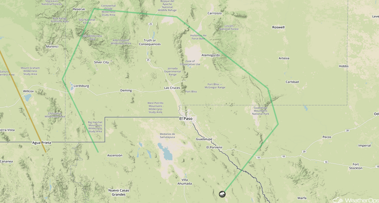
SPC Convective Outlook for Friday
Tropical Update
A non-tropical area of low pressure located about 1000 miles northeast of the northern Leeward Islands (green oval) continues to produce gale-force winds and widespread cloudiness and showers over the central Atlantic. This system could acquire some subtropical characteristics late Friday or Saturday while it moves north-northeastward over the north-central Atlantic.
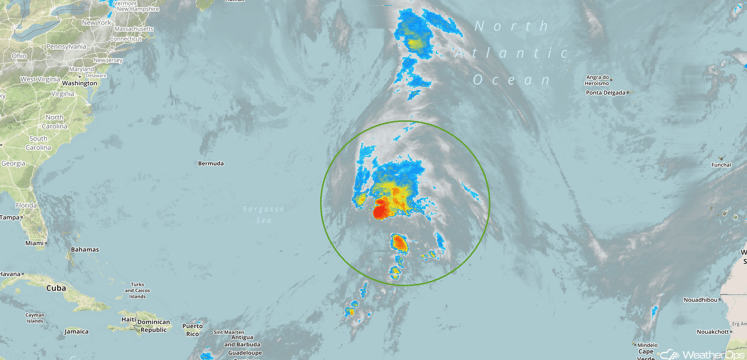
Enhanced Infrared Tropical Satellite
A Look Ahead
Rain chances will increase over the central and southern High Plains for the weekend as an area of low pressure develops in the lee of the Rockies. Rain chances will increase across the Pacific Northwest as an area of low pressure approaches the region. By midweek, an area of low pressure will bring a chance of rain to portions of the Northeast.
This is just a brief look at current weather hazards. We can provide you site-specific forecast information for the purpose of protecting your personnel and assets. Try a 7-day demo right away and learn how timely precision weather information can enhance your bottom line.


