


by David Moran, on Nov 2, 2017 10:09:57 AM
Thunderstorms may develop across portions of the Deep South on Thursday ahead of a cold front.
- Thunderstorms Thursday for Portions of the Deep South
- Snow for the Northern Rockies and Plains Friday through Early Sunday
 US Hazards

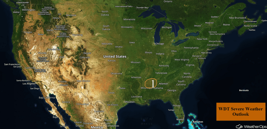
Thunderstorms Thursday for Portions of the Deep South
An area of low pressure and attendant cold front will move through the Southern Plains toward the Deep South today. Thunderstorms will develop along and ahead of the cold front this afternoon and evening. Large hail, damaging winds, and tornadoes will all be potential hazards with these storms. Activity should weaken after dark.
Major Cities in Region: Tupelo, MS, Columbus, MS
 Region 1
Snow for the Northern Rockies and Plains Friday through Early Sunday
An upper level disturbance moving into the Pacific Northwest will allow a surface low to intensify over portions of Idaho and Wyoming. The upper level trough will enhance lift and moisture near a stalled front along the Idaho/Montana border with precipitation increasing early Friday into Saturday. Snow accumulations of 3-6 inches are expected in the lower elevations with locally higher amounts in excess of 8 inches. Above 5,000 feet, 8-12 inches with locally higher amounts in excess of 14 inches are forecast. Precipitation will come to an end by Saturday evening as an area of low pressure moves eastward. Across Northern and Central Montana into portions of the Northern Plains, snow accumulations of 2-4 inches with locally higher amounts in excess of 5 inches are forecast through early Sunday.
 Snow Outline for Friday through Sunday
A Look Ahead
There will be a threat for strong to severe thunderstorms on Sunday across the Great Lakes region. With a surface low and its associated fronts tracking eastward from the Central Plains and Midwest into the Great Lakes on Sunday, instability will build out ahead of the area of low pressure's associated cold front across portions of the Midwest and Great Lakes. With this instability in place, in addition to ample low level moisture and strong wind shear, scattered showers and thunderstorms will develop during the afternoon and evening. Some of these thunderstorms could become strong to severe in nature. At this time, large hail, damaging winds, and tornadoes will all be potential hazards. The threat will transition to a primarily damaging wind threat by the evening hours on Sunday.
Learn what to expect this winter by signing up for our Winter Weather Outlook webinar today.
This is just a brief look at current weather hazards. We can provide you site-specific weather forecast information for the purpose of protecting your personnel and assets and to assess your weather risk. Try a 7-day demo right away and learn how timely precision weather information can enhance your bottom line.
