National Weather Summary for Thursday, June 23, 2016
by David Moran, on Jun 23, 2016 11:33:43 AM
A cold front moving through the Ohio Valley will allow for the development of severe thunderstorms across portions of the Ohio Valley on Thursday. Further to the east, strong to severe thunderstorms will be possible across portions of the Mid Atlantic. Across portions of the Plains, strong to severe thunderstorms will be possible as an upper level trough moves over the region. An area of low pressure developing over Montana will lead to the potential for strong to severe thunderstorms across the Northern Plains on Friday. A stalled cold front will serve as the focal point for the development of thunderstorms from the Central Plains to the Carolinas. As the area of low pressure developing over Montana continues to develop and tracks to the northeast on Saturday, strong to severe thunderstorms will be possible from the Great Lakes to the South Central Plains.
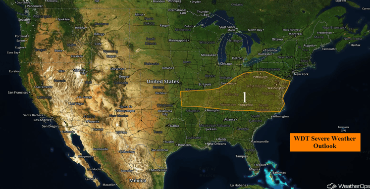
US Hazards
Region 1
Ongoing thunderstorm activity in the Virginias will present some limited severe potential this morning, but that potential is quickly diminishing. The main focus will be this afternoon when fresh thunderstorms develop along the stalling cold front and outflow wind boundaries from this morning's thunderstorms. The primary threats will be large hail and severe wind gusts, but a tornado or two cannot be ruled out. The threat for thunderstorms will decrease further to the west into Missouri and Arkansas.
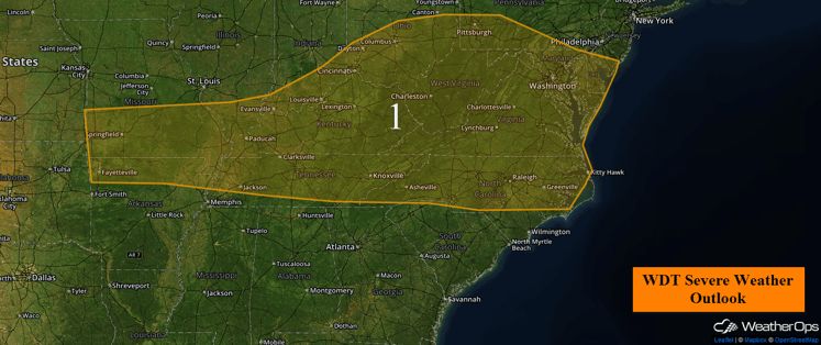
Region 1
Strong to Severe Thunderstorms Thursday Possible for Central High Plains
Heating across the High Plains and portions of the Central Plains into the afternoon will allow instability to build. Strong to severe thunderstorms will be possible as an upper level system moves across the region, however thunderstorms are forecast to remain somewhat isolated.
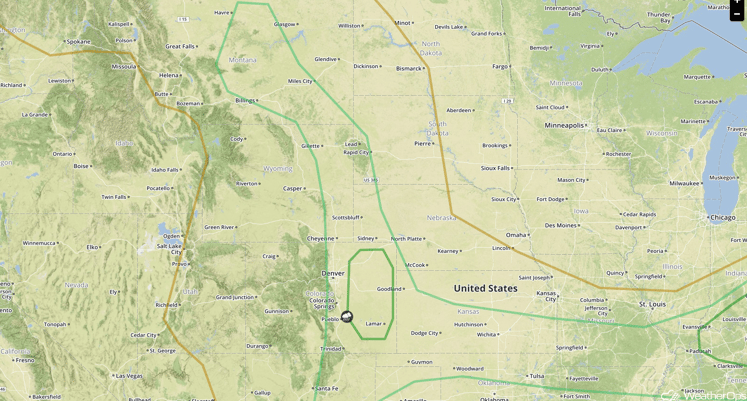
SPC Convective Outlook for Thursday
Strong to Severe Thunderstorms Possible Across Northern Plains on Friday
An area of low pressure developing across southeastern Montana is forecast to lead to the potential for strong to severe thunderstorms across the Northern Plains. An upper level trough is forecast to move through the region, creating an environment favorable for thunderstorm development. As the cold front moves through the region, thunderstorms are expected ahead of the front. Primary impacts with any thunderstorms that develop will be large hail, damaging winds, and an isolated tornado or two.
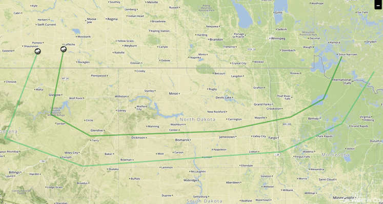
SPC Convective Outlook for Friday
Strong to Severe Thunderstorms Possible from the Central Plains to the Carolinas on Friday
A stalled front is forecast to extend to the west from the Carolinas into the Central Plains. Thunderstorm development is possible during the afternoon with damaging winds possible in the afternoon with damaging winds possible. Further to the west across the Central Plains, isolated strong to severe thunderstorms will be possible ahead of the warm front associated with the developing surface low over Montana.
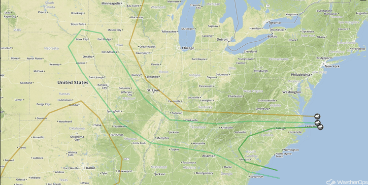
SPC Convective Outlook for Friday
Strong to Severe Thunderstorms Possible Saturday from the Great Lakes to the South Central Plains
The area of low pressure across Montana is forecast to continue to develop and track to the northeast with the associated cold front extending to the south-southwest of the center of the low. Moderate instability is forecast to develop ahead of the cold front with rich southerly flow bringing moisture into the region. Additionally, upper level support is forecast to exist. As a result, strong heating will result in the potential for strong to severe thunderstorms across the region ahead of the front with large hail and damaging winds the primary hazards. Heavy rainfall will also be possible across portions of the Great Lakes and into Canada in locations closer to the surface low. Total accumulations of 1-3 inches will be possible.
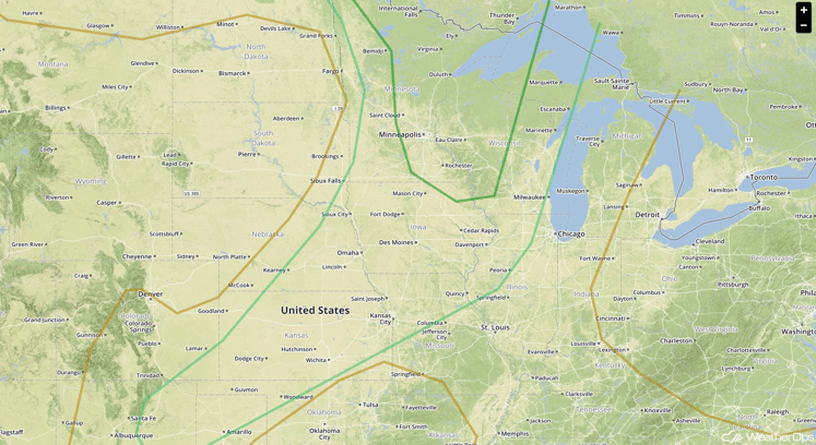
SPC Convective Outlook for Saturday


