National Weather Summary for Thursday, June 16, 2016
by David Moran, on Jun 16, 2016 11:03:49 AM
An area of low pressure tracking through the Great Lakes and into the Ohio Valley will allow for severe thunderstorms from the Ohio Valley and Mid Atlantic into the Missouri Valley. Strong to severe thunderstorms will be possible for portions of the Southeast and across the Dakotas; the potential for strong to severe thunderstorms will continue across the Southeast and the Dakotas on Friday. An area of low pressure developing in the lee of the Rockies will allow for the potential for strong to severe thunderstorms across portions of the Northern Plains on Saturday.
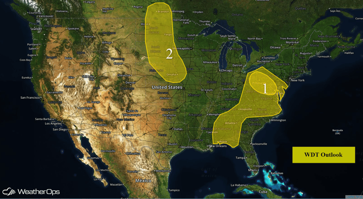
US Hazards
Region 1
An upper level trough will move over Region 1 today and provide the forcing for scattered strong to severe thunderstorm development in the early afternoon hours. The primary threats will be large hail and damaging winds. Tornadoes will also be possible in some storms. The storms will likely coalesce into a larger complex that will move to the south and east tonight with damaging winds being the primary threat.
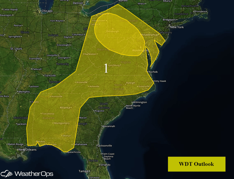
Region 1
Region 2
Warm temperatures and a relatively moist atmosphere, combined with weak upper level forcing, will result in the development of strong to severe thunderstorms late this afternoon and evening. Large hail and damaging winds will be the primary hazards.
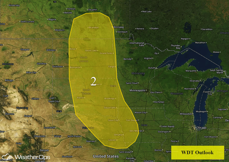
Region 2
Strong to Severe Thunderstorms Possible Across the Southeast on Thursday
Thunderstorms will be possible across portions of the Southeast for much of the day on Thursday with some storms becoming strong to severe. While severe thunderstorms should be isolated, damaging winds will be the primary hazard with any thunderstorm that becomes severe.
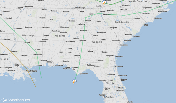
SPC Convective Outlook for Thursday
Strong to Severe Thunderstorms Possible for the Southeast on Friday
The chance for strong to severe thunderstorms will return to the Southeast on Friday as a cold front surges through the region. Moderate instability will form by the late afternoon, with storms developing along and ahead of a cold front during the late afternoon and evening hours. The primary hazard with any of these storms will be damaging winds.
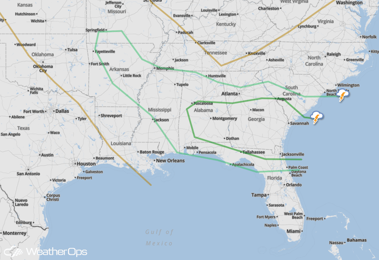
SPC Convective Outlook for Friday
Strong to Severe Thunderstorms Possible Across Northern Plains on Friday
Isolated to scattered strong to severe thunderstorms will be possible across portions of the Northern Plains, mainly along the higher terrain where upslope flow will be present. Moderate to strong instability will develop across the region by the afternoon with thunderstorm development possible by late afternoon. Large hail and damaging winds will be the primary hazards with any storms that become severe.
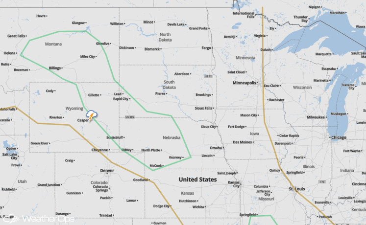
SPC Convective Outlook for Friday
Strong to Severe Thunderstorms Possible for Northern Plains on Saturday
There will be a risk for strong to severe thunderstorms across the far Northern Plains on Saturday. Showers and thunderstorms are expected to be ongoing for much of the day with moderate instability expected by the afternoon. More intense thunderstorms are expected to form in the afternoon and evening in response to an area of low pressure forming in the lee of the Northern Rockies. Primary hazards with any storm that becomes severe will be large hail and damaging winds. In addition to the severe weather, there will be the potential for excessive rainfall across the region. Showers and thunderstorms are expected to become nearly stationary or very slow moving, which will likely produce areas of intense rainfall. Rainfall accumulations of 1-2 inches, with locally higher amounts in excess of 3 inches will be possible.
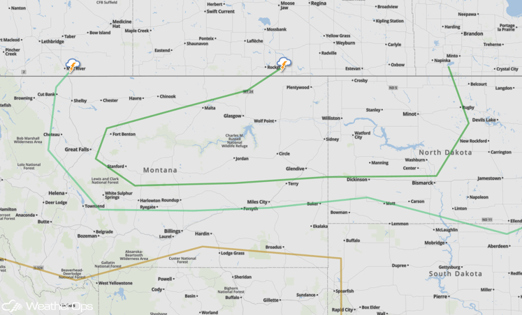
SPC Convective Outlook for Saturday


