National Weather Summary for Thursday July 7, 2016
by David Moran, on Jul 7, 2016 11:31:43 AM
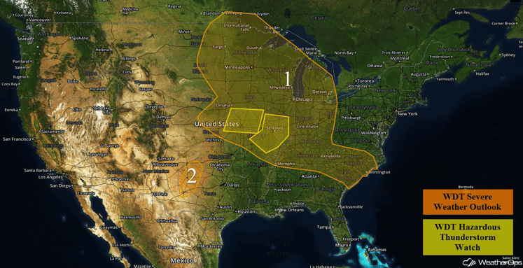
Two areas of low pressure moving across the country will bring a risk for strong to severe thunderstorms to portions of the Northern Plains and Upper Midwest on Thursday, in addition to the threat for excessive rainfall. From the Carolinas into the Mid Mississippi Valley, isolated to scattered thunderstorms will be possible ahead of an area of low pressure. On Friday, thunderstorms will be possible across the High Plains as an upper level trough approaches. A cold front approaching the Mid Atlantic will support thunderstorm development across the Mid Atlantic. Thunderstorms will be possible from the Kansas/Oklahoma border into the Tennessee Valley. As an upper level trough moves across the Rockies on Saturday, strong to severe thunderstorms will be possible for portions of the Northern High Plains and Northern Rockies. Another round of thunderstorms will be possible for portions of the Mid Atlantic.
US Hazards
Region 1
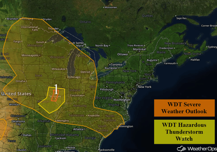
An intense line of thunderstorms is currently stretched roughly along the Mississippi River from Burlington, IA southward to Quincy, IL, then extends southwest into central Missouri. This line of thunderstorms has been producing wind gusts in excess of 60 mph with a few gusts above 70 mph possible. This line will continue to push east into the Lower Midwest this afternoon as well as into western portions of Kentucky and Tennessee. Damaging winds will be likely with this squall line. In addition, there will be a risk for excessive rainfall. Rainfall accumulations of 1-2 inches, with locally higher amounts in excess of 2.5 inches, may lead to localized flooding and runoff.
Over the Northern Plains, scattered thunderstorms are forecast to develop near a cold front. Conditions will be favorable for some of these thunderstorms to become severe. Initially, the primary hazard will be large hail, but this threat will likely shift toward damaging winds later in the evening.
Across the Southeast, thunderstorms will develop during the afternoon hours in response to strong surface heating. Some of these thunderstorms may become severe and produce wind gusts in excess of 50 mph. The severe weather threat will likely diminish during the evening hours.
Region 1
Region 2
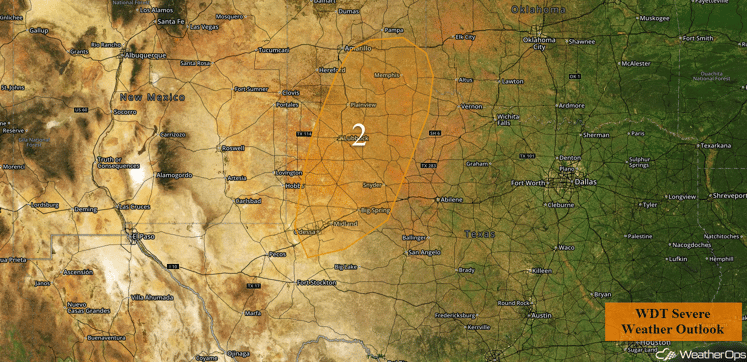
Isolated thunderstorms may develop this afternoon across Region 2. A few of these thunderstorms could become strong and produce wind gusts in excess of 50 mph. The severe weather threat should rapidly diminish after sunset.
Region 2
Strong to Severe Thunderstorms Possible for the High Plains on Friday
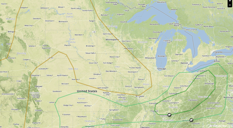
An approaching upper level trough will aid in the development of thunderstorms across the High Plains from Montana southward into Northwest Texas. Storms will pose a risk for large hail and damaging wind gusts, mainly during the afternoon and evening hours.
SPC Convective Outlook for Friday
Strong to Severe Thunderstorms Possible on Friday for the Mid Atlantic
An upper level trough will continue to push through the Great Lakes with a cold front approaching the Tennessee Valley and Delmarva region. Plenty of moisture and adequate instability will support severe thunderstorm development by mid to late afternoon. Storms will likely be most prevalent over Pennsylvania and southward into the D.C. area. Primary impacts with the stronger storms will include hail and damaging wind gusts.
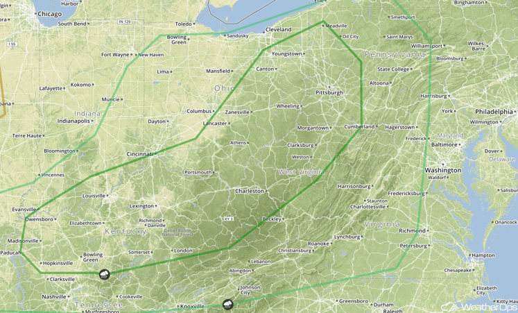
SPC Convective Outlook for Friday
Strong to Severe Thunderstorms Possible Friday from Kansas/Oklahoma border to Tennessee Valley
What remains of a stationary front draped from west to east across the Central United States may be enough for isolated to scattered thunderstorms from along the Kansas/Oklahoma border eastward into the Tennessee Valley. Storms may pose a brief threat for large hail and an isolated damaging wind gust or two before diminishing with the loss of daytime heating.
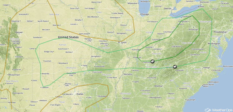
SPC Convective Outlook for Friday
Strong to Severe Thunderstorms Possible for Northern High Plains and Northern Rockies on Saturday
High pressure is forecast to strengthen over the Central US on Saturday while a trough of low pressure deepens over the Great Basin region. Thunderstorm chances will be limited to areas downstream of the upper level trough, namely the Northern Rockies and Northern High Plains, with a risk for small hail and damaging wind gusts.
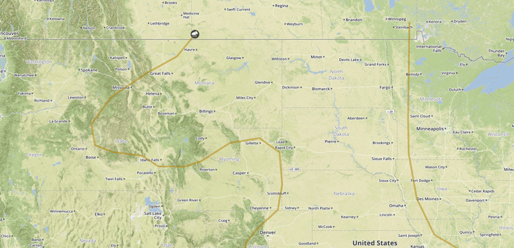
SPC Convective Outlook for Saturday
Strong to Severe Thunderstorms Possible for Mid Atlantic on Saturday
A second area of storms will be possible across the Mid Atlantic, where a weaker trough of low pressure is forecast to be located. Main impacts should be limited to isolated hail and damaging wind gusts, with activity weakening by or just after dark.
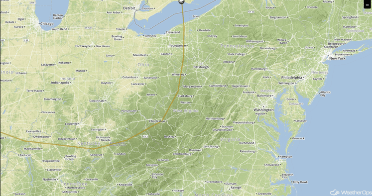
SPC Convective Outlook for Saturday
This is just a brief look at current weather hazards. We can provide you site-specific forecast information. Try a 7-day demo right away.


