


by Chris Kerr, on Mar 13, 2018 10:42:48 AM
A large winter storm located over the Plains will push eastward into the Great Lakes later today causing widespread travel issues. Periods of moderate to heavy snow will occur across the Intermountain West as a low pressure system tracks into the Pacific Northwest. Finally, hazardous conditions are expected across the Gulf of Mexico later today and into Friday morning as a cold front pushes offshore.
- Heavy snowfall and high winds will persist through much of the day across the central and northern Plains.
- Moderate to heavy snow is likely across the Intermountain West.
- A powerful front will push into Gulf of Mexico late this afternoon.
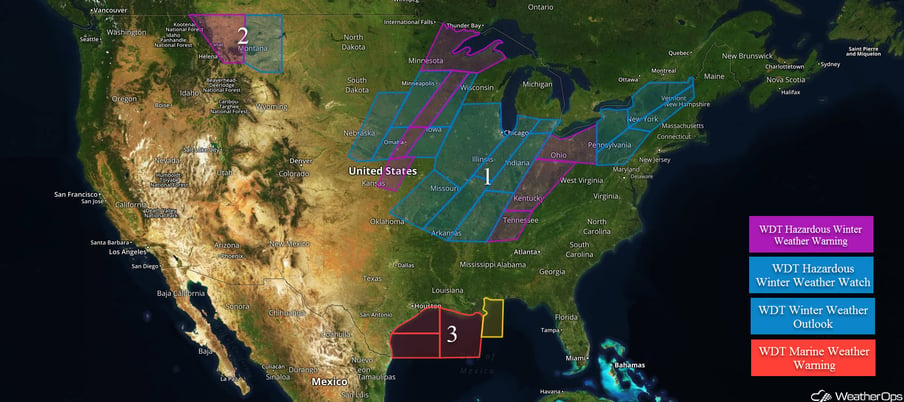 US Hazards
Heavy snowfall and high winds will persist through much of the day across the central and northern Plains.
A broad surface low pressure system will bring a threat of wintry weather to much of the Plains today. A few to several inches a snow will be possible from the eastern Great Plains northeastward through portions of the Upper Midwest. Across the Ohio and Tennessee Valleys, lighter snow accumulations are expected for today, but some icing due to freezing rain and sleet will be possible.
Major Cities in Region: Omaha, NE, Des Moines, IA, Minneapolis, MN, Chicago, IL, St. Louis, MO.
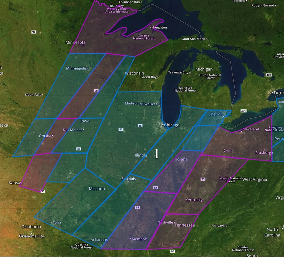 Region 1
Moderate to heavy snow is likely across the Intermountain West.
A storm system moving from the Pacific Ocean into the Pacific Northwest will bring a potential for heavy snowfall to much of the higher elevations of the region, especially by this afternoon and evening into the overnight hours. Snowfall amounts in excess of 12 inches will be possible across the higher peaks.
Major Cities in Region: Billings, MT, Great Falls, MT
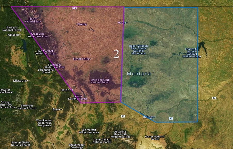 Region 2
A powerful front will push into Gulf of Mexico late this afternoon.
A powerful cold front will surge southeastward off the Texas coast late Thursday afternoon. A narrow, broken line of strong thunderstorms may form along and ahead of the frontal boundary. Isolated severe storm activity along the front may generate damaging wind gusts. By the late afternoon and early evening, all waters off the mid to upper Texas and southwest Louisiana coasts will see post-frontal northwesterly winds quickly rise to near or at Gale force. Wind gusts will range between 45-50 knots for many locations within the warning area. Seas along the immediate shore will range closer to 6-8 feet whereas deepwater seas will peak between 13-15 feet.
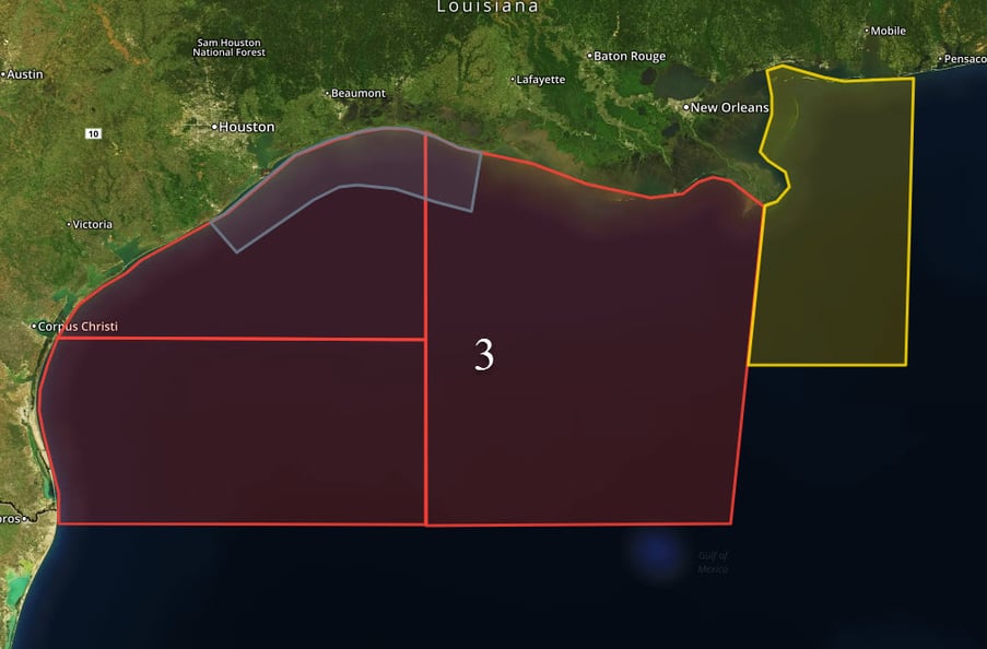
Region 3
A Look Ahead
The winter storm affecting the Plains today will translate eastward into the Midwest/Great Lakes and eventually interior portions of the Northeast tonight and into Friday, allowing for sleet, freezing rain, and snow. As of now, the heaviest snowfall amounts look to occur across the Ohio Valley. Some questions regarding precipitation type and the timing of a transition from liquid to frozen precipitation, and this will determine where the heaviest precipitation occurs. Significant travel issues will be expected from Friday and into the weekend.
This is just a brief look at current weather hazards. We can provide you site-specific weather forecast information for the purpose of protecting your personnel and assets and to assess your weather risk. Try a 7-day demo right away and learn how timely precision weather information can enhance your bottom line.
