National Weather Summary for Thursday, December 7, 2017
by David Moran, on Dec 7, 2017 10:40:49 AM
Snow and freezing rain will continue for portions of Southern New Mexico and West Texas on Thursday. Lake effect snow will continue for portions of western New York through Friday morning as cold air filters into the region. A cold front will bring the potential for a wintry mix across portions of the Lower Mississippi Valley late Thursday into Friday. Elevated winds and seas will continue for portions of the Gulf of Mexico through Saturday morning.
- Snow and Freezing Rain Continuing for Southern New Mexico and West Texas on Thursday
- Lake Effect Snow Continuing Through Friday Morning across Western New York
- Snow for Portions of the Lower Mississippi Valley Late Thursday into Early Friday
- Elevated Winds and Seas Continue through Saturday Morning across the Gulf of Mexico
- Thunderstorms for Central Florida on Friday
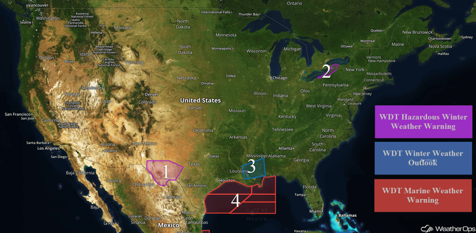 US Hazards
Snow and Freezing Rain Continuing for Southern New Mexico and West Texas on Thursday
Snow and freezing rain will continue through early Thursday afternoon across southern New Mexico and west Texas. Precipitation will decrease from north to south through the day. Snow accumulations of 1-3 inches, as well as ice accumulation up to a tenth of an inch, are expected in the lower elevations. Above 4,000 feet, snow accumulations of 3-5 inches are forecast. Hazardous travel conditions may develop in some areas.
Major Cities in Region: Fort Stockton, TX, Odessa, TX, Midland, TX
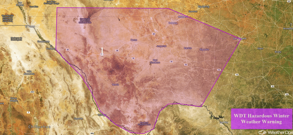 Region 1
Lake Effect Snow Continuing Through Friday Morning across Western New York
Lake effect snow will continue across Western New York through Friday morning. Total snowfall accumulations will range 10-16 inches with locally higher amounts in excess of 18 inches. Winds of 20-25 mph with gusts 30-40 mph and hourly snow rates of several inches per hour may reduce visibilities to less than a quarter of a mile at times.
Major Cities in Region: Buffalo, NY
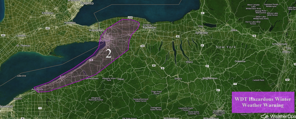 Region 2
Snow for Portions of the Lower Mississippi Valley Late Thursday into Early Friday
Cold air moving in behind a cold front could result in a wintry mix over the area this evening. Snow will likely mix with sleet early on, but will become all snow as temperatures continue to fall. Accumulations will generally range from a trace to a quarter of an inch of snow, as well as trace accumulations of sleet. Caution should be exercised when traveling Friday morning.
Major Cities in Region: Baton Rouge, LA
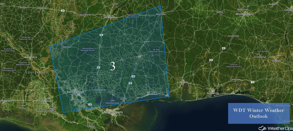 Region 3
Elevated Winds and Seas Continue through Saturday Morning across the Gulf of Mexico
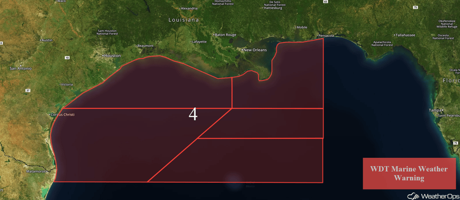
Elevated winds and seas will continue for portions of the Gulf of Mexico through Saturday morning. A second area of low pressure is forecast to move across the region on Friday, allowing for continued elevated winds and seas. Northerly winds of 30-35 knots with gusts in excess of 45 knots are forecast across northwestern portions of the region. In southwestern and eastern areas, winds may gust in excess of 50 knots. Seas of 7-10 feet are expected near the shore and 10-15 feet in deeper waters for most areas. In southern portions of the region, seas of 14-18 feet and locally higher seas in excess of 20 feet are forecast.
 Region 4
Thunderstorms for Central Florida on Friday
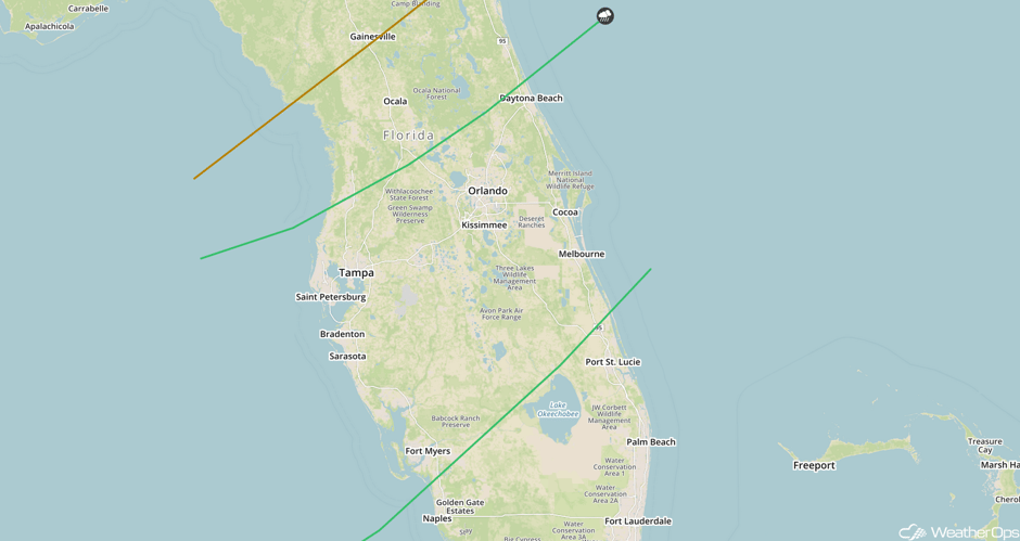
A stalled cold front will finally begin moving across Florida on Friday, allowing for a risk for strong to severe thunderstorms on Friday. Ongoing cloud cover will likely limit the intensity of the storms, but a few stronger storms will have the potential to produce severe winds and hail. The threat will begin during the evening and continue into the nighttime hours as the front progresses southeastward.
Major Cities in Region: Tampa, FL, Fort Myers, FL, Orlando, FL, Daytona Beach, FL
 SPC Convective Outlook for Friday
A Look Ahead
Heading into the weekend, a weak area of low pressure may bring some light snow to portions of the Great Lakes on Saturday. Snowfall amounts of 1-2 inches are expected. As this area of low pressure moves eastward on Sunday, snow may develop across the Northeast; accumulations currently appear to be light. Early next week, another area of low pressure will bring light snow to the Great Lakes and the Northeast. Snowfall amounts of 1-2 inches are currently expected. As an area of low pressure begins to stall out across the Northeast and strengthen Tuesday into Wednesday, some significant snowfall totals will be possible for the Northeastern US. Models are indicating the potential for snowfall amounts in excess of 6 inches of snowfall during the duration of the event. The heaviest totals will be along the US/Canada border, as well as for the areas of New York bordering the Great Lakes where lake effect snow is forecast.
This is just a brief look at current weather hazards. We can provide you site-specific weather forecast information for the purpose of protecting your personnel and assets and to assess your weather risk. Try a 7-day demo right away and learn how timely precision weather information can enhance your bottom line.


