National Weather Summary for Thursday, April 6, 2017
by David Moran, on Apr 6, 2017 10:55:08 AM
Thunderstorms will continue for portions of the Mid Atlantic through early afternoon as a cold front pushes offshore. Across Central Florida, thunderstorms will continue through the morning. Snow is expected to continue for portions of Michigan as an area of low pressure moves to the south of the area,
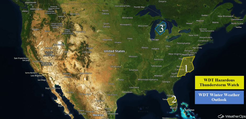 US Hazards
Region 1
Thunderstorms will continue across the region through early afternoon as a cold front pushes offshore. Within these thunderstorms, hail, damaging winds, frequent lightning, and heavy rainfall will all be possible with these storms. An isolated tornado can't be ruled out.
Update 12:28pm EDT: Severe Thunderstorm Warnings across the Mid Atlantic. Hail and damaging winds will be the primary hazards.
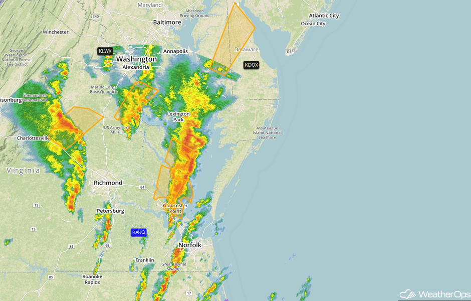 Radar 12:28pm EDT
Update 12:44pm EDT: Tornado Warning including the city of Norfolk, VA
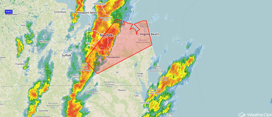 Radar 12:44pm EDT
Update 12:53pm EDT: Severe Thunderstorm Watch in effect for portions of Delaware, Maryland, New Jersey, Pennsylvania, and Virginia until 5pm EDT. Hail to 1.5", damaging winds to 70 mph, and isolated tornadoes will be the primary hazards.
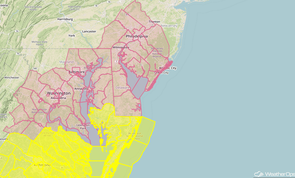 Severe Thunderstorm Watch
Update 1:46pm EDT: Tornado Warning northwest of Washington, DC.
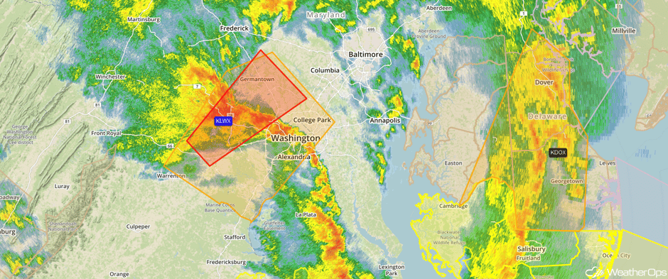 Tornado Warning
Update 2:55pm EDT: Severe thunderstorm capable of damaging winds northeast of Baltimore, MD.
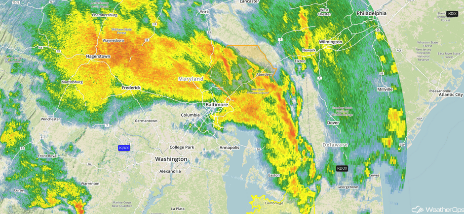 Radar 2:55pm EDT
Major Cities in Region: Myrtle Beach, SC, Wilmington, NC, Raleigh, NC, Norfolk, VA, Richmond, VA
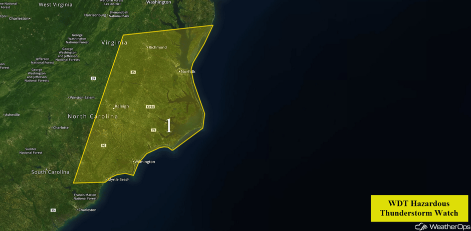 Region 1
Region 2
A line of thunderstorms across the eastern Gulf of Mexico is forecast to continue to progress to the east throughout the morning on Thursday. As storms move ashore across the Gulf coast of Florida, the thunderstorms are forecast to maintain intensity with strong winds and hail possible. Frequent lightning and heavy rain are also possible, in addition to an isolated tornado.
Major Cities in Region: Tampa, FL, Fort Myers, FL
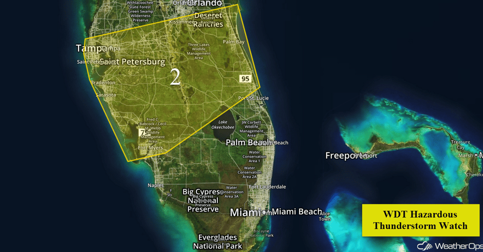 Region 2
Region 3
Snow will continue across Region 3 through this morning as an area of low pressure moves to the south of the region. Snowfall amounts of 3-6 inches are expected with isolated higher amounts in excess of 8 inches. In addition to the snow, winds of 15-25 mph with gusts in excess of 35 mph are expected and could produce areas of blowing snow and reduced visibilities.
Major Cities in Region: Cadillac, MI, Alpena, MI, Bay City, MI
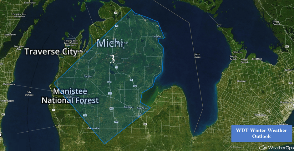 Region 3
Excessive Rainfall Possible for Portions of the Northeast on Thursday
Scattered to numerous showers, along with a threat of thunderstorms, are forecast to spread across the Northeast as an area of low pressure moves through the region. Rainfall amounts of 1-2 inches with locally higher amounts in excess of 3 inches, for many locations from northern New Jersey through Rhode Island. Due to recent heavy rains, this may allow for an increased risk of flooding across the region.
Major Cities in Region: New York, NY, Bridgeport, CT, New Haven, CT
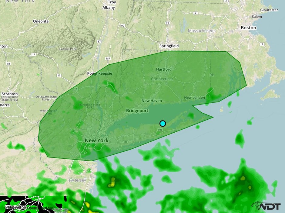 Excessive Rainfall Risk Outline for Thursday
Strong to Severe Thunderstorms Possible Friday Across the Intermountain West
Scattered thunderstorms are expected to develop across northern portions of the Intermountain West Friday afternoon into early evening as a cold front moves eastward into the region. A strong upper level trough moving across the northwestern US will allow for the potential for strong to severe thunderstorms. Gusty winds and hail will be the primary hazards with the stronger storms.
Major Cities in Region: Spokane, WA
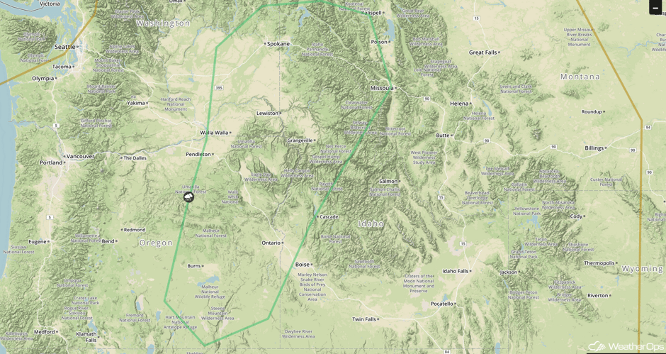 SPC Convective Outlook for Friday
A Look Ahead
A strong upper level disturbance is forecast to track into the Plains on Sunday. As an area of low pressure intensifies and moves into the Plains, thunderstorm development is expected across the Plains and Mid Mississippi Valley, especially over Nebraska and Iowa. Large hail and damaging winds will be the primary hazards, but a few isolated tornadoes cannot be ruled out.
This is just a brief look at current weather hazards. We can provide you site-specific weather forecast information for the purpose of protecting your personnel and assets and to assess your weather risk. Try a 7-day demo right away and learn how timely precision weather information can enhance your bottom line.


