National Weather Summary for Thursday, April 13, 2017
by David Moran, on Apr 13, 2017 11:07:20 AM
Isolated strong to severe thunderstorms may develop across portions of New Mexico and West Texas Thursday afternoon as instability builds. Plentiful moisture and strong lift will allow for heavy to excessive rainfall across portions of the Southern Plains on Thursday.
- Strong to Severe Thunderstorms Possible Across New Mexico and West Texas on Thursday
- Thunderstorm Potential for Portions of Northwest Texas and Southwest Oklahoma
- Risk for Excessive to Heavy Rainfall Across the Southern Plains on Thursday
- Strong to Severe Thunderstorms Friday from Central Plains into West Texas
- Excessive Rainfall Possible for Upper Mississippi Valley on Friday
- Potential for Strong to Severe Thunderstorms Across Central and Southern Plains on Saturday
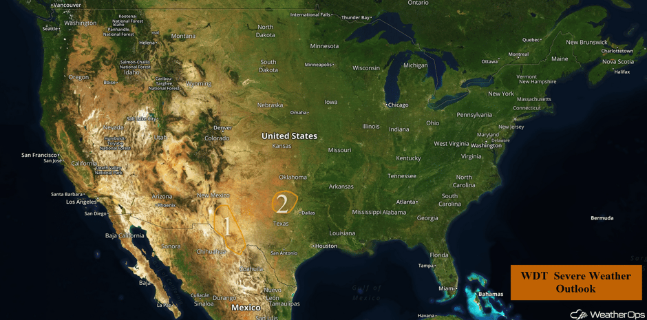 US Hazards
Strong to Severe Thunderstorms Possible Across New Mexico and West Texas on Thursday
Another day of thunderstorms will be possible for far West Texas this afternoon with the approach and passage of a weak upper level disturbance. While instability and wind shear are not expected to be overly impressive, daytime heating may allow for the development of a few strong to severe thunderstorms this afternoon and evening. Any storms that develop should weaken with the loss of daytime heating.
Major Cities in Region: Roswell, NM, Carlsbad, NM
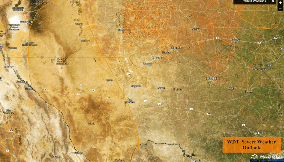 Region 1
Thunderstorm Potential for Portions of Northwest Texas and Southwest Oklahoma
An ongoing area of showers and thunderstorms associated with an area of low pressure over southwestern Oklahoma and northwestern Texas will likely see periodic redevelopment during the day. Daytime heating and plentiful moisture may allow for strong to severe thunderstorms throughout the day. Hail and damaging winds will be the primary hazards, but an isolated tornado or two cannot be ruled out. Activity should weaken with the loss of daytime heating.
Major Cities in Region: Seymour, TX, Wichita Falls, TX, Lawton, OK
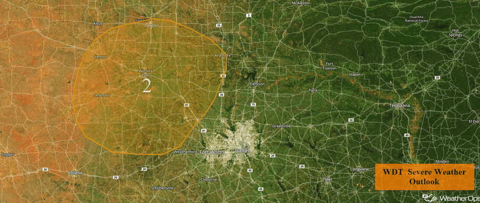 Region 2
Risk for Excessive to Heavy Rainfall Across the Southern Plains on Thursday
Early morning showers and thunderstorms are currently weakening as they slowly move eastward. However, as an upper level disturbance moves eastward more showers and thunderstorms are forecast to develop during the afternoon and evening hours. With the upper level low providing ample lift and ample moisture in place for these showers and thunderstorms, heavy to excessive rainfall will be likely this evening. Total rainfall amounts of 1-2 inches with locally heavier amounts in excess of 3 inches possible where thunderstorms train over the same region.
Major Cities in Region: Altus, OK, Enid, OK, Wichita, KS, Salina, KS
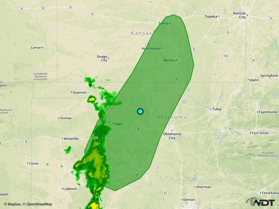 Excessive Rainfall Possible for Thursday
Strong to Severe Thunderstorms Friday from Central Plains into West Texas
Moisture return is expected to occur on Friday across the Central Plains and West Texas to the east of a cold front and dryline. Instability will increase with daytime heating ahead of the cold front and dryline. With the advancement of the cold front as well as upslope flow over the higher terrain, strong to severe thunderstorm development will be possible starting in the afternoon. Should thunderstorms develop, large hail and damaging winds will be the primary impacts.
Major Cities in Region: Amarillo, TX, Dodge City, KS, Goodland, KS, North Platte, NE, Omaha, NE
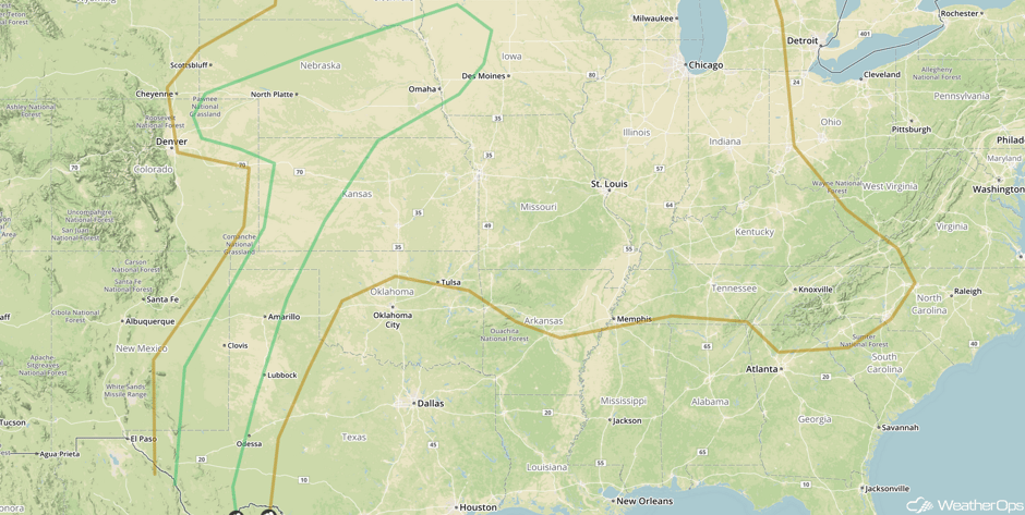 SPC Convective Outlook for Friday
Excessive Rainfall Possible for Upper Mississippi Valley on Friday
The dryline and cold front complex that developed in the lee of the Rockies will develop further on Thursday, and an area of low pressure should develop in eastern Colorado. A warm front should develop with this low, and as it moves northeastward, widespread rain should develop along the front. Locations from central Iowa into western Wisconsin are currently forecast to receive the most rainfall. Rainfall amounts of 1-2 inches with locally higher amounts of 3 inches are expected. The rain will mainly fall during the overnight hours and should continue into Saturday as the low moves through the region.
Major Cities in Region: Wichita, KS, Topeka, KS, Kansas City, MO
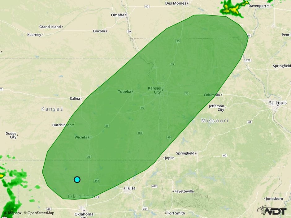 Excessive Rainfall Risk Outline for Friday
Potential for Strong to Severe Thunderstorms Across Central and Southern Plains on Saturday
The low that is responsible for the severe weather potential in the Plains on Friday will be moving northeastward into the Upper Mississippi Valley, with the cold front moving through the Plains. Daytime heating ahead of the front should result in destabilization and the cold front should provide the lift for the development of thunderstorms. At this time, at least isolated to strong severe thunderstorms are expected from the eastern Texas Panhandle northeastward into northwestern Missouri. Storms should develop in the afternoon, and will likely continue through the night as the front moves slowly to the south. The primary threat with these storms will be gusty winds. In addition to these thunderstorms, heavy to excessive rainfall will be possible as well. Rainfall amounts of 1-2 inches with locally higher amounts in excess of 3 inches possible with any training thunderstorms.
Major Cities in Region: Woodward, OK, Wichita, KS, Kansas City, MO
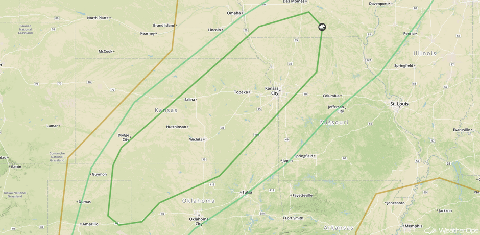
A Look Ahead
An area of low pressure will develop east of the Rockies on Tuesday. The associated front will move across the Plains, allowing for the potential for thunderstorms across portions of the Northern Plains. North of the low, snow may develop Tuesday across portions of North Dakota and Minnesota.
This is just a brief look at current weather hazards. We can provide you site-specific weather forecast information for the purpose of protecting your personnel and assets and to assess your weather risk. Try a 7-day demo right away and learn how timely precision weather information can enhance your bottom line.


