National Weather Summary for Monday, October 16, 2017
by David Moran, on Oct 16, 2017 10:02:21 AM
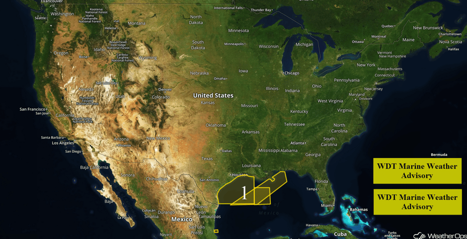
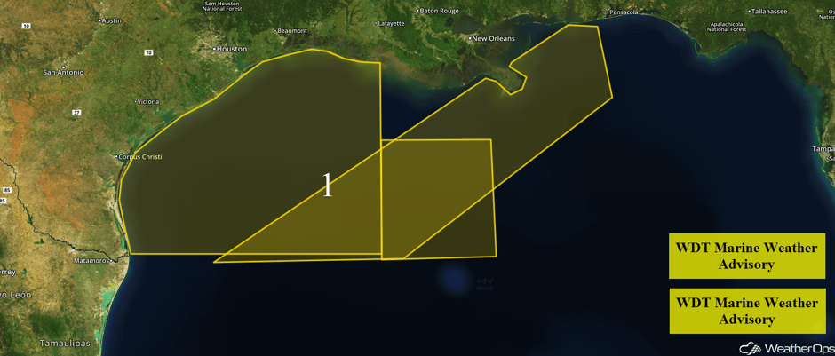
Elevated winds and seas are forecast across portions of the Gulf of Mexico through early Tuesday morning.
- Elevated Winds and Seas for Portions of the Gulf of Mexico through early Tuesday morning
- Tropical Update
 US Hazards
Elevated Winds and Seas for Portions of the Gulf of Mexico through early Tuesday morning
A cold front will continue to move eastward across the Gulf of Mexico, allowing for elevated winds and seas through early Tuesday. Across the western portions of the region, northerly to north-northeasterly winds of 23-28 knots with gusts in excess of 35 knots are expected. For eastern portions of the region, winds will be northeasterly at 20-25 knots with gusts in excess of 30 knots. Seas will be 4-6 feet near the shore and 7-9 feet in the deeper waters. In addition, thunderstorms will continue through early evening. Winds in excess of 40 knots, waterspouts, heavy rain, and frequent lightning will all be potential hazards with these storms.
 Region 1
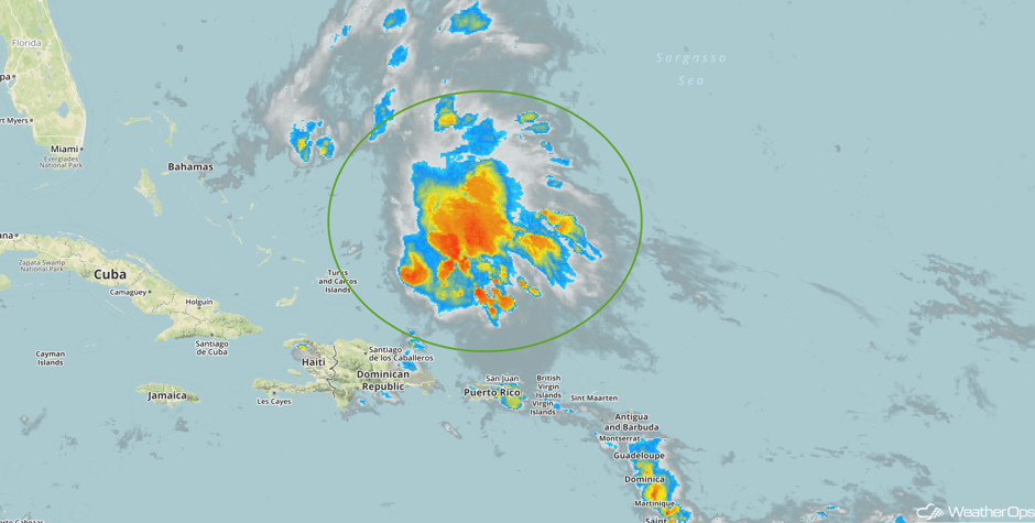
Tropical Update
Showers and thunderstorms associated with a broad area of low pressure located about 175 miles north-northeast of the Turks and Caicos Islands have increased overnight. Although the system is producing wind gusts to near tropical storm force, the system lacks a well defined center. Upper level winds are forecast to remain conducive for some additional development while the system moves northward. Conditions are expected to become unfavorable for further development by Wednesday as the system merges with a frontal system over the western Atlantic.
 Enhanced Infrared Tropical Satellite
A Look Ahead
High pressure will dominate much of the country for the next several days, leading to mostly calm conditions. A few thunderstorms may develop across portions of the Central and Southern Plains on Saturday ahead of a cold front.
This is just a brief look at current weather hazards. We can provide you site-specific weather forecast information for the purpose of protecting your personnel and assets and to assess your weather risk. Try a 7-day demo right away and learn how timely precision weather information can enhance your bottom line.


