National Weather Summary for Monday, May 15, 2017
by David Moran, on May 15, 2017 11:15:06 AM
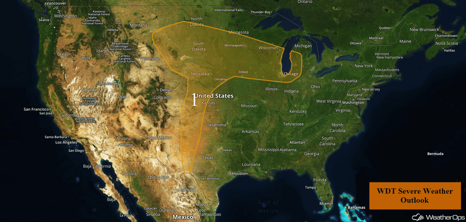
Strong daytime heating and increasing moisture will allow for the development of thunderstorms across much of the Plains and Upper Midwest on Monday.
- Thunderstorms Developing Monday for the Plains and Upper Midwest
- Thunderstorms Continue for the Plains and Upper Midwest on Tuesday
- Risk for Thunderstorms from the Ozarks into the Midwest on Wednesday
 US Hazards
Thunderstorms Developing Monday for the Plains and Upper Midwest
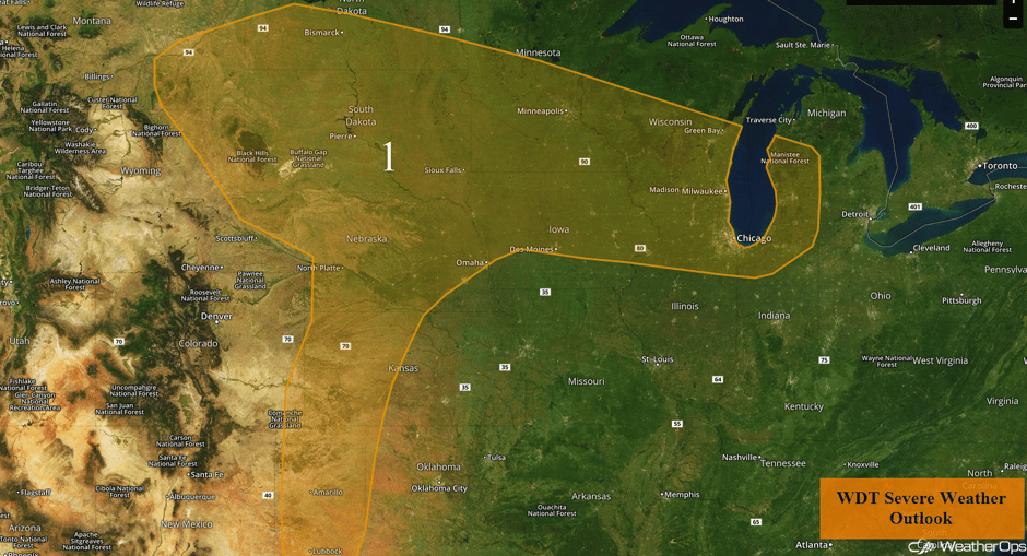
Ongoing thunderstorm activity across the High Plains and the Midwest will continue to track eastward throughout much of the day on Monday. An area of low pressure in Wyoming will track eastward into South Dakota, with the associated warm front lifting northward into Minnesota. With the warm front lifting northward, southerly flow will bring deep low level moisture northward. In addition to this moisture, instability is forecast to increase into the afternoon as daytime heating increases. With this ample low level moisture, instability, and increasing wind shear across the area, further strengthening of these early morning thunderstorms into a complex is expected. Large hail and damaging winds will be the primary hazard with any of the stronger storms, however, an isolated tornado or two cannot be ruled out.
Further south in the Central and Southern Plains, thunderstorms may develop along a dry line. Some of these storms may be strong to severe with large hail and damaging winds the primary hazards.
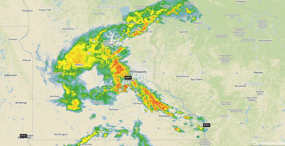
Update 12:55pm CDT: Storms approaching the Minneapolis area. Activity is not severe, but may contain some small hail.
 Radar 12:55pm CDT
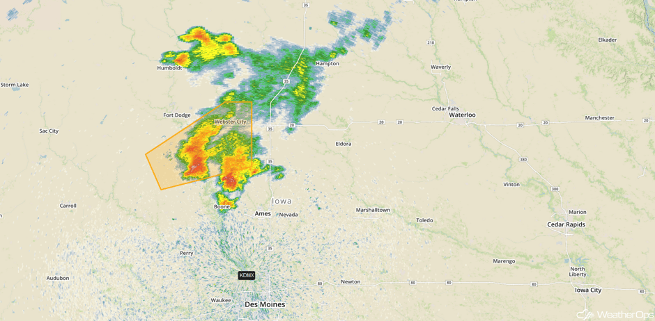
Update 1:13pm CDT: Severe thunderstorms capable of hail and damaging winds northwest of Des Moines, IA.
 Radar 1:13pm CDT
Major Cities in Region: Lubbock, TX, Amarillo, TX, Dodge City, KS, North Platte, NE, Bismarck, ND, Sioux Falls, SD, Omaha, NE, Des Moines, IA, Minneapolis, MN, Green Bay, WI, Milwaukee, WI, Chicago, IL
 Region 1
Thunderstorms Continue for the Plains and Upper Midwest on Tuesday
Strong to severe thunderstorms will continue across the Plains and Upper Midwest on Tuesday as an upper level trough moves eastward. At the surface, an area of low pressure will develop over South Dakota. Thunderstorms will likely develop during the late afternoon into the evening. Large hail and damaging winds will be the primary hazards, but an isolated tornado cannot be ruled out. Storms will likely evolve into a linear structure after dark, with damaging winds becoming the primary hazard.
Across the Northern Plains and Upper Midwest, storms may develop along the warm front associated with the aforementioned area of low pressure. The primary hazards with any storms that develop will be large hail and damaging winds. These storms will continue into the overnight hours.
Major Cities in Region: Lubbock, TX, Oklahoma City, OK, Tulsa, OK, Topeka, KS, Omaha, NE, Des Moines, IA, Sioux Falls, SD, Minneapolis, MN
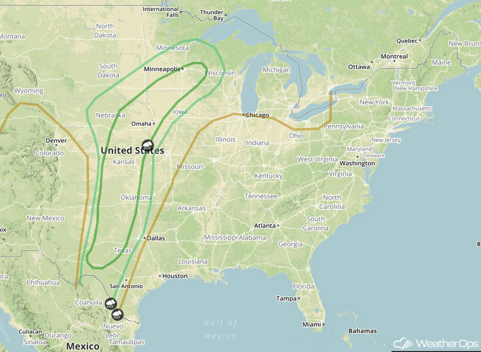 SPC Convective Outlook for Tuesday
Risk for Thunderstorms from the Ozarks into the Midwest on Wednesday
While the overall threat for thunderstorms is limited on Wednesday, strong to severe thunderstorms may develop over the Ozarks and into the Midwest. Instability will build through the day, allowing for the development of thunderstorms from the late afternoon into the evening and overnight hours. Hail and damaging winds will be the primary hazards with these storms.
Major Cities in Region: Fort Smith, AR, Little Rock, AR, St. Louis, MO, Memphis, TN
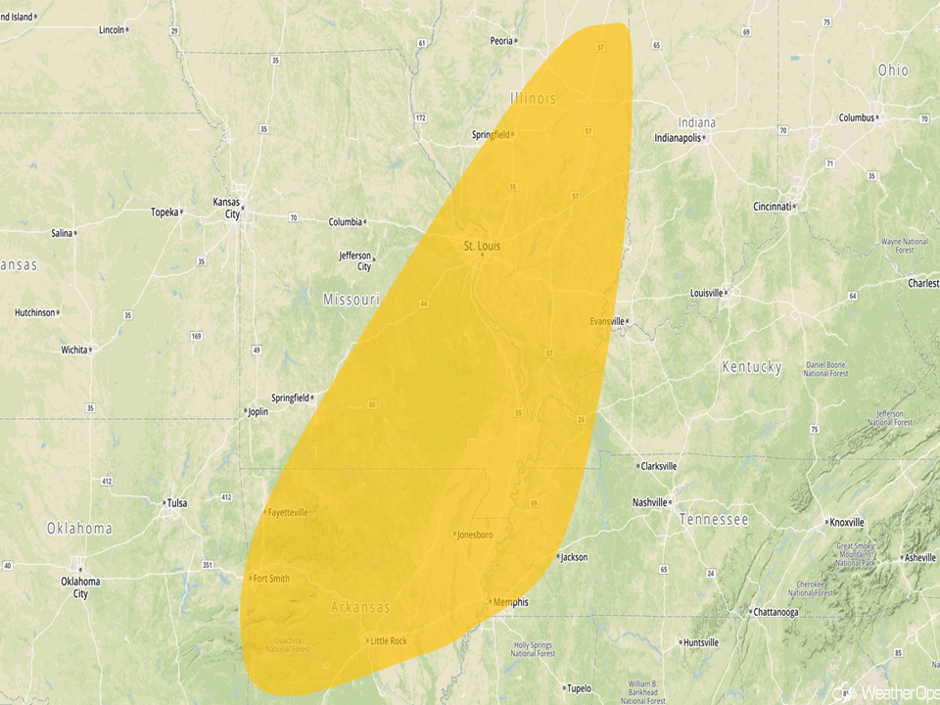 Thunderstorm Risk Outline for Wednesday
A Look Ahead
Thunderstorm chances return to the Southern Plains on Thursday, as an upper level trough moves over the Rockies. Large hail, damaging winds, and tornadoes will all be potential hazards with these storms. This risk will continue into Friday as the upper level trough continues eastward. A few thunderstorms may develop Friday across portions of the Ohio Valley along a stalled front. Into the weekend, thunderstorms will continue for portions of the Southern Plains on Saturday. Thunderstorms will be possible for portions of the Ohio and Mississippi Valleys Saturday into Sunday.
This is just a brief look at current weather hazards. We can provide you site-specific weather forecast information for the purpose of protecting your personnel and assets and to assess your weather risk. Try a 7-day demo right away and learn how timely precision weather information can enhance your bottom line.


