


by David Moran, on Mar 5, 2018 11:21:39 AM
Wintry precipitation will continue from the Northern Rockies into the Great Lakes through Tuesday as an area of low pressure moves through the region. Thunderstorms may develop Monday from east Texas into Mississippi ahead of a cold front. Dense fog is expected along the Texas coast through Tuesday evening.
- Wintry Precipitation from the Northern Rockies into the Great Lakes through Tuesday
- Thunderstorms Monday from East Texas into Mississippi
- Dense Fog along the Texas Coast through Tuesday Evening
- Winter Storm Potential for the Northeast Wednesday into Thursday Morning
 US Hazards

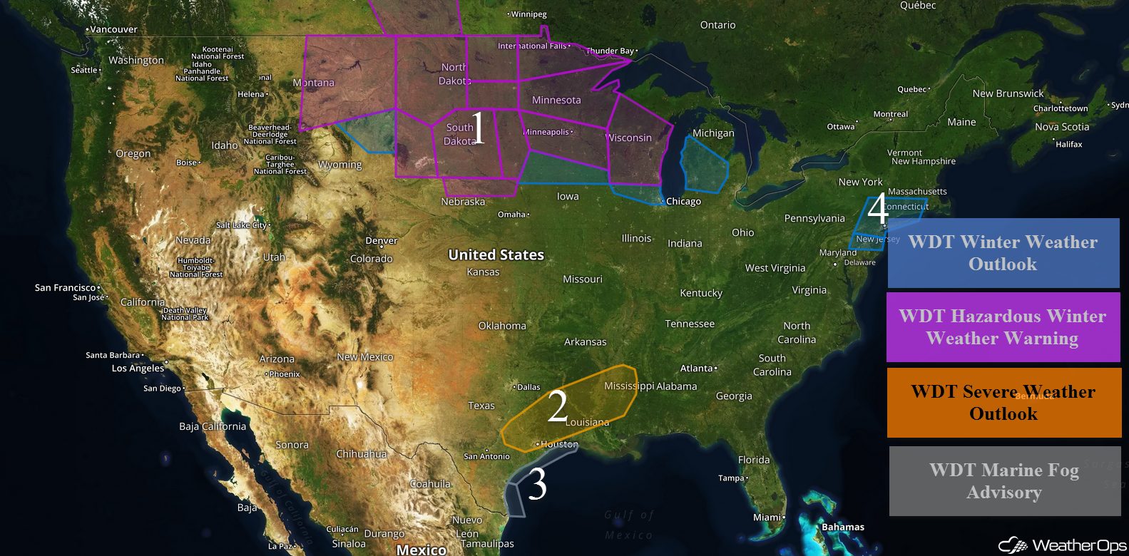
Wintry Precipitation from the Northern Rockies into the Great Lakes through Tuesday
Snow will continue from the Northern Rockies into the Northern Plains on Monday as an area of low pressure continues to move eastward. Across portions of Montana, snow accumulations will range 5-8 inches with locally heavier amounts in excess of 10 inches are expected. For extreme southeastern Montana and northeastern Wyoming, 2-4 inches with locally higher amounts are forecast.
Further east across western North Dakota, snow accumulations will range 10-16 inches with locally higher amounts in excess of 20 inches. Ice accumulations up to 0.10 inch are expected. In addition, winds in excess of 35 mph will allow for blowing snow and reduced visibilities. For central and eastern North Dakota, 5-7 inches of snow with locally higher accumulations in excess of a foot are forecast, in addition to ice accumulations up to 0.10 inch. Across western portions of South Dakota, snow accumulations of 2-5 inches with locally higher amounts in excess of 6 inches and wind gusts 50-65 mph will lead to blizzard conditions. Across central South Dakota, snow accumulations of 5-10 inches with locally higher amounts in excess of a foot are expected, in addition to ice accumulations less than 0.15 inch. Across eastern South Dakota, 3-7 inches of snow and ice accumulations up to 0.05 inch are forecast.
In northern Nebraska, snowfall accumulations of 2-4 inches with locally higher amounts in excess of 6 inches are forecast, in addition to ice accumulations up to 0.10 inch. Winds 40-50 mph will allow for blowing snow and reduced visibilities.
For portions of northern Minnesota, snowfall accumulations of 5-7 inches with locally higher amounts in excess of 9 inches are expected in addition to ice accumulations up to 0.15 inch through Tuesday morning. Central and eastern Minnesota will get 6-10 inches of snow with locally higher amounts in excess of a foot are expected. Ice accumulations will be less than 0.15 inch. Across southern Minnesota, 4-8 inches with locally higher amounts in excess of 10 inches are expected in addition to ice accumulations up to a tenth of an inch. Winds gusting 30-40 mph will allow for blowing snow and reduced visibilities. In southern Minnesota and northern Iowa, snow accumulations will range 3-5 inches. Ice accumulations up to 0.10 inch are forecast.
For western Wisconsin, 6-10 inches with locally higher amounts in excess of a foot are expected through Tuesday evening. Across Central and eastern Wisconsin, snowfall totals will range 4-8 inches. Ice accumulations up to 0.10 inch are expected through Tuesday afternoon. Winds will gust to 25-35 mph.
Snow accumulations will range 2-4 inches with locally higher amounts in excess of 5 inches across northern Illinois, in addition to ice accumulations up to a tenth of an inch through early Wednesday morning.
In western and central Michigan, 1-3 inches of snow with locally higher amounts in excess of 4 inches are expected late Monday through Tuesday evening.
Major Cities in Region: Billings, MT, Rapid City, SD, Minot, ND, Bismarck, ND, Pierre, SD, Sioux Falls, SD, Minneapolis, MN, Green Bay, WI, Milwaukee, WI, Chicago, IL, Lansing, MI
 Region 1
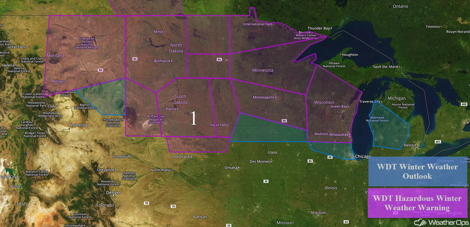
Thunderstorms Monday from East Texas into Mississippi
The cold front associated with an area of low pressure in the Upper Midwest will stretch to the south over southeast Texas, Louisiana, and Mississippi. Clouds may limit instability, but with moisture in place and the upper level environment, thunderstorms may develop during the afternoon. Gusty winds and large hail will be the primary hazards. Activity will diminish after sunset.
Major Cities in Region: Houston, TX, Shreveport, LA, Jackson, MS
 Region 2
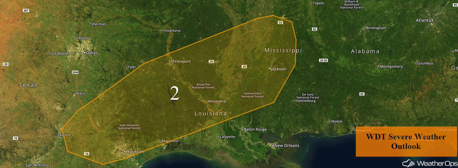
Dense Fog along the Texas Coast through Tuesday Evening
Fog will continue along the Texas and Louisiana coasts through Tuesday evening. Visibilities will be less than a mile at times before a cold front moves through the region.
Winter Storm Potential for the Northeast Wednesday into Thursday Morning
Rain will begin to transition to snow across portions of the Northeast Wednesday morning as a strong area of low pressure develops off the coast. This area of low pressure is forecast to rapidly develop while moving northeastward, with the potential for moderate to heavy snow north and northwest of the center of the low. Snow accumulations will range 6-10 inches with locally higher amounts in excess of a foot from eastern New York eastward to Connecticut. Across southeastern Pennsylvania into northern New Jersey, snow accumulations of 3-5 inches with locally higher amounts in excess of 7 inches are expected. Winds 20-25 mph with gusts in excess of 35 mph will allow for blowing snow and low visibilities.
Major Cities in Region: Philadelphia, PA, New York, NY, Hartford, CT, Providence, RI
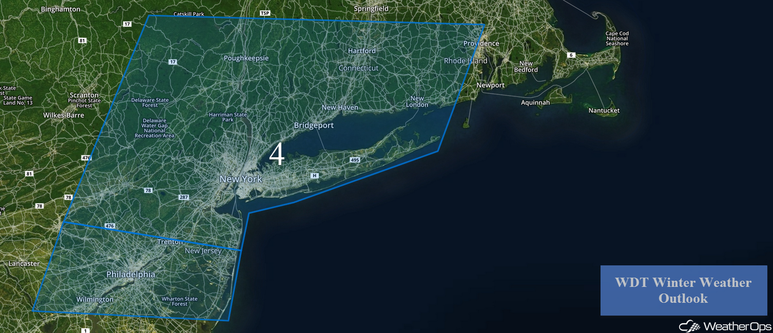 Region 4
A Look Ahead
After Thursday, high pressure will dominate much of the country. An area of low pressure will move into the Pacific Northwest on Thursday, bringing rain and high elevation snow to the region. By the weekend, an area of low pressure may develop and bring showers and thunderstorms to the Ohio and Tennessee Valleys.
That is a brief look at current weather hazards. We can provide you site-specific weather forecast information to protect your staff and assets and to assess your weather risk. Try a 7-day demo right away and learn how timely precision weather information can enhance your bottom line.
