


by Daphne Thompson, on Mar 19, 2018 1:15:36 PM
A potent low-pressure center will bring severe thunderstorms with a significant threat for tornadoes to portions of Alabama, Georgia, and Tennessee today. This system will then continue eastward and develop into a nor'easter Tuesday night into Wednesday.
- Severe Thunderstorms with a Significant Risk for Tornadoes for Portions of AL, GA, and TN
- Increasing Nor'easter Threat from the Mid-Atlantic into New England for Mid-week
- Severe Thunderstorm Threat for Northern FL, and Coastal GA, SC, and NC Tuesday
US Hazards

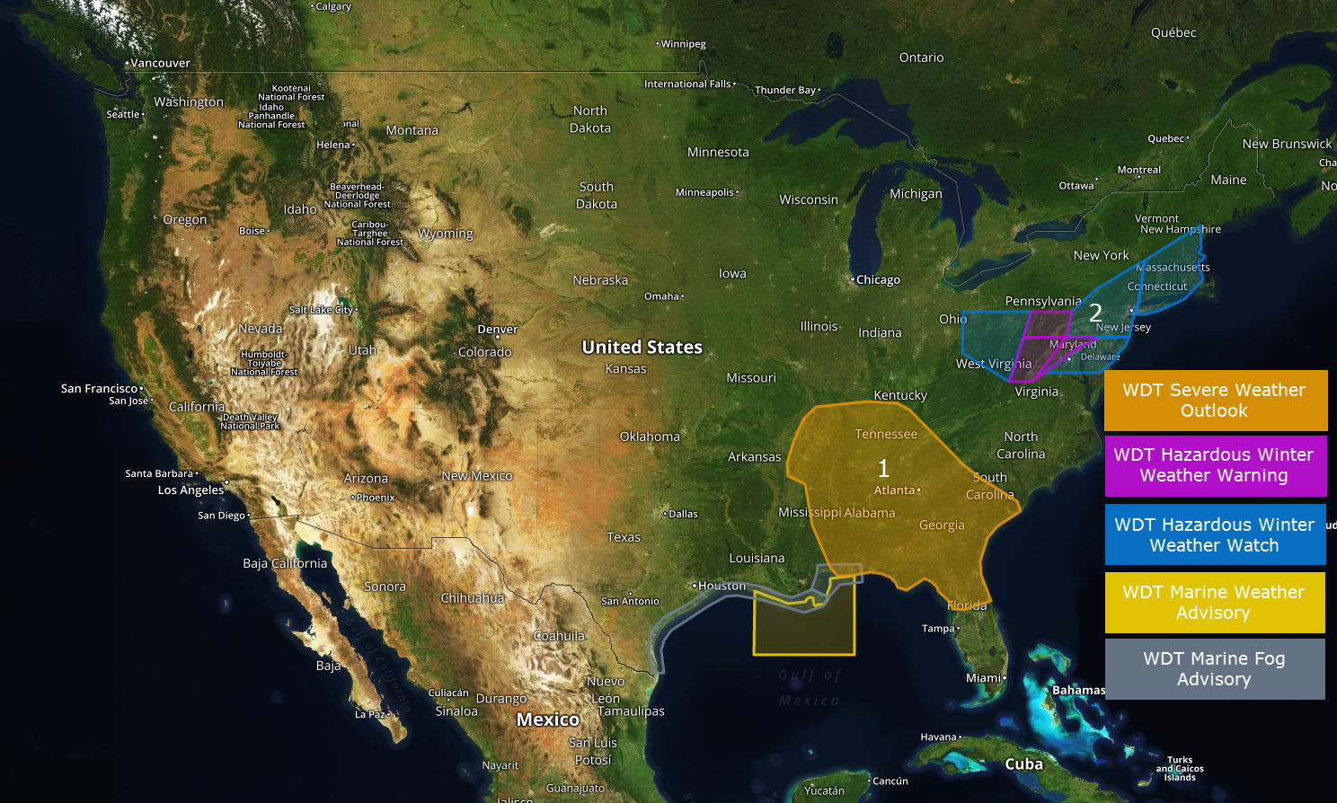
Severe Thunderstorms with a Significant Risk for Tornadoes for Portions of AL, GA, and TN
A potent spring-time low-pressure center will interact with a favorable environment to produce a significant round of severe thunderstorm activity from central Tennessee southeastward across much of Alabama and Georgia today. The peak of the severe weather threat is likely to occur from 3 PM to 9 PM eastern time. The highest threat for tornadoes and large hail is focused across south-central Tennessee and the northern half of Alabama. Environmental conditions do appear to support the possibility for at least one or two intense/long-track tornadoes in this area.
Major Cities in Region: Atlanta, GA, Birmingham, AL, Nashville, TN
Region 1
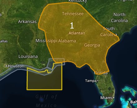
Increasing Nor'easter Threat from the Mid-Atlantic into New England for Mid-week
The low pressure center bringing severe weather to the Tennessee Valley and Deep South today will continue it's eastward journey through midweek, likely developing into a nor'easter by Wednesday. This will result in a variety of winter weather threats from the Mid-Atlantic northeastward into southern New England. There remains uncertainty regarding just how widespread the heavy snowfall will be but interests from the upper Ohio Valley and Mid-Atlantic states northeastward to coastal Maine should continue to closely monitor weather forecasts this week.
Major Cities in Region: Pittsburgh, PA, Washington, DC, Philadelphia, PA, New York, NY, Boston, MA
Region 2
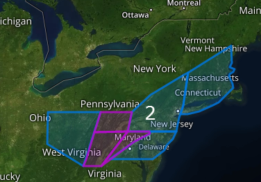
Severe Thunderstorm Threat for Northern FL, and Coastal GA, SC, and NC Tuesday
The cold front expected to produce severe thunderstorms from central TN southward across AL and GA today will continue toward the coast on Tuesday. Severe thunderstorms with primarily a wind and hail threat will be possible through the afternoon and evening hours, along and ahead of the front.
Major Cities in Region: Jacksonville, FL, Savannah, GA, Charleston, SC, Orlando, FL, Tampa, FL
 SPC Convective Outlook for Tuesday
That is a brief look at current weather hazards. We can provide you site-specific weather forecast information to protect your staff and assets and to assess your weather risk. Try a 7-day demo right away and learn how timely precision weather information can enhance your bottom line.
