


by David Moran, on Mar 12, 2018 10:58:05 AM
Heavy snow and strong winds are expected across portions of the Northeast through Wednesday as an area of low pressure intensifies off the East Coast. Snow will continue for portions of the Ohio Valley and Appalachians through the day on Monday in association with a weak area of low pressure. Thunderstorms may develop across Southern Florida ahead of a cold front on Monday. Elevated winds and seas will continue for portions of the Gulf of Mexico through Monday evening in the wake of a cold front.
- Heavy Snow and Strong Winds for the Northeast through Wednesday
- Snow Monday for the Ohio Valley and Appalachians
- Thunderstorms for Southern Florida on Monday
- Elevated Winds and Seas Monday for Portions of the Gulf of Mexico
 US Hazards

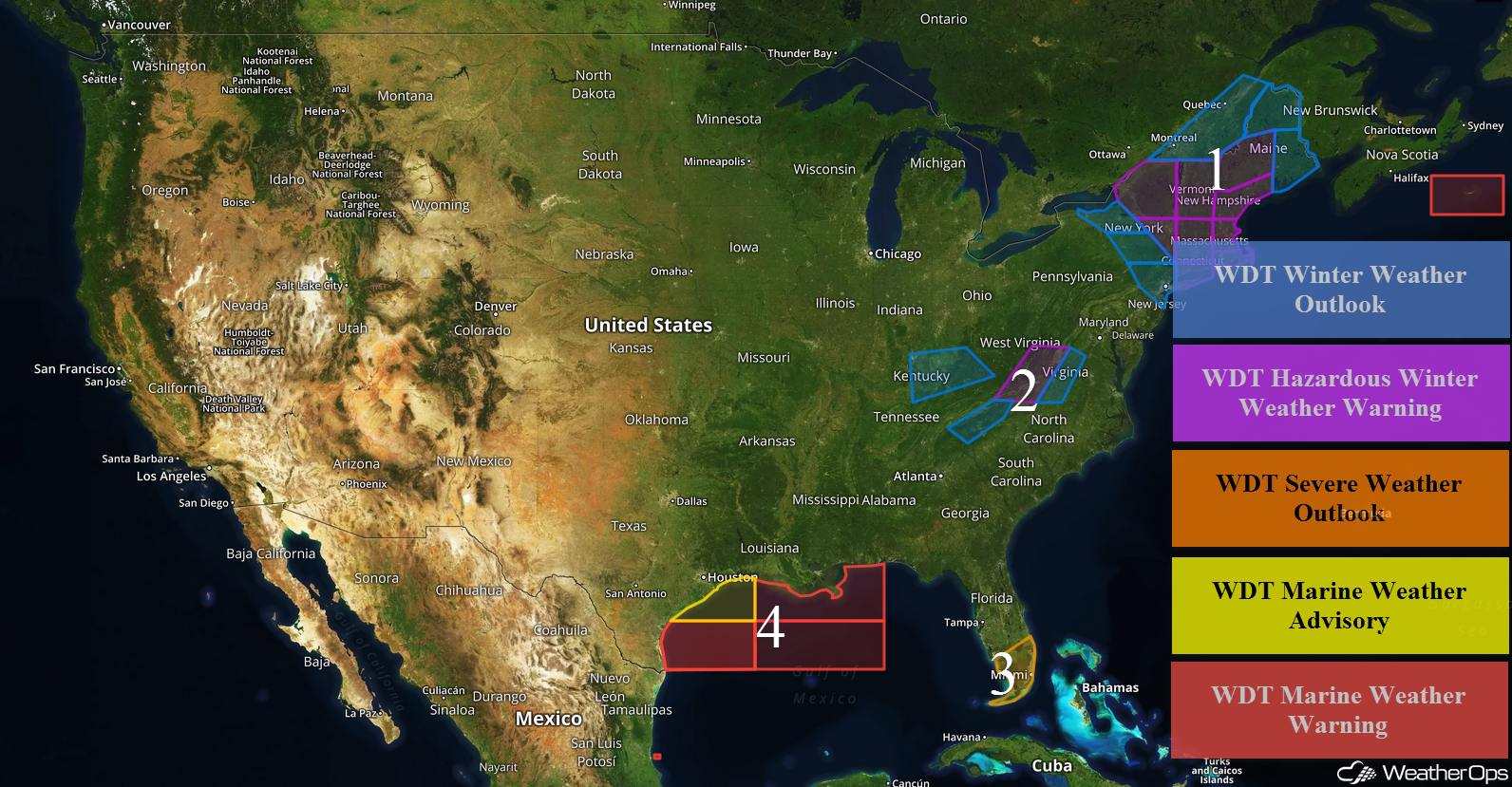
Heavy Snow and Strong Winds for the Northeast through Wednesday
An area of low pressure will develop off the East Coast on Monday, bringing heavy snow and strong winds to portions of the Northeast through Wednesday. While snowfall amounts will be dependent upon how far offshore the area of low pressure develops, 3-6 inches are currently forecast across portions of New York and Pennsylvania. From Connecticut and Rhode Island northward into Vermont, New Hampshire, and southern Maine, 6-12 inches of snow are expected with locally higher amounts in excess of 16 inches. Across northern Maine, snow accumulations of 12-16 inches with locally higher amounts in excess of 20 inches are forecast.
In addition to the snow, winds will range 55-65 mph along the coast. Further inland, winds will range 25-35 mph, allowing for blowing snow and reduced visibilities. Snow will taper off across the region on Wednesday.
Major Cities in Region: Syracuse, NY, New York City, NY, Albany, NY, Burlington, VT, Providence, RI, Boston, MA, Portland, ME, Augusta, ME, Bangor, ME, Caribou, ME
 Region 1
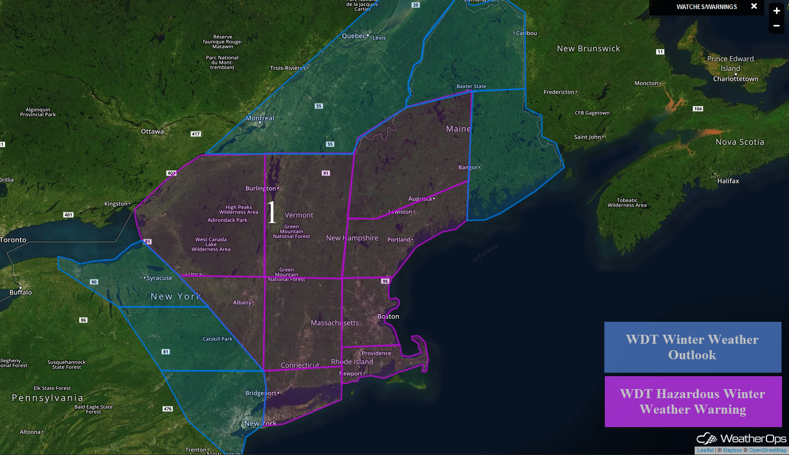
Snow Monday for the Ohio Valley and Appalachians
Snow will continue for the Ohio Valley and Appalachians on Monday as an area of low pressure moves eastward. Snow accumulations of 2-3 inches are forecast across the lower elevations. In the higher elevations, 3-6 inches with locally higher amounts in excess of 8 inches are expected.
Major Cities in Region: Louisville, KY, Asheville, NC, Blacksburg, VA, Roanoke, VA, Lynchburg, VA
 Region 2
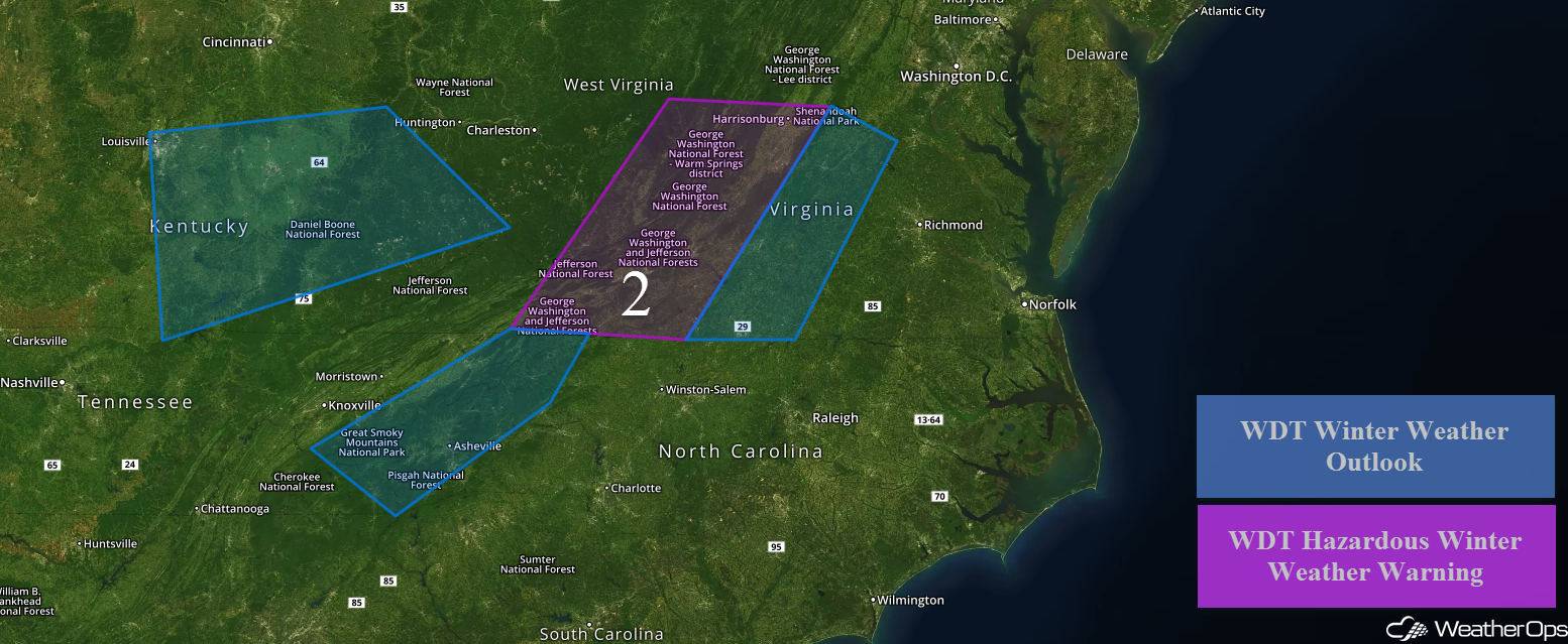
Thunderstorms for Southern Florida on Monday
A cold front over central Florida will continue to track southeastward through the day toward the Florida Keys and Bahamas. Ongoing showers and thunderstorms ahead of the front will continue all day. Southerly winds will bring warm moist air northward across much of southern Florida. In addition, some breaks in the clouds later this morning and early afternoon should be enough for some instability to build. With strong wind shear in place, ongoing thunderstorm activity is forecast to increase in intensity with some of these storms becoming strong to severe. Large hail and damaging winds will be the primary hazards with any of the stronger storms.
Major Cities in Region: Naples, FL, Miami, FL, Palm Beach, FL
 Region 3
Elevated Winds and Seas Monday for Portions of the Gulf of Mexico
Elevated winds and seas will continue for portions of the Gulf of Mexico through Monday evening. Winds will be northerly to north-northeasterly at 25-35 knots with gusts in excess of 40 knots across the western areas. Seas will range 6-9 feet. For eastern areas, winds will range 20-30 knots with gusts in excess of 35 knots. Seas will range 4-7 feet near the shore and 7-11 feet in the deeper waters.
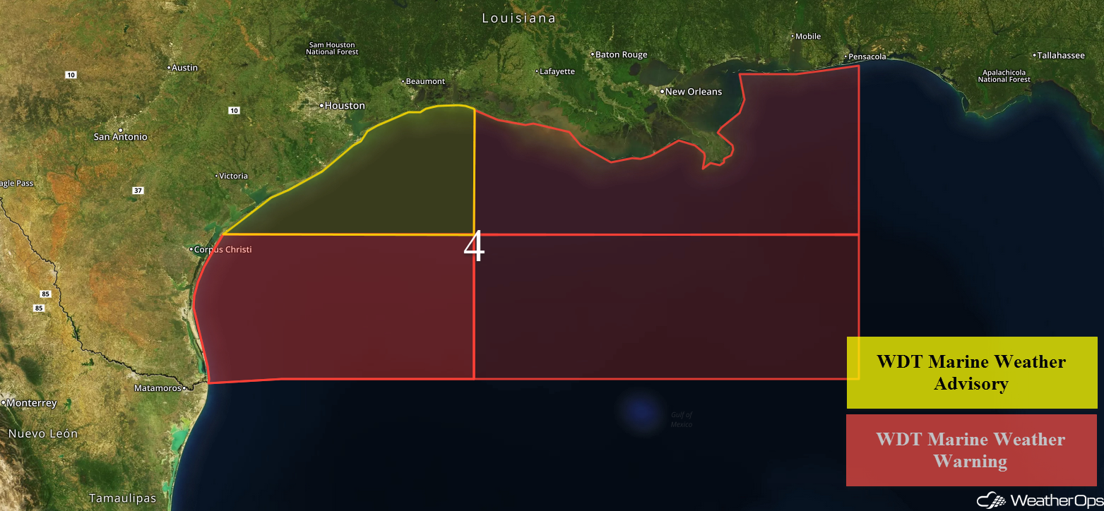 Region 4
A Look Ahead
Light snow may develop for portions of the Northern Rockies Thursday into Friday as an area of low pressure moves into the region. By Friday, an area of low pressure may develop over the Plains, bringing the potential for showers and thunderstorms from Nebraska southeastward into Missouri and Illinois.
That is a brief look at current weather hazards. We can provide you site-specific weather forecast information to protect your staff and assets and to assess your weather risk. Try a 7-day demo right away and learn how timely precision weather information can enhance your bottom line.
